C
Seller's Agent in 2020
Chip Leveson
Rbg-Anderson Company
(229) 347-9641
1 Total Sale
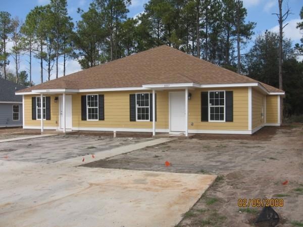
Estimated Value: $184,000 - $216,676
Rent is $675 per side. 3BR/2BA each side.
Last Agent to Sell the Property
Rbg-Anderson Company Brokerage Phone: 2298885646 License #263210 Listed on: 07/31/2020
Last Buyer's Agent
Lacey Mccarty
Re/Max Of Albany
| Date | Buyer | Sale Price | Title Company |
|---|---|---|---|
| Hall Michael | $130,000 | -- | |
| Mabrey River Enterprises Llc A Georgia | $755,000 | -- | |
| Flint Community Bank | -- | -- | |
| G A Barfield Construction Inc | $250,000 | -- |
| Date | Status | Borrower | Loan Amount |
|---|---|---|---|
| Open | Hall Michael | $97,500 |
| Date | Event | Price | List to Sale | Price per Sq Ft |
|---|---|---|---|---|
| 09/01/2020 09/01/20 | Sold | $130,000 | -- | $54 / Sq Ft |
| 07/31/2020 07/31/20 | Pending | -- | -- | -- |
| Year | Tax Paid | Tax Assessment Tax Assessment Total Assessment is a certain percentage of the fair market value that is determined by local assessors to be the total taxable value of land and additions on the property. | Land | Improvement |
|---|---|---|---|---|
| 2024 | $2,452 | $51,400 | $9,400 | $42,000 |
| 2023 | $2,395 | $51,400 | $9,400 | $42,000 |
| 2022 | $2,404 | $51,400 | $9,400 | $42,000 |
| 2021 | $2,228 | $51,400 | $9,400 | $42,000 |
| 2020 | $2,086 | $48,000 | $9,400 | $38,600 |
| 2019 | $2,094 | $48,000 | $9,400 | $38,600 |
| 2018 | $2,103 | $48,000 | $9,400 | $38,600 |
| 2017 | $1,959 | $48,000 | $9,400 | $38,600 |
| 2016 | $1,960 | $48,000 | $9,400 | $38,600 |
| 2015 | $2,484 | $60,680 | $9,400 | $51,280 |
| 2014 | $2,453 | $60,680 | $9,400 | $51,280 |
C
Seller's Agent in 2020
Chip Leveson
Rbg-Anderson Company
(229) 347-9641
1 Total Sale
L
Buyer's Agent in 2020
Lacey Mccarty
Re/Max Of Albany
Source: Albany Board of REALTORS®
MLS Number: 145172
APN: 00367-00002-066
