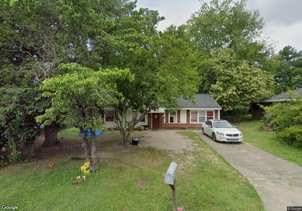
3939 Lindsey Dr Macon, GA 31206
Estimated Value: $64,000 - $106,000
3
Beds
1
Bath
1,342
Sq Ft
$64/Sq Ft
Est. Value
About This Home
This home is located at 3939 Lindsey Dr, Macon, GA 31206 and is currently estimated at $85,651, approximately $63 per square foot. 3939 Lindsey Dr is a home located in Bibb County with nearby schools including Southfield Elementary School, Southwest High School, and Gilead Christian Academy.
Ownership History
Date
Name
Owned For
Owner Type
Purchase Details
Closed on
Nov 1, 2010
Sold by
Us Bank National Association
Bought by
Dummitt Llc
Current Estimated Value
Purchase Details
Closed on
Nov 6, 2007
Sold by
Simpson Trentia
Bought by
Us Bank N A As Trustee
Purchase Details
Closed on
Nov 9, 2005
Sold by
No 1 Property Rehab Llc
Bought by
Simpson Treutia
Purchase Details
Closed on
Apr 29, 2005
Sold by
Wells Fargo Bank Minnesota Na
Bought by
No 1 Property Rehab Llc
Purchase Details
Closed on
Jan 4, 2005
Sold by
Mosely George Kenneth
Bought by
No #1 Property Rehab Llc
Create a Home Valuation Report for This Property
The Home Valuation Report is an in-depth analysis detailing your home's value as well as a comparison with similar homes in the area
Home Values in the Area
Average Home Value in this Area
Purchase History
| Date | Buyer | Sale Price | Title Company |
|---|---|---|---|
| Dummitt Llc | $8,000 | None Available | |
| Us Bank N A As Trustee | $53,000 | -- | |
| Us Bank Na | $53,011 | None Available | |
| Simpson Treutia | -- | None Available | |
| No 1 Property Rehab Llc | $28,200 | None Available | |
| No #1 Property Rehab Llc | $40,800 | -- |
Source: Public Records
Tax History Compared to Growth
Tax History
| Year | Tax Paid | Tax Assessment Tax Assessment Total Assessment is a certain percentage of the fair market value that is determined by local assessors to be the total taxable value of land and additions on the property. | Land | Improvement |
|---|---|---|---|---|
| 2025 | $787 | $32,012 | $6,000 | $26,012 |
| 2024 | $813 | $32,012 | $6,000 | $26,012 |
| 2023 | $651 | $30,773 | $6,000 | $24,773 |
| 2022 | $689 | $19,910 | $3,578 | $16,332 |
| 2021 | $535 | $14,072 | $2,504 | $11,568 |
| 2020 | $453 | $11,673 | $2,146 | $9,527 |
| 2019 | $457 | $11,673 | $2,146 | $9,527 |
| 2018 | $880 | $11,673 | $2,146 | $9,527 |
| 2017 | $437 | $11,673 | $2,146 | $9,527 |
| 2016 | $404 | $11,673 | $2,146 | $9,527 |
| 2015 | $572 | $11,673 | $2,146 | $9,527 |
| 2014 | $657 | $11,673 | $2,146 | $9,527 |
Source: Public Records
Map
Nearby Homes
- 3947 Lindsey Dr
- 3933 Lindsey Dr
- 3955 Lindsey Dr
- 3927 Lindsey Dr
- 3940 Lindsey Dr
- 3963 Lindsey Dr
- 3926 Lindsey Dr
- 3950 Lindsey Dr
- 3921 Lindsey Dr
- 3958 Lindsey Dr
- 0 Lindsey Dr Unit 7185936
- 0 Lindsey Dr Unit 8300880
- 0 Lindsey Dr Unit 9044060
- 0 Lindsey Dr Unit 8994121
- 0 Lindsey Dr Unit 7040183
- 3916 Lindsey Dr
- 3971 Lindsey Dr
- 3913 Lindsey Dr
- 3964 Lindsey Dr
- 131 Lindsey Ct