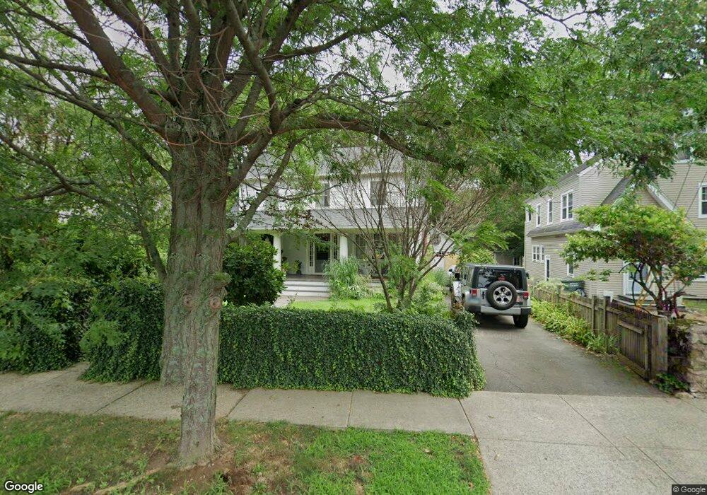
394 Brewster St Bridgeport, CT 06605
Black Rock NeighborhoodEstimated Value: $409,000 - $762,000
3
Beds
2
Baths
2,296
Sq Ft
$266/Sq Ft
Est. Value
About This Home
This home is located at 394 Brewster St, Bridgeport, CT 06605 and is currently estimated at $611,136, approximately $266 per square foot. 394 Brewster St is a home located in Fairfield County with nearby schools including Black Rock School, Bassick High School, and Park City Prep Charter School.
Ownership History
Date
Name
Owned For
Owner Type
Purchase Details
Closed on
Apr 22, 1998
Sold by
Schneider David S
Bought by
Leito John K and Leito Karen
Current Estimated Value
Home Financials for this Owner
Home Financials are based on the most recent Mortgage that was taken out on this home.
Original Mortgage
$119,600
Interest Rate
7.11%
Mortgage Type
Unknown
Purchase Details
Closed on
Jun 3, 1994
Sold by
Stone B Corey and Mcdonald Susan
Bought by
Schneider David S
Purchase Details
Closed on
Jun 22, 1987
Sold by
Dick Gary
Bought by
Stone B Corey
Create a Home Valuation Report for This Property
The Home Valuation Report is an in-depth analysis detailing your home's value as well as a comparison with similar homes in the area
Home Values in the Area
Average Home Value in this Area
Purchase History
| Date | Buyer | Sale Price | Title Company |
|---|---|---|---|
| Leito John K | $130,000 | -- | |
| Leito John K | $130,000 | -- | |
| Schneider David S | $105,000 | -- | |
| Schneider David S | $105,000 | -- | |
| Stone B Corey | $195,000 | -- |
Source: Public Records
Mortgage History
| Date | Status | Borrower | Loan Amount |
|---|---|---|---|
| Open | Stone B Corey | $297,000 | |
| Closed | Stone B Corey | $119,600 |
Source: Public Records
Tax History
| Year | Tax Paid | Tax Assessment Tax Assessment Total Assessment is a certain percentage of the fair market value that is determined by local assessors to be the total taxable value of land and additions on the property. | Land | Improvement |
|---|---|---|---|---|
| 2025 | $11,840 | $272,496 | $143,556 | $128,940 |
| 2024 | $11,840 | $272,496 | $143,556 | $128,940 |
| 2023 | $11,840 | $272,496 | $143,556 | $128,940 |
| 2022 | $11,840 | $272,496 | $143,556 | $128,940 |
| 2021 | $11,840 | $272,496 | $143,556 | $128,940 |
| 2020 | $12,334 | $228,450 | $117,760 | $110,690 |
| 2019 | $12,334 | $228,450 | $117,760 | $110,690 |
| 2018 | $12,421 | $228,450 | $117,760 | $110,690 |
| 2017 | $12,421 | $228,450 | $117,760 | $110,690 |
| 2016 | $12,421 | $228,450 | $117,760 | $110,690 |
| 2015 | $10,529 | $249,500 | $103,170 | $146,330 |
| 2014 | $10,529 | $249,500 | $103,170 | $146,330 |
Source: Public Records
Map
Nearby Homes
- 65 Ellsworth St Unit 302
- 27 Nash Ln Unit 5
- 554 Brewster St Unit 4
- 318 Grovers Ave
- 20 Haddon St Unit 5
- 117 Nash Ln
- 78 Rowsley St Unit 4
- 37 Rowsley St Unit 6
- 97 Fayerweather Terrace
- 132 Gilman St
- 377 Midland St
- 22 Monroe St Unit 24
- 90 Clarkson St
- 148 Alfred St
- 165 Bennett St
- 315 Seaside Ave
- 855 Brewster St Unit 857
- 188 Monroe St Unit 190
- 3250 Fairfield Ave Unit 302
- 287 Hansen Ave
- 404 Brewster St
- 414 Brewster St
- 385 Brewster St
- 399 Brewster St
- 401 Brewster St
- 411 Brewster St
- 384 Brewster St
- 368 Brewster St Unit 370
- 26 Woodland Ave
- 427 Brewster St
- 28 Woodland Ave
- 97 Bartram Ave
- 365 Brewster St Unit 367
- 38 Woodland Ave
- 590 Brewster St Unit 6
- 590 Brewster St Unit 5
- 568 Brewster St Unit 3
- 568 Brewster St Unit 2
- 590 Brewster St Unit 3
- 568 Brewster St Unit 6
Your Personal Tour Guide
Ask me questions while you tour the home.