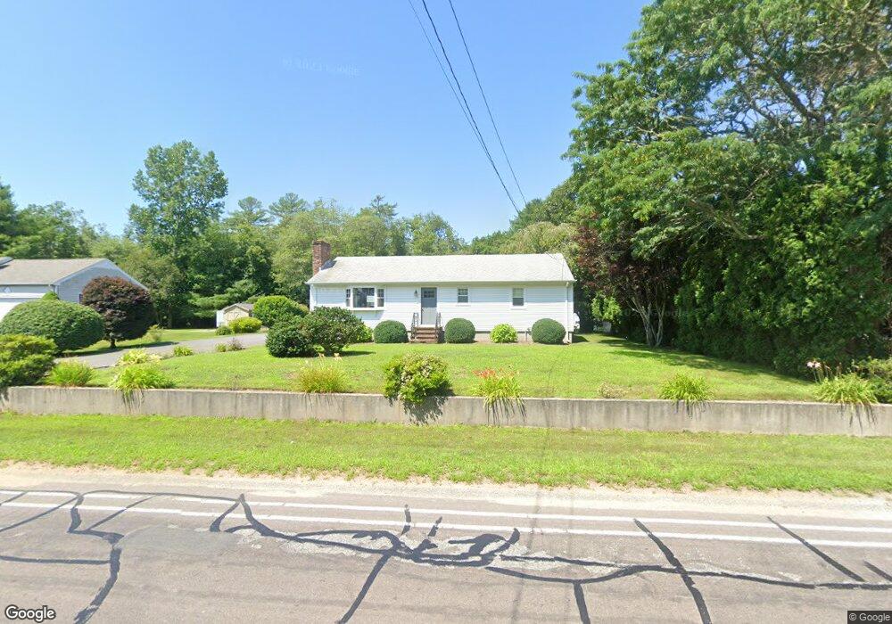
394 Chase Rd North Dartmouth, MA 02747
Estimated Value: $477,788 - $550,000
3
Beds
2
Baths
1,344
Sq Ft
$391/Sq Ft
Est. Value
About This Home
This home is located at 394 Chase Rd, North Dartmouth, MA 02747 and is currently estimated at $524,947, approximately $390 per square foot. 394 Chase Rd is a home located in Bristol County with nearby schools including Dartmouth High School, Nazarene Christian Academy, and Bishop Stang High School.
Ownership History
Date
Name
Owned For
Owner Type
Purchase Details
Closed on
Jun 1, 2005
Sold by
Duval Arsene G
Bought by
Goncalves Donald
Current Estimated Value
Home Financials for this Owner
Home Financials are based on the most recent Mortgage that was taken out on this home.
Original Mortgage
$247,200
Interest Rate
5.83%
Mortgage Type
Purchase Money Mortgage
Purchase Details
Closed on
Nov 3, 1995
Sold by
Mailhot Normand J and Mailhot Yvonne A
Bought by
Duval Arsene G and Duval Mathra N
Create a Home Valuation Report for This Property
The Home Valuation Report is an in-depth analysis detailing your home's value as well as a comparison with similar homes in the area
Home Values in the Area
Average Home Value in this Area
Purchase History
| Date | Buyer | Sale Price | Title Company |
|---|---|---|---|
| Goncalves Donald | $309,900 | -- | |
| Duval Arsene G | $136,000 | -- |
Source: Public Records
Mortgage History
| Date | Status | Borrower | Loan Amount |
|---|---|---|---|
| Open | Duval Arsene G | $308,700 | |
| Closed | Duval Arsene G | $247,200 | |
| Closed | Duval Arsene G | $61,800 | |
| Previous Owner | Duval Arsene G | $78,550 |
Source: Public Records
Tax History Compared to Growth
Tax History
| Year | Tax Paid | Tax Assessment Tax Assessment Total Assessment is a certain percentage of the fair market value that is determined by local assessors to be the total taxable value of land and additions on the property. | Land | Improvement |
|---|---|---|---|---|
| 2025 | $3,608 | $391,300 | $165,300 | $226,000 |
| 2024 | $3,529 | $381,100 | $165,300 | $215,800 |
| 2023 | $3,570 | $360,600 | $165,300 | $195,300 |
| 2022 | $3,534 | $328,700 | $165,300 | $163,400 |
| 2021 | $3,497 | $314,500 | $160,500 | $154,000 |
| 2020 | $3,423 | $306,200 | $158,900 | $147,300 |
| 2019 | $3,323 | $298,000 | $152,500 | $145,500 |
| 2018 | $5,948 | $285,000 | $155,700 | $129,300 |
| 2017 | $2,948 | $271,000 | $143,900 | $127,100 |
| 2016 | $2,720 | $246,800 | $127,300 | $119,500 |
| 2015 | $2,639 | $239,900 | $118,900 | $121,000 |
| 2014 | $2,583 | $234,000 | $115,500 | $118,500 |
Source: Public Records
Map
Nearby Homes
- 219 Chase Rd
- 14 Westview Dr
- 10 Westview Dr
- Lot 6 Rafael Rd
- 24 Wayne Memorial Dr
- 312 Old Westport Rd
- 320 Old Westport Rd
- 310 Old Westport Rd
- 53 Morton Ave
- 6 Strathmore Rd
- 135 Old Westport Rd
- 117 Old Westport Rd
- 1004 Allen St
- 360 Russells Mills Rd
- 34 Country Way
- 5 Samosett Dr
- 75 Country Way Unit 75
- 65 Cross Rd
- 28 Greystone Ave
- 3 Mishawum Dr