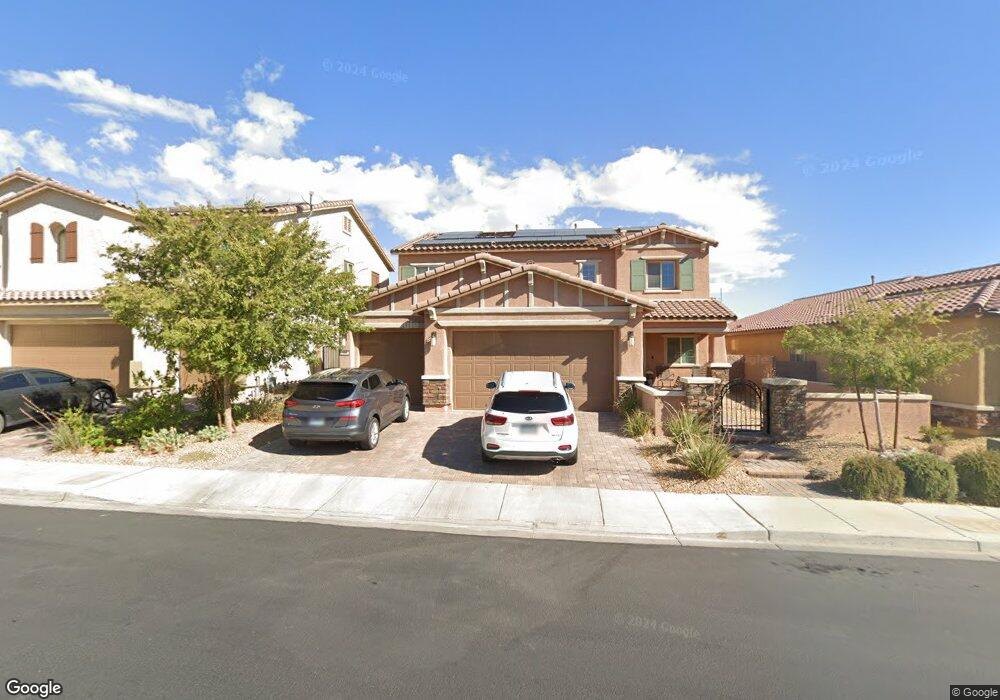
394 Lost Horizon Ave Henderson, NV 89002
Highland Hills NeighborhoodEstimated Value: $746,000 - $769,000
4
Beds
4
Baths
3,479
Sq Ft
$218/Sq Ft
Est. Value
About This Home
This home is located at 394 Lost Horizon Ave, Henderson, NV 89002 and is currently estimated at $756,693, approximately $217 per square foot. 394 Lost Horizon Ave is a home with nearby schools including J. Marlan Walker International School, Jack & Terry Mannion Middle School, and Foothill High School.
Ownership History
Date
Name
Owned For
Owner Type
Purchase Details
Closed on
Feb 13, 2018
Sold by
Greystone Nevada Llc
Bought by
Mckenzie Wade J and Mckenzie Rebecca R
Current Estimated Value
Home Financials for this Owner
Home Financials are based on the most recent Mortgage that was taken out on this home.
Original Mortgage
$370,632
Outstanding Balance
$313,576
Interest Rate
3.95%
Mortgage Type
New Conventional
Estimated Equity
$443,117
Create a Home Valuation Report for This Property
The Home Valuation Report is an in-depth analysis detailing your home's value as well as a comparison with similar homes in the area
Home Values in the Area
Average Home Value in this Area
Purchase History
| Date | Buyer | Sale Price | Title Company |
|---|---|---|---|
| Mckenzie Wade J | $463,290 | North American Title Main |
Source: Public Records
Mortgage History
| Date | Status | Borrower | Loan Amount |
|---|---|---|---|
| Open | Mckenzie Wade J | $370,632 |
Source: Public Records
Tax History Compared to Growth
Tax History
| Year | Tax Paid | Tax Assessment Tax Assessment Total Assessment is a certain percentage of the fair market value that is determined by local assessors to be the total taxable value of land and additions on the property. | Land | Improvement |
|---|---|---|---|---|
| 2025 | $5,660 | $251,081 | $50,400 | $200,681 |
| 2024 | $5,496 | $251,081 | $50,400 | $200,681 |
| 2023 | $611 | $232,945 | $55,300 | $177,645 |
| 2022 | $5,336 | $224,572 | $45,500 | $179,072 |
| 2021 | $5,181 | $179,638 | $42,350 | $137,288 |
| 2020 | $5,022 | $176,557 | $38,500 | $138,057 |
| 2019 | $4,659 | $162,748 | $37,450 | $125,298 |
| 2018 | $814 | $32,200 | $32,200 | $0 |
| 2017 | $649 | $22,400 | $22,400 | $0 |
| 2016 | $611 | $0 | $0 | $0 |
Source: Public Records
Map
Nearby Homes
- 1030 Wavehugger Dr
- 1020 Wavehugger Dr
- 1045 Wavehugger Dr
- 1040 Wavehugger Dr
- 1035 Wavehugger Dr
- 467 Mission Dr
- 434 Lost Horizon Ave
- 409 Hightop Ln
- 641 Patti Ann Woods Dr
- 533 Calypso Dr
- 322 Wintercress Dr
- 860 Bergamont Dr
- 1028 Twin Berry Ct
- 1055 Lush Hillside Ct
- 815 Crabapple Dr
- 854 Coral Cottage Dr
- 848 Coral Cottage Dr
- 200 Black Eagle Ave
- 709 Greenway Rd
- 710 Greenway Rd
- 396 Lost Horizon Ave
- 392 Lost Horizon Ave
- 398 Lost Horizon Ave
- 390 Lost Horizon Ave
- 988 Cedar Cliff Ct
- 400 Lost Horizon Ave
- 989 Rustic Rock Ct
- 388 Lost Horizon Ave
- 990 Cedar Cliff Ct
- 987 Cedar Cliff Ct
- 402 Lost Horizon Ave
- 991 Rustic Rock Ct
- 386 Lost Horizon Ave
- 989 Cedar Cliff Ct
- 993 Rustic Rock Ct
- 384 Lost Horizon Ave
- 990 Rustic Rock Ct
- 994 Cedar Cliff Ct
- 986 Fairway Hill St
- 995 Rustic Rock Ct