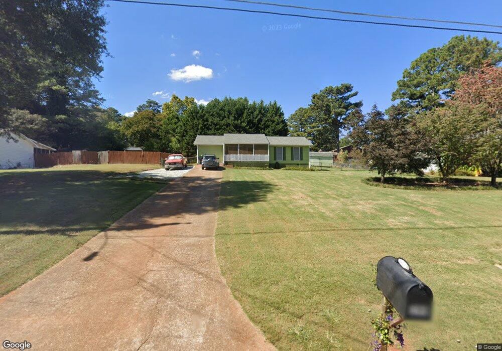
394 Mephisto Cir Unit 2 Lawrenceville, GA 30046
Estimated Value: $293,423 - $333,000
3
Beds
2
Baths
1,357
Sq Ft
$228/Sq Ft
Est. Value
About This Home
This home is located at 394 Mephisto Cir Unit 2, Lawrenceville, GA 30046 and is currently estimated at $309,356, approximately $227 per square foot. 394 Mephisto Cir Unit 2 is a home located in Gwinnett County with nearby schools including Benefield Elementary School, Richards Middle School, and Discovery High School.
Ownership History
Date
Name
Owned For
Owner Type
Purchase Details
Closed on
Jan 24, 2018
Sold by
Blount Debbie L
Bought by
Blount Debbie L and Blount James R
Current Estimated Value
Purchase Details
Closed on
May 31, 1996
Sold by
Crain Michael L Susan
Bought by
Blount Debbie L
Create a Home Valuation Report for This Property
The Home Valuation Report is an in-depth analysis detailing your home's value as well as a comparison with similar homes in the area
Home Values in the Area
Average Home Value in this Area
Purchase History
| Date | Buyer | Sale Price | Title Company |
|---|---|---|---|
| Blount Debbie L | -- | -- | |
| Blount Debbie L | $76,000 | -- |
Source: Public Records
Mortgage History
| Date | Status | Borrower | Loan Amount |
|---|---|---|---|
| Closed | Blount Debbie L | $0 |
Source: Public Records
Tax History Compared to Growth
Tax History
| Year | Tax Paid | Tax Assessment Tax Assessment Total Assessment is a certain percentage of the fair market value that is determined by local assessors to be the total taxable value of land and additions on the property. | Land | Improvement |
|---|---|---|---|---|
| 2025 | -- | $111,800 | $21,120 | $90,680 |
| 2024 | $640 | $104,440 | $21,120 | $83,320 |
| 2023 | $640 | $96,840 | $20,800 | $76,040 |
| 2022 | $0 | $83,520 | $20,800 | $62,720 |
| 2021 | $1,863 | $69,720 | $16,800 | $52,920 |
| 2020 | $1,842 | $61,840 | $14,400 | $47,440 |
| 2019 | $1,690 | $56,360 | $14,400 | $41,960 |
| 2018 | $1,656 | $52,600 | $12,080 | $40,520 |
| 2016 | $1,480 | $43,400 | $10,000 | $33,400 |
| 2015 | $1,211 | $30,800 | $7,200 | $23,600 |
| 2014 | $1,215 | $30,800 | $7,200 | $23,600 |
Source: Public Records
Map
Nearby Homes
- 1384 Sunrise Way
- 1469 Bridgestone Dr
- 921 Appian Way Unit 3
- 493 Tracy Ct
- 474 Daisy Trail
- 457 Casey Ct
- 398 Parc River Blvd
- 1522 Parc Main St
- 1350 Lawrenceville Hwy
- 912 Noble Oak Ct
- 440 Sterling Hill Dr
- 1330 Lawrenceville Hwy
- 1634 Lamancha Dr
- 682 Brass Key Ct
- 209 Towler Rd
- 4575 Windale Dr
- 4359 Annlette Dr
- 1102 Noble Oak Ct
- 2099 Riverlanding Cir Unit II
- 484 Fieldstream Way
- 404 Mephisto Cir
- 384 Mephisto Cir
- 1334 Monfort Rd
- 1334 Monfort Rd
- 1340 Monfort Rd
- 1340 Monfort Rd Unit Lot 6 BA Independenc
- 1328 Monfort Rd
- 374 Mephisto Cir
- 403 Mephisto Cir
- 393 Mephisto Cir Unit 2
- 1346 Monfort Rd
- 323 Mephisto Cir
- 364 Mephisto Cir
- 313 Mephisto Cir
- 1316 Monfort Rd
- 1266 Haliburton Ave
- 1352 Monfort Rd
- 413 Mephisto Cir
- 424 Mephisto Cir
- 424 Mephisto Cir