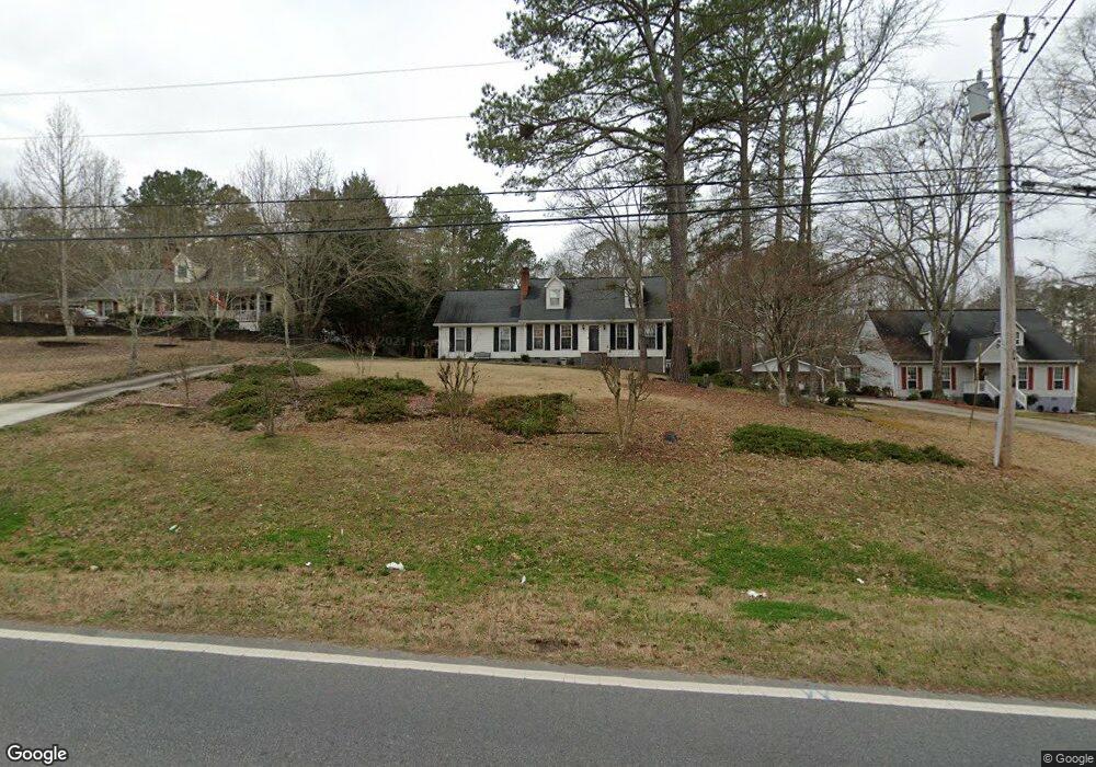
394 Miles Patrick Rd Unit 1 Winder, GA 30680
Estimated Value: $321,205 - $379,000
3
Beds
3
Baths
2,283
Sq Ft
$153/Sq Ft
Est. Value
About This Home
This home is located at 394 Miles Patrick Rd Unit 1, Winder, GA 30680 and is currently estimated at $349,301, approximately $153 per square foot. 394 Miles Patrick Rd Unit 1 is a home located in Barrow County with nearby schools including County Line Elementary School, Russell Middle School, and Winder-Barrow High School.
Ownership History
Date
Name
Owned For
Owner Type
Purchase Details
Closed on
Nov 30, 1998
Sold by
Gandy Bruce S and Gandy Marcia A
Bought by
Manley Calire and Charles Fulk
Current Estimated Value
Home Financials for this Owner
Home Financials are based on the most recent Mortgage that was taken out on this home.
Original Mortgage
$114,941
Outstanding Balance
$24,659
Interest Rate
6.95%
Mortgage Type
FHA
Estimated Equity
$324,642
Purchase Details
Closed on
Jul 1, 1987
Bought by
Gandy Bruce S and Gandy Marc
Create a Home Valuation Report for This Property
The Home Valuation Report is an in-depth analysis detailing your home's value as well as a comparison with similar homes in the area
Home Values in the Area
Average Home Value in this Area
Purchase History
| Date | Buyer | Sale Price | Title Company |
|---|---|---|---|
| Manley Calire | $115,000 | -- | |
| Gandy Bruce S | $73,800 | -- |
Source: Public Records
Mortgage History
| Date | Status | Borrower | Loan Amount |
|---|---|---|---|
| Open | Manley Calire | $114,941 |
Source: Public Records
Tax History
| Year | Tax Paid | Tax Assessment Tax Assessment Total Assessment is a certain percentage of the fair market value that is determined by local assessors to be the total taxable value of land and additions on the property. | Land | Improvement |
|---|---|---|---|---|
| 2025 | $878 | $81,142 | $14,400 | $66,742 |
| 2024 | $887 | $79,448 | $14,400 | $65,048 |
| 2023 | $695 | $79,448 | $14,400 | $65,048 |
| 2022 | $854 | $61,384 | $14,400 | $46,984 |
| 2021 | $797 | $61,384 | $14,400 | $46,984 |
| 2020 | $793 | $61,384 | $14,400 | $46,984 |
| 2019 | $912 | $58,984 | $12,000 | $46,984 |
| 2018 | $1,958 | $58,984 | $12,000 | $46,984 |
| 2017 | $1,516 | $50,824 | $12,000 | $38,824 |
| 2016 | $1,499 | $48,470 | $12,000 | $36,470 |
| 2015 | $1,501 | $48,470 | $12,000 | $36,470 |
| 2014 | $1,275 | $42,350 | $5,880 | $36,470 |
| 2013 | -- | $39,404 | $5,880 | $33,524 |
Source: Public Records
Map
Nearby Homes
- 27 Creekside Dr
- 421 N 5th Ave
- 326 Miles Patrick Rd
- 223 Lacey Ln
- 222 Ryan Rd
- 538 Valleyview Dr
- 571 Greenvalley Dr
- 0 E Northcrest Dr Unit 10648147
- 197 Buena Vista St
- 469 Plantation Dr
- 436 Northcrest Dr
- 303 Rocky Point Ct
- 326 Fayette Dr
- 128 Northridge Dr
- 845 Idlewood Rd
- 905 Dogwood Ln
- 284 E 5th Ave
- 273 Partridge Trail
- 318 Ryan Rd
- 5 Olevia St
- 398 Miles Patrick Rd
- 390 Miles Patrick Rd Unit 1
- 386 Miles Patrick Rd
- 382 Miles Patrick Rd
- 391 Miles Patrick Rd Unit 1
- 385 Miles Patrick Rd
- 378 Miles Patrick Rd
- 379 Miles Patrick Rd Unit 1
- 2.23 ACRES Miles Patrick Rd
- 414 Miles Patrick Rd
- 374 Miles Patrick Rd
- 377 Miles Patrick Rd Unit 1
- 368 Miles Patrick Rd
- 375 Miles Patrick Rd Unit 1
- 422 Miles Patrick Rd
- 705 North Ave
- 711 North Ave
- 501 Valley View Dr
- 367 Miles Patrick Rd Unit 1
- 362 Miles Patrick Rd