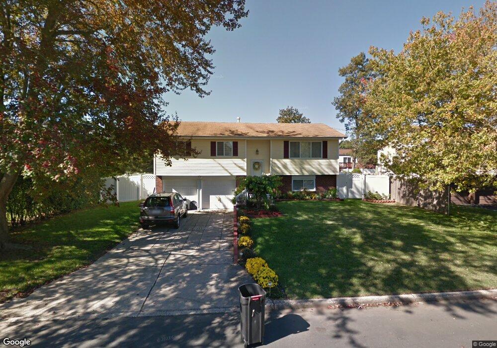
394 Nelligan Ct North Babylon, NY 11703
Estimated Value: $560,000 - $706,000
--
Bed
1
Bath
1,763
Sq Ft
$356/Sq Ft
Est. Value
About This Home
This home is located at 394 Nelligan Ct, North Babylon, NY 11703 and is currently estimated at $627,350, approximately $355 per square foot. 394 Nelligan Ct is a home located in Suffolk County with nearby schools including Robert Moses Middle School and North Babylon High School.
Ownership History
Date
Name
Owned For
Owner Type
Purchase Details
Closed on
Apr 18, 2011
Sold by
Jacla Mary Rose
Bought by
Jacla Mary Rose and Carbonilla Percilyn
Current Estimated Value
Purchase Details
Closed on
Dec 3, 2009
Sold by
Klasek Stanley J
Bought by
Jacla Mary Rose
Home Financials for this Owner
Home Financials are based on the most recent Mortgage that was taken out on this home.
Original Mortgage
$328,652
Interest Rate
5%
Mortgage Type
FHA
Purchase Details
Closed on
Mar 30, 2009
Sold by
Estate Levine Jack
Bought by
Klasek Stanely J
Create a Home Valuation Report for This Property
The Home Valuation Report is an in-depth analysis detailing your home's value as well as a comparison with similar homes in the area
Home Values in the Area
Average Home Value in this Area
Purchase History
| Date | Buyer | Sale Price | Title Company |
|---|---|---|---|
| Jacla Mary Rose | -- | -- | |
| Jacla Mary Rose | $340,000 | -- | |
| Klasek Stanely J | $200,000 | Jack West |
Source: Public Records
Mortgage History
| Date | Status | Borrower | Loan Amount |
|---|---|---|---|
| Previous Owner | Jacla Mary Rose | $328,652 |
Source: Public Records
Tax History Compared to Growth
Tax History
| Year | Tax Paid | Tax Assessment Tax Assessment Total Assessment is a certain percentage of the fair market value that is determined by local assessors to be the total taxable value of land and additions on the property. | Land | Improvement |
|---|---|---|---|---|
| 2024 | $11,463 | $3,420 | $310 | $3,110 |
| 2023 | $11,463 | $3,420 | $310 | $3,110 |
| 2022 | $8,751 | $3,420 | $310 | $3,110 |
| 2021 | $8,751 | $3,420 | $310 | $3,110 |
| 2020 | $9,307 | $3,420 | $310 | $3,110 |
| 2019 | $9,307 | $0 | $0 | $0 |
| 2018 | $8,921 | $3,420 | $310 | $3,110 |
| 2017 | $8,921 | $3,420 | $310 | $3,110 |
| 2016 | $8,800 | $3,420 | $310 | $3,110 |
| 2015 | -- | $3,420 | $310 | $3,110 |
| 2014 | -- | $3,420 | $310 | $3,110 |
Source: Public Records
Map
Nearby Homes
- 57 Shipman Ave
- 524 Davis St
- 512 Leader Ave
- 511 Spruce St
- 506 Dewitt Ave
- 69 Commack Rd
- 104 Woods Rd
- 27 Central Ave
- 50 Carlls Path
- 77 Lloyd Ave
- 5 Primrose Ln
- 105 Commack Rd
- 247 Woods Rd
- 1 Primrose Ln Unit 1
- 77 Carlls Path
- 27 Primrose Ln
- 42 Primrose Ln Unit 42
- 11 Primrose Ln Unit 11
- 61 Primrose Ln Unit 61
- 23 Caroline Ct