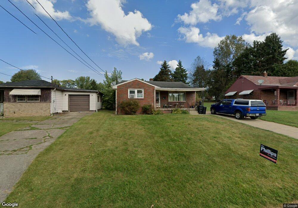
394 Porter Ave Campbell, OH 44405
Estimated Value: $91,000 - $131,000
3
Beds
2
Baths
1,102
Sq Ft
$103/Sq Ft
Est. Value
About This Home
This home is located at 394 Porter Ave, Campbell, OH 44405 and is currently estimated at $113,112, approximately $102 per square foot. 394 Porter Ave is a home located in Mahoning County with nearby schools including Campbell Elementary School, Memorial High School, and Northeast Ohio Impact Academy.
Ownership History
Date
Name
Owned For
Owner Type
Purchase Details
Closed on
Nov 1, 2002
Sold by
Diamondis Stavros E
Bought by
Ramunno Lisa M
Current Estimated Value
Purchase Details
Closed on
Mar 25, 1998
Sold by
Diamandis Thelma
Bought by
Diamandis Elias S and Diamandis Starros E
Purchase Details
Closed on
Aug 11, 1993
Bought by
Diamandis Thelma
Create a Home Valuation Report for This Property
The Home Valuation Report is an in-depth analysis detailing your home's value as well as a comparison with similar homes in the area
Home Values in the Area
Average Home Value in this Area
Purchase History
| Date | Buyer | Sale Price | Title Company |
|---|---|---|---|
| Ramunno Lisa M | -- | -- | |
| Diamandis Stavros E | -- | -- | |
| Diamandis Elias S | $40,000 | -- | |
| Diamandis Thelma | -- | -- |
Source: Public Records
Tax History
| Year | Tax Paid | Tax Assessment Tax Assessment Total Assessment is a certain percentage of the fair market value that is determined by local assessors to be the total taxable value of land and additions on the property. | Land | Improvement |
|---|---|---|---|---|
| 2025 | $1,181 | $22,010 | $2,140 | $19,870 |
| 2024 | $1,182 | $22,010 | $2,140 | $19,870 |
| 2023 | $1,168 | $22,010 | $2,140 | $19,870 |
| 2022 | $1,115 | $17,590 | $2,140 | $15,450 |
| 2021 | $1,046 | $17,590 | $2,140 | $15,450 |
| 2020 | $1,063 | $17,590 | $2,140 | $15,450 |
| 2019 | $1,048 | $14,540 | $1,770 | $12,770 |
| 2018 | $1,012 | $14,540 | $1,770 | $12,770 |
| 2017 | $1,009 | $14,540 | $1,770 | $12,770 |
| 2016 | $1,138 | $17,420 | $1,770 | $15,650 |
| 2015 | $1,116 | $17,420 | $1,770 | $15,650 |
| 2014 | $1,113 | $17,420 | $1,770 | $15,650 |
| 2013 | $1,091 | $17,420 | $1,770 | $15,650 |
Source: Public Records
Map
Nearby Homes
- 462 13th St
- 330 Sanderson Ave
- 412 Whipple Ave
- 311 Park Dr
- 296 Sanderson Ave
- 0 Penhale Ave
- 460 Devitt Ave
- 369 6th St
- 576 Breetz Dr
- 374 Tenney Ave
- 459 Tenney Ave
- 631 Coitsville Rd
- 114 Penhale Ave
- 0 Creed Cir Unit 5189573
- 190 10th St
- 377 Coitsville Rd
- 687 Moore Ave
- 541 Blossom Ave
- 130 12th St
- 279 Coitsville Rd
- 392 Porter Ave
- 396 Porter Ave
- 390 Porter Ave
- 444 Porter Ave
- 431 Blossom Ave
- 429 Blossom Ave
- 455 Blossom Ave
- 393 Porter Ave
- 395 Porter Ave
- 413 Blossom Ave
- 421 Porter Ave
- 441 Porter Ave
- 466 Porter Ave
- 387 Porter Ave
- 383 Porter Ave
- 459 Blossom Ave
- 405 Blossom Ave
- 401 12th St
- 461 Porter Ave
- 381 Porter Ave
Your Personal Tour Guide
Ask me questions while you tour the home.