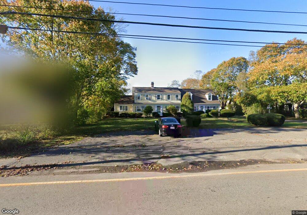
394 South St Hyannis, MA 02601
Estimated Value: $753,000 - $991,156
7
Beds
4
Baths
3,212
Sq Ft
$286/Sq Ft
Est. Value
About This Home
This home is located at 394 South St, Hyannis, MA 02601 and is currently estimated at $919,539, approximately $286 per square foot. 394 South St is a home located in Barnstable County with nearby schools including Hyannis West Elementary School, Barnstable United Elementary School, and Barnstable Intermediate School.
Ownership History
Date
Name
Owned For
Owner Type
Purchase Details
Closed on
Jan 8, 2020
Sold by
John Yeransian Rt and Yeransian
Bought by
Yeransian Benjamin P
Current Estimated Value
Home Financials for this Owner
Home Financials are based on the most recent Mortgage that was taken out on this home.
Original Mortgage
$428,000
Interest Rate
3.4%
Mortgage Type
New Conventional
Create a Home Valuation Report for This Property
The Home Valuation Report is an in-depth analysis detailing your home's value as well as a comparison with similar homes in the area
Home Values in the Area
Average Home Value in this Area
Purchase History
| Date | Buyer | Sale Price | Title Company |
|---|---|---|---|
| Yeransian Benjamin P | $535,000 | None Available |
Source: Public Records
Mortgage History
| Date | Status | Borrower | Loan Amount |
|---|---|---|---|
| Previous Owner | Yeransian Benjamin P | $428,000 |
Source: Public Records
Tax History Compared to Growth
Tax History
| Year | Tax Paid | Tax Assessment Tax Assessment Total Assessment is a certain percentage of the fair market value that is determined by local assessors to be the total taxable value of land and additions on the property. | Land | Improvement |
|---|---|---|---|---|
| 2025 | $8,158 | $880,000 | $234,700 | $645,300 |
| 2024 | $7,619 | $841,900 | $234,700 | $607,200 |
| 2023 | $7,094 | $741,300 | $213,400 | $527,900 |
| 2022 | $6,836 | $590,800 | $146,800 | $444,000 |
| 2021 | $6,353 | $533,400 | $149,000 | $384,400 |
| 2020 | $0 | $474,100 | $149,000 | $325,100 |
| 2019 | $0 | $484,700 | $158,000 | $326,700 |
| 2018 | $0 | $473,600 | $184,200 | $289,400 |
| 2017 | $0 | $465,700 | $184,200 | $281,500 |
| 2016 | -- | $461,700 | $180,200 | $281,500 |
| 2015 | -- | $521,100 | $182,400 | $338,700 |
Source: Public Records
Map
Nearby Homes
- 574 Main St
- 93 Sea St
- 65 Louis St Unit A
- 199 Hamden Cir
- 287 Ocean St Unit C2
- 287 Ocean St Unit 2 BLDG C
- 49 Snow Creek Dr
- 24 Betty's Pond Rd Unit 1K
- 24 Bettys Pond Rd Unit K
- 49 Center St
- 35 Pleasant St
- 72 Grove St
- 381 Ocean St Unit 1
- 25 Ripple Cove Rd
- 107 Channel Point Rd
- 28 Bumpus Rd
- 16 Iyanough Rd
- 115 School St Unit W206
- 112 W Main St Unit 8
- 112 W Main St Unit 7
- 402 South St
- 380 South St
- 33 Pine Ave
- 557 Main St
- 557 Main St
- 41 Pinewood Ave
- 414 South St
- 379 South St
- 391 South St
- 395 South St
- 569 Main Unit D-1
- 569 Main St
- 569 Main St Unit D3
- 569 Main St Unit 9
- 569 Main St Unit 8
- 569 Main St Unit 7
- 569 Main St Unit 6
- 569 Main St Unit 5
- 569 Main St Unit 4
- 569 Main St Unit 1210