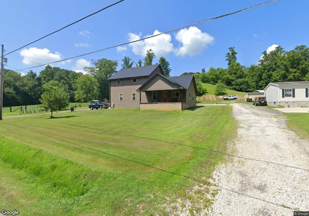
394 State Route 693 Greenup, KY 41144
Estimated Value: $147,000 - $236,093
2
Beds
2
Baths
1,792
Sq Ft
$108/Sq Ft
Est. Value
About This Home
This home is located at 394 State Route 693, Greenup, KY 41144 and is currently estimated at $193,273, approximately $107 per square foot. 394 State Route 693 is a home with nearby schools including Greenup County High School.
Ownership History
Date
Name
Owned For
Owner Type
Purchase Details
Closed on
Jun 24, 2010
Sold by
Bailey Mark A and Bailey Susan
Bought by
Bailey William T
Current Estimated Value
Create a Home Valuation Report for This Property
The Home Valuation Report is an in-depth analysis detailing your home's value as well as a comparison with similar homes in the area
Home Values in the Area
Average Home Value in this Area
Purchase History
| Date | Buyer | Sale Price | Title Company |
|---|---|---|---|
| Bailey William T | -- | -- |
Source: Public Records
Tax History Compared to Growth
Tax History
| Year | Tax Paid | Tax Assessment Tax Assessment Total Assessment is a certain percentage of the fair market value that is determined by local assessors to be the total taxable value of land and additions on the property. | Land | Improvement |
|---|---|---|---|---|
| 2025 | $1,907 | $161,000 | $32,500 | $128,500 |
| 2024 | $1,950 | $161,000 | $32,500 | $128,500 |
| 2023 | $1,840 | $161,000 | $32,500 | $128,500 |
| 2022 | $1,875 | $161,000 | $32,500 | $128,500 |
| 2021 | $1,867 | $161,000 | $32,500 | $128,500 |
| 2020 | $1,855 | $161,000 | $32,500 | $128,500 |
| 2019 | $1,872 | $161,000 | $32,500 | $128,500 |
| 2018 | $1,944 | $161,000 | $32,500 | $128,500 |
| 2017 | $1,882 | $161,000 | $32,500 | $128,500 |
| 2016 | $1,882 | $161,000 | $32,500 | $128,500 |
| 2015 | $2,057 | $173,556 | $32,500 | $141,056 |
| 2014 | $1,958 | $131,239 | $32,500 | $98,739 |
| 2011 | -- | $32,500 | $32,500 | $0 |
Source: Public Records
Map
Nearby Homes
- 0 Cox St
- 612 Fulton Ave
- 503 Fulton Ave
- 608 Wurtland Ave
- 1206 Kentucky 693
- 3210 Deer Creek Ct
- 0 Tango Ave
- 18 Tango Ave
- 19 Tango Ave
- 929 Oaks Dr
- 924 Mccloud Dr
- 2860 Oakwood Ct
- 2830 Oakwood Ct
- 0000 U S 23
- 1413 Bryan Dr
- 1205 Dillow Ave
- 202 Rice Ave
- 612 Rogers Ave
- 2110 Sloan St
- 0 Township Road 330 Unit 59289
- 81 Grubb Rd
- 128 Horsley Cemetery Rd
- 33 Grubb Rd
- 64 Grubb Rd
- 18 Grubb Rd
- 2 Horsley Cemetery Rd
- 329 State Route 693
- 483 State Route 693
- 299 State Route 693
- 408 Chinns Branch
- 68 Baptist St
- 95 Baptist St
- 265 State Route 693
- 92 Baptist St
- 71 Stephenson Cemetery Rd
- 226 State Route 693
- 215 State Route 693
- 204 State Route 693
- 200 Clark Ln
- 111 Clark Ln