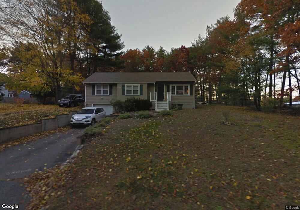
394 Union St Hanover, MA 02339
Estimated Value: $582,574 - $749,000
3
Beds
1
Bath
1,050
Sq Ft
$650/Sq Ft
Est. Value
About This Home
This home is located at 394 Union St, Hanover, MA 02339 and is currently estimated at $682,394, approximately $649 per square foot. 394 Union St is a home located in Plymouth County with nearby schools including Hanover High School, Cadence Academy Preschool - Hanover, and The Master's Academy.
Ownership History
Date
Name
Owned For
Owner Type
Purchase Details
Closed on
May 30, 2008
Sold by
Gelly Lynne R
Bought by
Sidor Donnell and Donovan Kaitlin E
Current Estimated Value
Home Financials for this Owner
Home Financials are based on the most recent Mortgage that was taken out on this home.
Original Mortgage
$329,824
Interest Rate
5.91%
Mortgage Type
Purchase Money Mortgage
Purchase Details
Closed on
Feb 19, 2008
Sold by
Kahler Peter M
Bought by
Gelly Lynne R
Create a Home Valuation Report for This Property
The Home Valuation Report is an in-depth analysis detailing your home's value as well as a comparison with similar homes in the area
Home Values in the Area
Average Home Value in this Area
Purchase History
| Date | Buyer | Sale Price | Title Company |
|---|---|---|---|
| Sidor Donnell | $335,000 | -- | |
| Sidor Donnell | $335,000 | -- | |
| Gelly Lynne R | $245,000 | -- | |
| Gelly Lynne R | $245,000 | -- |
Source: Public Records
Mortgage History
| Date | Status | Borrower | Loan Amount |
|---|---|---|---|
| Open | Gelly Lynne R | $337,084 | |
| Closed | Gelly Lynne R | $332,741 | |
| Closed | Gelly Lynne R | $329,824 |
Source: Public Records
Tax History
| Year | Tax Paid | Tax Assessment Tax Assessment Total Assessment is a certain percentage of the fair market value that is determined by local assessors to be the total taxable value of land and additions on the property. | Land | Improvement |
|---|---|---|---|---|
| 2025 | $6,732 | $545,100 | $271,500 | $273,600 |
| 2024 | $6,999 | $545,100 | $271,500 | $273,600 |
| 2023 | $6,424 | $476,200 | $246,700 | $229,500 |
| 2022 | $6,346 | $416,100 | $246,700 | $169,400 |
| 2021 | $6,357 | $389,300 | $224,600 | $164,700 |
| 2020 | $6,274 | $384,700 | $224,600 | $160,100 |
| 2019 | $6,009 | $366,200 | $224,600 | $141,600 |
| 2018 | $5,862 | $360,100 | $224,600 | $135,500 |
| 2017 | $5,589 | $338,300 | $213,700 | $124,600 |
| 2016 | $5,375 | $318,800 | $194,200 | $124,600 |
| 2015 | $4,903 | $303,600 | $194,200 | $109,400 |
Source: Public Records
Map
Nearby Homes
- 62 Larchmont Ln
- 53 Chestnut St
- 68 East St
- 506 Main St
- 776 Main St
- 33 1st Parish Ln
- 44 Stone Meadow Ln
- 47 Stone Meadow Ln
- 36 Grove St
- 535 Webster St
- 250 Center St
- 51 Cervelli Farm Dr
- 37 Dr
- 23 Cervelli Farm Dr
- 38 Cervelli Farm Dr
- 9 Cervelli Farm Dr
- 164 Main St
- 46 Brookwood Rd
- 23 John Neil Dr
- 7 Assinippi Ave Unit 205
- 386 Union St
- 389 Union St
- 372 Union St
- 184 Old Washington St
- 1076 Washington St
- 375 Union St
- 1070 Washington St
- 1070 Washington St Unit 1070
- 27 Pine St
- 1080 Washington St
- 170 Old Washington St
- 37 Pine St
- 24 Hearthstone Way
- 9 Hearthstone Way
- 1100 Washington St Unit 5
- 1100 Washington St Unit 7
- 1100 Washington St Unit 3
- 1100 Washington St Unit Annex
- 1100 Washington St Unit 9
- 1096 Washington St
Your Personal Tour Guide
Ask me questions while you tour the home.