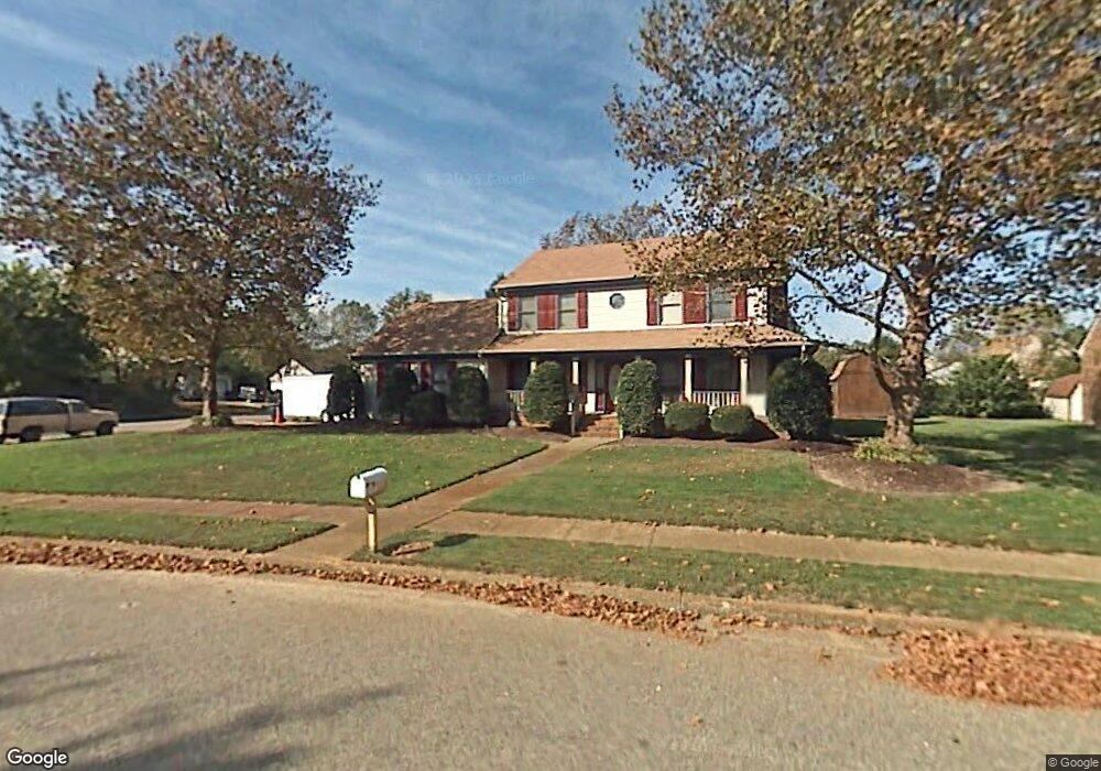
3944 Long Point Blvd Portsmouth, VA 23703
Churchland NeighborhoodEstimated Value: $395,000 - $439,000
3
Beds
3
Baths
2,252
Sq Ft
$184/Sq Ft
Est. Value
About This Home
This home is located at 3944 Long Point Blvd, Portsmouth, VA 23703 and is currently estimated at $413,795, approximately $183 per square foot. 3944 Long Point Blvd is a home located in Portsmouth City with nearby schools including Churchland Primary/Intermediate School, Churchland Middle School, and Churchland High School.
Ownership History
Date
Name
Owned For
Owner Type
Purchase Details
Closed on
Mar 11, 2003
Sold by
Milam Rickie D
Bought by
Toretti Phillip A
Current Estimated Value
Home Financials for this Owner
Home Financials are based on the most recent Mortgage that was taken out on this home.
Original Mortgage
$148,000
Outstanding Balance
$63,385
Interest Rate
5.95%
Mortgage Type
FHA
Estimated Equity
$350,410
Create a Home Valuation Report for This Property
The Home Valuation Report is an in-depth analysis detailing your home's value as well as a comparison with similar homes in the area
Home Values in the Area
Average Home Value in this Area
Purchase History
| Date | Buyer | Sale Price | Title Company |
|---|---|---|---|
| Toretti Phillip A | $185,000 | -- |
Source: Public Records
Mortgage History
| Date | Status | Borrower | Loan Amount |
|---|---|---|---|
| Open | Toretti Phillip A | $148,000 |
Source: Public Records
Tax History Compared to Growth
Tax History
| Year | Tax Paid | Tax Assessment Tax Assessment Total Assessment is a certain percentage of the fair market value that is determined by local assessors to be the total taxable value of land and additions on the property. | Land | Improvement |
|---|---|---|---|---|
| 2025 | $4,603 | $382,260 | $93,410 | $288,850 |
| 2024 | $4,603 | $360,300 | $93,410 | $266,890 |
| 2023 | $4,119 | $329,550 | $93,410 | $236,140 |
| 2022 | $4,227 | $325,160 | $93,410 | $231,750 |
| 2021 | $3,596 | $276,650 | $77,840 | $198,810 |
| 2020 | $3,463 | $266,350 | $74,130 | $192,220 |
| 2019 | $3,434 | $264,150 | $74,130 | $190,020 |
| 2018 | $3,434 | $264,150 | $74,130 | $190,020 |
| 2017 | $3,434 | $264,150 | $74,130 | $190,020 |
| 2016 | $3,320 | $255,370 | $74,130 | $181,240 |
| 2015 | $3,320 | $255,370 | $74,130 | $181,240 |
| 2014 | $3,243 | $255,370 | $74,130 | $181,240 |
Source: Public Records
Map
Nearby Homes
- 17 Shoal Ct
- 8 Compass Ct
- 3866 Augustine Cir
- 4071 Long Point Blvd
- 3877 Peachtree Ln W
- 3818 Peach Orchard Cir
- 4100 Mayfair Way
- 3860 Sugar Creek Cir
- 3913 Stateflower Ct
- 3817 Harvest Ct
- 6446 Olde Bullocks Cir
- 5807 Dunkin St
- 3660B Towne Point Rd Unit A
- 3433 Willow Breeze Dr
- 6417 Pelican Crescent N
- 3791 Towne Point Rd
- 4200 Quince Rd
- 21 Windy Pines Crescent
- 3715 Magnolia Dr
- 5833 Hawthorne Ln
- 2 Sailfish St
- 3948 Long Point Blvd
- 3940 Long Point Blvd
- 1 Sailfish St
- 3947 Long Point Blvd
- 4 Sailfish St
- 3952 Long Point Blvd
- 11 Shoal Ct
- 3951 Long Point Blvd
- 13 Shoal Ct
- 3 Sailfish St
- 3943 Long Point Blvd
- 9 Shoal Ct
- 5 Sailfish St
- 3956 Long Point Blvd
- 15 Shoal Ct
- 3936 Long Point Blvd
- 6 Sailfish St
- 3939 Long Point Blvd
- 4005 Ebbtide Ln