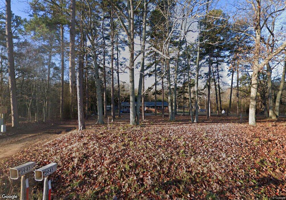
3945 Lesslie Hwy Catawba, SC 29704
Estimated Value: $274,000 - $339,000
3
Beds
2
Baths
1,440
Sq Ft
$214/Sq Ft
Est. Value
About This Home
This home is located at 3945 Lesslie Hwy, Catawba, SC 29704 and is currently estimated at $308,404, approximately $214 per square foot. 3945 Lesslie Hwy is a home located in York County with nearby schools including Lesslie Elementary School, Castle Heights Middle School, and Rock Hill High School.
Ownership History
Date
Name
Owned For
Owner Type
Purchase Details
Closed on
Feb 14, 2023
Sold by
Vang Tria
Bought by
Xiong James Buchanan and Xiong Chris Moua
Current Estimated Value
Home Financials for this Owner
Home Financials are based on the most recent Mortgage that was taken out on this home.
Original Mortgage
$235,653
Outstanding Balance
$227,974
Interest Rate
6.12%
Mortgage Type
FHA
Estimated Equity
$80,430
Purchase Details
Closed on
May 21, 2001
Sold by
Shields Robert C and Shields Joanne G
Bought by
Ker Vang Tria and Ker Thao
Create a Home Valuation Report for This Property
The Home Valuation Report is an in-depth analysis detailing your home's value as well as a comparison with similar homes in the area
Home Values in the Area
Average Home Value in this Area
Purchase History
| Date | Buyer | Sale Price | Title Company |
|---|---|---|---|
| Xiong James Buchanan | $240,000 | -- | |
| Ker Vang Tria | $110,000 | -- |
Source: Public Records
Mortgage History
| Date | Status | Borrower | Loan Amount |
|---|---|---|---|
| Open | Xiong James Buchanan | $235,653 |
Source: Public Records
Tax History Compared to Growth
Tax History
| Year | Tax Paid | Tax Assessment Tax Assessment Total Assessment is a certain percentage of the fair market value that is determined by local assessors to be the total taxable value of land and additions on the property. | Land | Improvement |
|---|---|---|---|---|
| 2024 | $1,316 | $9,370 | $1,120 | $8,250 |
| 2023 | $705 | $4,899 | $916 | $3,983 |
| 2022 | $708 | $4,899 | $916 | $3,983 |
| 2021 | -- | $4,899 | $916 | $3,983 |
| 2020 | $705 | $4,899 | $0 | $0 |
| 2019 | $643 | $4,260 | $0 | $0 |
| 2018 | $638 | $4,260 | $0 | $0 |
| 2017 | $602 | $4,260 | $0 | $0 |
| 2016 | $583 | $4,260 | $0 | $0 |
| 2014 | $534 | $4,260 | $1,360 | $2,900 |
| 2013 | $534 | $4,420 | $1,360 | $3,060 |
Source: Public Records
Map
Nearby Homes
- 4000 Lesslie Hwy
- 4001 Lesslie Hwy
- 3886 Lesslie Hwy
- 1009 Rainbow Cir
- 3835 Lesslie Hwy
- 0000 Tract #1A Roddey Rd
- 355 Leisure Ln
- 686 Cannon Dr
- 356 Emma Wood Ln
- 574 Karen Dr
- 1903 Manning Place
- 00 Whispering Pines Dr Unit 31
- 3339 Lesslie Hwy Unit 2
- 505 Fencepost Ln
- 925 Four Cross Rd
- 3943 Walker Rd Unit LOT ONLY
- 3943 Walker Rd
- 3943 Walker Road (Land Only)
- 611 Pondway Downs
- 4575 Cureton Ferry Rd
- 3953 Lesslie Hwy
- 3917 Lesslie Hwy
- 3977 Lesslie Hwy
- 3991 Lesslie Hwy
- 117 Ole Simpson Place
- 162 Old Friendship Rd
- 199 Old Friendship Rd
- 184 Old Friendship Rd
- 190 Old Friendship Rd
- 0000 Old Friendship Rd
- 0000 Old Friendship Rd Unit 2
- 00 Old Friendship Rd
- 3980 Roddey Rd
- 121 Ole Simpson Place
- 143 Old Friendship Rd
- 113 Old Friendship Rd
- 144 Old Friendship Rd
- 3869 Lesslie Hwy
- 110 Ole Simpson Place
- 3980 Joanna Ln