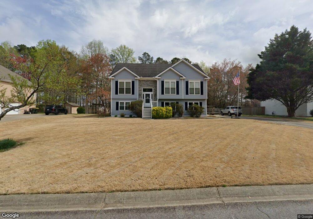
3945 Pheasant Run Trace Cumming, GA 30028
Estimated Value: $399,000 - $413,000
4
Beds
3
Baths
1,415
Sq Ft
$287/Sq Ft
Est. Value
About This Home
This home is located at 3945 Pheasant Run Trace, Cumming, GA 30028 and is currently estimated at $405,883, approximately $286 per square foot. 3945 Pheasant Run Trace is a home located in Forsyth County with nearby schools including Poole's Mill Elementary School, Liberty Middle School, and North Forsyth High School.
Ownership History
Date
Name
Owned For
Owner Type
Purchase Details
Closed on
Jun 6, 2003
Sold by
Lane James J
Bought by
Lane Janet and Lane James
Current Estimated Value
Home Financials for this Owner
Home Financials are based on the most recent Mortgage that was taken out on this home.
Original Mortgage
$152,000
Interest Rate
5.68%
Mortgage Type
New Conventional
Purchase Details
Closed on
Jan 16, 2001
Sold by
Chase Manhattan Mtg Corp
Bought by
Lane James J
Purchase Details
Closed on
Sep 29, 1995
Sold by
Steve Arthur Constr Co Inc
Bought by
Vonhoffmann Christopher
Create a Home Valuation Report for This Property
The Home Valuation Report is an in-depth analysis detailing your home's value as well as a comparison with similar homes in the area
Home Values in the Area
Average Home Value in this Area
Purchase History
| Date | Buyer | Sale Price | Title Company |
|---|---|---|---|
| Lane Janet | -- | -- | |
| Lane James J | -- | -- | |
| Vonhoffmann Christopher | $121,900 | -- |
Source: Public Records
Mortgage History
| Date | Status | Borrower | Loan Amount |
|---|---|---|---|
| Closed | Lane Janet | $152,000 | |
| Closed | Vonhoffmann Christopher | $0 |
Source: Public Records
Tax History Compared to Growth
Tax History
| Year | Tax Paid | Tax Assessment Tax Assessment Total Assessment is a certain percentage of the fair market value that is determined by local assessors to be the total taxable value of land and additions on the property. | Land | Improvement |
|---|---|---|---|---|
| 2025 | $3,209 | $167,500 | $48,000 | $119,500 |
| 2024 | $3,209 | $155,816 | $46,000 | $109,816 |
| 2023 | $2,524 | $142,648 | $38,000 | $104,648 |
| 2022 | $2,643 | $92,592 | $18,000 | $74,592 |
| 2021 | $2,315 | $92,592 | $18,000 | $74,592 |
| 2020 | $2,232 | $88,576 | $18,000 | $70,576 |
| 2019 | $2,225 | $88,040 | $18,000 | $70,040 |
| 2018 | $2,001 | $76,980 | $14,000 | $62,980 |
| 2017 | $1,888 | $71,268 | $14,000 | $57,268 |
| 2016 | $1,888 | $71,268 | $14,000 | $57,268 |
| 2015 | $1,745 | $65,908 | $14,000 | $51,908 |
| 2014 | $1,478 | $59,136 | $14,000 | $45,136 |
Source: Public Records
Map
Nearby Homes
- 3880 Deer Run Dr
- 3875 Deer Run Dr
- 3820 Pheasant Run Trace
- 3705 Williams Point Dr
- 3985 Haven Way
- 3975 Haven Way
- 3945 Silverthorn Trace
- 3975 Silverthorn Trace
- 4020 Haven Way
- BELLVIEW Plan at Haven Abbey
- WESTERLY Plan at Haven Abbey
- LYNNBROOK Plan at Haven Abbey
- 3905 Hurt Bridge Rd
- GRAYSON Plan at Haven Abbey
- 4275 Hunters Walk Way
- 4305 Hunters Walk Way
- 4150 Starr Creek Rd
- 3435 Summerdale Walk
- 3955 Pheasant Run Trace Unit 58
- 3955 Pheasant Run Trace
- 3935 Pheasant Run Trace
- 3965 Pheasant Run Trace
- 3925 Pheasant Run Trace
- 3940 Pheasant Run Trace
- 3950 Pheasant Run Trace Unit 12
- 3950 Pheasant Run Trace
- 3950 Pheasant Run
- 3930 Pheasant Run Trace
- 3960 Pheasant Run Trace
- 3975 Pheasant Run Trace
- 3915 Pheasant Run Trace
- 3910 Pheasant Run Trace
- 3725 Hurt Bridge Rd
- 3970 Pheasant Run Trace
- 3915 Mallard Way
- 3985 Pheasant Run Trace
- 3845 Pheasant Run Trace
- 3850 Deer Run Dr