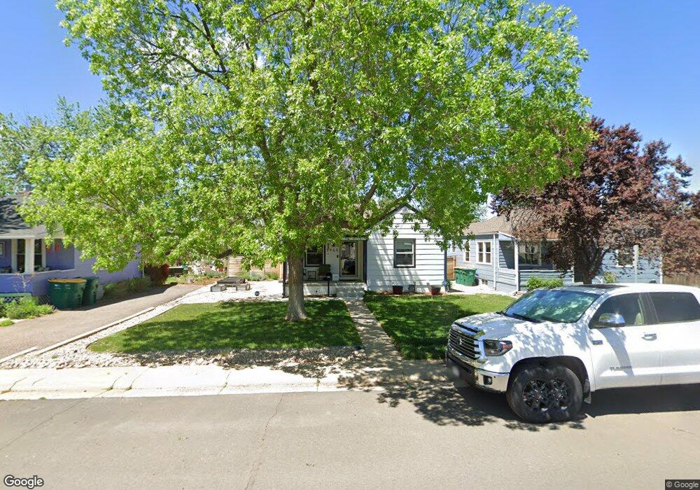
3945 S Grant St Englewood, CO 80113
South Broadway Heights NeighborhoodEstimated Value: $428,610 - $495,000
2
Beds
1
Bath
740
Sq Ft
$636/Sq Ft
Est. Value
About This Home
This home is located at 3945 S Grant St, Englewood, CO 80113 and is currently estimated at $470,403, approximately $635 per square foot. 3945 S Grant St is a home located in Arapahoe County with nearby schools including Cherrelyn Elementary School, Englewood Middle School, and Englewood High School.
Ownership History
Date
Name
Owned For
Owner Type
Purchase Details
Closed on
Jun 7, 2023
Sold by
Mcgrath Luke and Goluch Michelle
Bought by
Mcgrath Luke and Mcgrath Michelle
Current Estimated Value
Home Financials for this Owner
Home Financials are based on the most recent Mortgage that was taken out on this home.
Original Mortgage
$50,000
Outstanding Balance
$42,386
Interest Rate
9.25%
Mortgage Type
Credit Line Revolving
Estimated Equity
$428,017
Purchase Details
Closed on
May 6, 2021
Sold by
Mcgrath Luke
Bought by
Mcgrath Luke and Goluch Michelle
Home Financials for this Owner
Home Financials are based on the most recent Mortgage that was taken out on this home.
Original Mortgage
$326,200
Interest Rate
2.9%
Mortgage Type
New Conventional
Purchase Details
Closed on
Mar 23, 2015
Sold by
Maestas Glenyce A
Bought by
Mcgrath Luke
Home Financials for this Owner
Home Financials are based on the most recent Mortgage that was taken out on this home.
Original Mortgage
$222,300
Interest Rate
3.6%
Mortgage Type
New Conventional
Purchase Details
Closed on
Aug 31, 2004
Sold by
Aruldoss Michelle M and Aruldoss Robert G
Bought by
Maestas Glenyce A
Purchase Details
Closed on
Feb 8, 2003
Sold by
Maestas Michelle M and Maestas Glenyce A
Bought by
Aruldoss Michelle M and Aruldoss Robert G
Home Financials for this Owner
Home Financials are based on the most recent Mortgage that was taken out on this home.
Original Mortgage
$140,600
Interest Rate
5.9%
Purchase Details
Closed on
Oct 15, 1999
Sold by
Ball Family Trust
Bought by
Maestas Michelle M and Maestas Thomas V
Home Financials for this Owner
Home Financials are based on the most recent Mortgage that was taken out on this home.
Original Mortgage
$142,533
Interest Rate
7.85%
Mortgage Type
FHA
Purchase Details
Closed on
Jul 15, 1993
Sold by
Ball James S
Bought by
Ball James S & Shirley A Trustees
Purchase Details
Closed on
Jun 9, 1992
Sold by
Mcwilliams Marguerite
Bought by
Ball James S
Purchase Details
Closed on
Sep 30, 1986
Sold by
Conversion Arapco
Bought by
Mcwilliams Marguerite
Purchase Details
Closed on
Jul 4, 1776
Bought by
Conversion Arapco
Create a Home Valuation Report for This Property
The Home Valuation Report is an in-depth analysis detailing your home's value as well as a comparison with similar homes in the area
Home Values in the Area
Average Home Value in this Area
Purchase History
| Date | Buyer | Sale Price | Title Company |
|---|---|---|---|
| Mcgrath Luke | -- | None Listed On Document | |
| Mcgrath Luke | -- | First American Title | |
| Mcgrath Luke | $234,000 | Land Title Guarantee Company | |
| Maestas Glenyce A | $190,000 | Security Title | |
| Aruldoss Michelle M | -- | First American Heritage Titl | |
| Maestas Michelle M | $144,900 | Title Services | |
| Ball James S & Shirley A Trustees | -- | -- | |
| Ball James S | -- | -- | |
| Mcwilliams Marguerite | -- | -- | |
| Conversion Arapco | -- | -- |
Source: Public Records
Mortgage History
| Date | Status | Borrower | Loan Amount |
|---|---|---|---|
| Open | Mcgrath Luke | $50,000 | |
| Previous Owner | Mcgrath Luke | $326,200 | |
| Previous Owner | Mcgrath Luke | $222,300 | |
| Previous Owner | Aruldoss Michelle M | $140,600 | |
| Previous Owner | Maestas Michelle M | $142,533 |
Source: Public Records
Tax History Compared to Growth
Tax History
| Year | Tax Paid | Tax Assessment Tax Assessment Total Assessment is a certain percentage of the fair market value that is determined by local assessors to be the total taxable value of land and additions on the property. | Land | Improvement |
|---|---|---|---|---|
| 2024 | $2,039 | $28,984 | -- | -- |
| 2023 | $2,039 | $28,984 | $0 | $0 |
| 2022 | $1,730 | $23,756 | $0 | $0 |
| 2021 | $1,724 | $23,756 | $0 | $0 |
| 2020 | $1,566 | $21,321 | $0 | $0 |
| 2019 | $1,556 | $21,321 | $0 | $0 |
| 2018 | $1,426 | $18,230 | $0 | $0 |
| 2017 | $1,413 | $18,230 | $0 | $0 |
| 2016 | $1,288 | $15,745 | $0 | $0 |
| 2015 | $1,063 | $15,745 | $0 | $0 |
| 2014 | -- | $12,648 | $0 | $0 |
| 2013 | -- | $12,860 | $0 | $0 |
Source: Public Records
Map
Nearby Homes
- 3928 S Pearl St
- 3839 S Broadway
- 4127 S Logan St
- 3135 S Washington St
- 4159 S Sherman St
- 3837 S Acoma St
- 3978 S Washington St
- 3768 S Acoma St
- 3857 S Clarkson St
- 4065 S Bannock St
- 4087 S Clarkson St
- 3780 S Cherokee St
- 3675 S Cherokee St Unit 102A
- 4291 S Clarkson St
- 4221 S Cherokee St
- 3810 S Fox St
- 1075 E Oxford Ln
- 4420 S Grant St
- 3625 S Elati St
- 4221 S Elati St
- 3953 S Grant St
- 3935 S Grant St
- 3955 S Grant St
- 3923 S Grant St
- 3934 S Sherman St
- 3942 S Sherman St
- 3915 S Grant St
- 3965 S Grant St
- 3930 S Sherman St
- 3950 S Sherman St
- 3940 S Grant St
- 3936 S Grant St
- 3960 S Sherman St
- 3906 S Sherman St
- 3950 S Grant St
- 3930 S Grant St
- 3969 S Grant St
- 3903 S Grant St
- 3960 S Grant St
- 3920 S Grant St