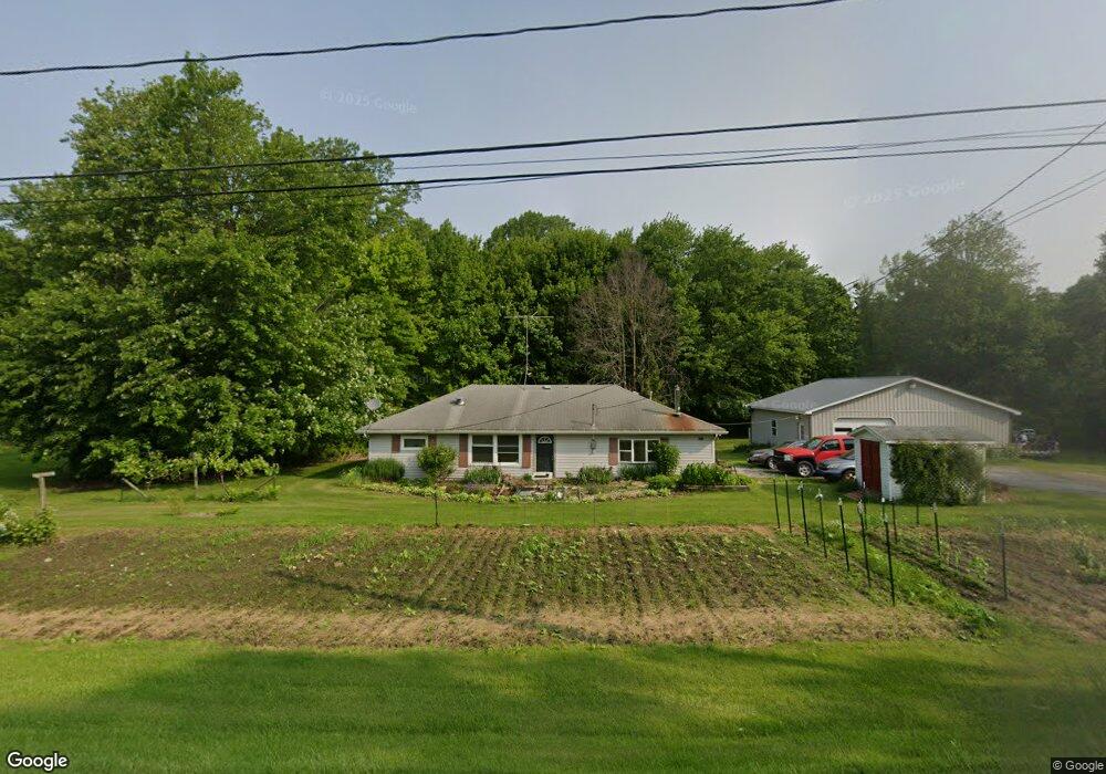
3947 Gore Rd Conneaut, OH 44030
Kingsville NeighborhoodEstimated Value: $142,063 - $177,000
2
Beds
1
Bath
1,300
Sq Ft
$122/Sq Ft
Est. Value
About This Home
This home is located at 3947 Gore Rd, Conneaut, OH 44030 and is currently estimated at $158,766, approximately $122 per square foot. 3947 Gore Rd is a home located in Ashtabula County with nearby schools including Kingsville Elementary School, Ridgeview Elementary School, and Wallace H. Braden Junior High School.
Ownership History
Date
Name
Owned For
Owner Type
Purchase Details
Closed on
Apr 29, 2005
Sold by
Vanerhoof Mark J and Vanderhoof Mary
Bought by
Hannold Dora L
Current Estimated Value
Home Financials for this Owner
Home Financials are based on the most recent Mortgage that was taken out on this home.
Original Mortgage
$92,547
Outstanding Balance
$48,935
Interest Rate
6.06%
Mortgage Type
FHA
Estimated Equity
$109,831
Purchase Details
Closed on
Jun 8, 2000
Sold by
Roboski Edward W
Bought by
Vanderhoof Mark J
Home Financials for this Owner
Home Financials are based on the most recent Mortgage that was taken out on this home.
Original Mortgage
$62,423
Interest Rate
8.14%
Mortgage Type
FHA
Create a Home Valuation Report for This Property
The Home Valuation Report is an in-depth analysis detailing your home's value as well as a comparison with similar homes in the area
Home Values in the Area
Average Home Value in this Area
Purchase History
| Date | Buyer | Sale Price | Title Company |
|---|---|---|---|
| Hannold Dora L | $94,000 | Chicago Title Agency | |
| Vanderhoof Mark J | $62,500 | -- |
Source: Public Records
Mortgage History
| Date | Status | Borrower | Loan Amount |
|---|---|---|---|
| Open | Hannold Dora L | $92,547 | |
| Previous Owner | Vanderhoof Mark J | $62,423 |
Source: Public Records
Tax History Compared to Growth
Tax History
| Year | Tax Paid | Tax Assessment Tax Assessment Total Assessment is a certain percentage of the fair market value that is determined by local assessors to be the total taxable value of land and additions on the property. | Land | Improvement |
|---|---|---|---|---|
| 2024 | $2,477 | $34,830 | $6,270 | $28,560 |
| 2023 | $1,211 | $34,830 | $6,270 | $28,560 |
| 2022 | $1,009 | $26,010 | $4,830 | $21,180 |
| 2021 | $1,010 | $26,010 | $4,830 | $21,180 |
| 2020 | $1,021 | $26,010 | $4,830 | $21,180 |
| 2019 | $1,276 | $31,090 | $5,500 | $25,590 |
| 2018 | $1,229 | $31,090 | $5,500 | $25,590 |
| 2017 | $1,229 | $31,090 | $5,500 | $25,590 |
| 2016 | $1,086 | $27,270 | $4,830 | $22,440 |
| 2015 | $1,085 | $27,270 | $4,830 | $22,440 |
| 2014 | $1,049 | $27,270 | $4,830 | $22,440 |
| 2013 | $1,029 | $26,950 | $3,500 | $23,450 |
Source: Public Records
Map
Nearby Homes
- 3988 Lake Rd
- 4017 Lake Rd Unit 17
- 7842 Cleveland Dr
- 4377 E Center St
- 7032 Reed Rd
- 7630 Darling Ave
- 7527 Tamkrist Trail
- 7002 Reed Rd
- 3339 Lake Rd
- 7328 Harmon Rd
- 7544 Glenwood Rd
- 7435 Glenwood Rd
- 7463 Glenwood Rd
- 6926 Reed Rd
- 106 Margor Dr
- 531 W Main Rd
- 0 Creek Rd Unit 5146859
- 40 Oakland Blvd
- 3241 S Forest Dr
- 2928 Placid Pointe Rd