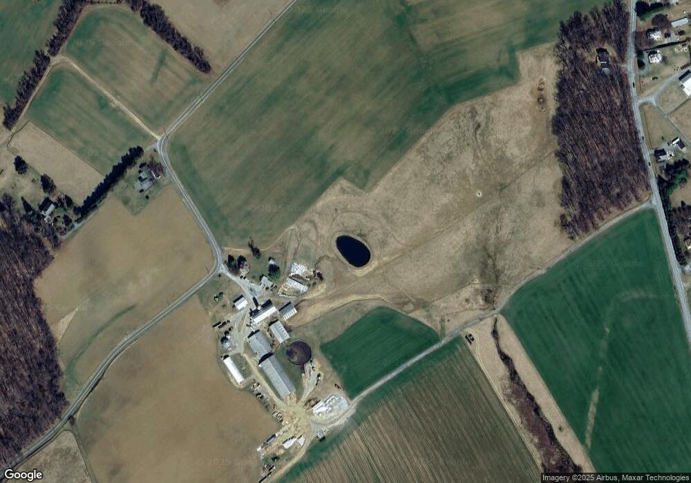
3948 Mount Zion Rd Upperco, MD 21155
Estimated Value: $461,783 - $598,000
Studio
2
Baths
2,280
Sq Ft
$243/Sq Ft
Est. Value
About This Home
This home is located at 3948 Mount Zion Rd, Upperco, MD 21155 and is currently estimated at $554,696, approximately $243 per square foot. 3948 Mount Zion Rd is a home located in Baltimore County with nearby schools including Fifth District Elementary School, Hereford Middle School, and Hereford High School.
Ownership History
Date
Name
Owned For
Owner Type
Purchase Details
Closed on
Jul 30, 2007
Sold by
Wenzel Timothy
Bought by
Wenzel Timothy and Wenzel Carla
Current Estimated Value
Home Financials for this Owner
Home Financials are based on the most recent Mortgage that was taken out on this home.
Original Mortgage
$487,500
Outstanding Balance
$352,648
Interest Rate
9.69%
Mortgage Type
New Conventional
Estimated Equity
$202,048
Purchase Details
Closed on
Apr 19, 2006
Sold by
Wisner John B
Bought by
Wenzel Timothy
Home Financials for this Owner
Home Financials are based on the most recent Mortgage that was taken out on this home.
Original Mortgage
$333,400
Interest Rate
6.26%
Mortgage Type
Purchase Money Mortgage
Purchase Details
Closed on
Jan 20, 1956
Sold by
Wisner George H
Bought by
Wisner John B
Create a Home Valuation Report for This Property
The Home Valuation Report is an in-depth analysis detailing your home's value as well as a comparison with similar homes in the area
Purchase History
| Date | Buyer | Sale Price | Title Company |
|---|---|---|---|
| Wenzel Timothy | -- | -- | |
| Wenzel Timothy | $260,000 | -- | |
| Wenzel Timothy | $260,000 | -- | |
| Wisner John B | $500 | -- |
Source: Public Records
Mortgage History
| Date | Status | Borrower | Loan Amount |
|---|---|---|---|
| Open | Wenzel Timothy | $487,500 | |
| Previous Owner | Wenzel Timothy | $333,400 |
Source: Public Records
Tax History Compared to Growth
Tax History
| Year | Tax Paid | Tax Assessment Tax Assessment Total Assessment is a certain percentage of the fair market value that is determined by local assessors to be the total taxable value of land and additions on the property. | Land | Improvement |
|---|---|---|---|---|
| 2025 | $4,923 | $432,200 | $90,100 | $342,100 |
| 2024 | $4,923 | $403,067 | -- | -- |
| 2023 | $2,296 | $373,933 | $0 | $0 |
| 2022 | $4,201 | $344,800 | $77,100 | $267,700 |
| 2021 | $3,884 | $330,167 | $0 | $0 |
| 2020 | $3,884 | $315,533 | $0 | $0 |
| 2019 | $3,707 | $300,900 | $77,100 | $223,800 |
| 2018 | $3,560 | $288,767 | $0 | $0 |
| 2017 | $3,382 | $276,633 | $0 | $0 |
| 2016 | $3,321 | $264,500 | $0 | $0 |
| 2015 | $3,321 | $264,500 | $0 | $0 |
| 2014 | $3,321 | $264,500 | $0 | $0 |
Source: Public Records
Map
Nearby Homes
- 4100 Black Rock Rd
- 16535 Trenton Rd
- 16306 Trenton Rd
- 17208 Hunter Green Rd
- 16506 Dubbs Rd
- 17 Mamopa Ct
- 3116 Mount Carmel Rd
- 0 Trenton Mill Rd Unit MDBC2117946
- 0 Falls Rd Unit MDBC2120964
- 0 Dover Rd Unit MDBC2012792
- 840 Century St
- 14628 Old Hanover Rd Unit REGINA
- 14628 Old Hanover Rd Unit BENTON
- 14628 Old Hanover Rd Unit RAINIER
- 14628 Old Hanover Rd Unit TULARE
- 28 Bush Cabin Ct
- 893 Century St
- 1209 Woodland Ct
- 4825 Osborn Rd
- 917 Century St
- 3948 Mount Zion Rd
- 3946 Mount Zion Rd
- 4019 Mount Zion Rd
- 3922 Mount Zion Rd
- 3741 Black Rock Rd
- 3831 Black Rock Rd
- 3801 Black Rock Rd
- 4075 Mount Zion Rd
- 3738 Black Rock Rd
- 3752 Black Rock Rd
- 3754 Black Rock Rd
- 3814 Black Rock Rd
- 3758 Black Rock Rd
- 3806 Black Rock Rd
- 3726 Black Rock Rd
- 3778 Black Rock Rd
- 3750 Black Rock Rd
- 3824 Black Rock Rd
- 3810 Black Rock Rd
- 4081 Mount Zion Rd
