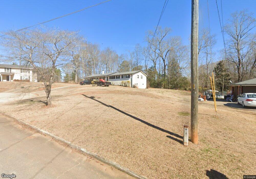
3948 Nations Dr Douglasville, GA 30135
Bill Arp NeighborhoodEstimated Value: $225,000 - $247,000
3
Beds
2
Baths
1,288
Sq Ft
$182/Sq Ft
Est. Value
About This Home
This home is located at 3948 Nations Dr, Douglasville, GA 30135 and is currently estimated at $233,936, approximately $181 per square foot. 3948 Nations Dr is a home located in Douglas County with nearby schools including Bill Arp Elementary School, Mason Creek Middle School, and Alexander High School.
Ownership History
Date
Name
Owned For
Owner Type
Purchase Details
Closed on
Jun 27, 2014
Sold by
Snyder Rhonda Ann
Bought by
Bright Steven Daniel
Current Estimated Value
Home Financials for this Owner
Home Financials are based on the most recent Mortgage that was taken out on this home.
Original Mortgage
$74,005
Outstanding Balance
$56,391
Interest Rate
4.17%
Mortgage Type
New Conventional
Estimated Equity
$177,545
Purchase Details
Closed on
Dec 22, 2010
Sold by
Snyder Marvine W
Bought by
Snyder Rhonda A and Snyder Kimberly Donna
Create a Home Valuation Report for This Property
The Home Valuation Report is an in-depth analysis detailing your home's value as well as a comparison with similar homes in the area
Home Values in the Area
Average Home Value in this Area
Purchase History
| Date | Buyer | Sale Price | Title Company |
|---|---|---|---|
| Bright Steven Daniel | $77,900 | -- | |
| Snyder Rhonda A | -- | -- |
Source: Public Records
Mortgage History
| Date | Status | Borrower | Loan Amount |
|---|---|---|---|
| Open | Bright Steven Daniel | $74,005 |
Source: Public Records
Tax History Compared to Growth
Tax History
| Year | Tax Paid | Tax Assessment Tax Assessment Total Assessment is a certain percentage of the fair market value that is determined by local assessors to be the total taxable value of land and additions on the property. | Land | Improvement |
|---|---|---|---|---|
| 2024 | $1,972 | $62,680 | $18,000 | $44,680 |
| 2023 | $1,972 | $46,080 | $8,800 | $37,280 |
| 2022 | $1,501 | $46,080 | $8,800 | $37,280 |
| 2021 | $1,358 | $41,640 | $9,920 | $31,720 |
| 2020 | $1,381 | $41,640 | $9,920 | $31,720 |
| 2019 | $1,265 | $40,840 | $9,920 | $30,920 |
| 2018 | $1,078 | $34,640 | $8,680 | $25,960 |
| 2017 | $1,002 | $31,600 | $8,680 | $22,920 |
| 2016 | $1,020 | $31,600 | $8,960 | $22,640 |
| 2015 | $784 | $28,920 | $8,440 | $20,480 |
| 2014 | $784 | $23,320 | $7,040 | $16,280 |
| 2013 | -- | $23,000 | $7,040 | $15,960 |
Source: Public Records
Map
Nearby Homes
- 3950 Sherwood Dr
- 4016 Nations Dr
- 6653 Prinston Cir
- 3976 Bright Star Rd
- 3948 Bright Star Rd
- 4766 Mockingbird Ln
- 3980 Highway 5
- 3741 100 Rd
- 3850 Bright Star Rd
- 3829 Bright Star Rd
- 3677 Bright Star Rd
- 4099 Highway 5
- 6549 Biscayne Way
- 3756 Bright Star Rd
- 20 Roper Dr
- 4045 Westview St
- 6464 Westerly Way
- 6662 Birchwood Ct
- 4153 Wells Cir
- 3960 Nations Dr
- 3960 Nations Dr Unit 7
- 3938 Nations Dr
- 0 Nations Dr Unit 8701434
- 0 Nations Dr Unit 8646032
- 0 Nations Dr Unit 7038853
- 0 Nations Dr Unit 7012987
- 0 Nations Dr Unit 7338648
- 0 Nations Dr Unit 7315936
- 0 Nations Dr Unit 7183973
- 0 Nations Dr Unit 9020377
- 0 Nations Dr Unit 9039821
- 0 Nations Dr Unit 6951800
- 0 Nations Dr Unit 9059238
- 0 Nations Dr Unit 8749560
- 0 Nations Dr Unit 8891841
- 0 Nations Dr Unit 3270391
- 0 Nations Dr Unit 7041019
- 0 Nations Dr Unit 7310113
- 0 Nations Dr Unit 7519042