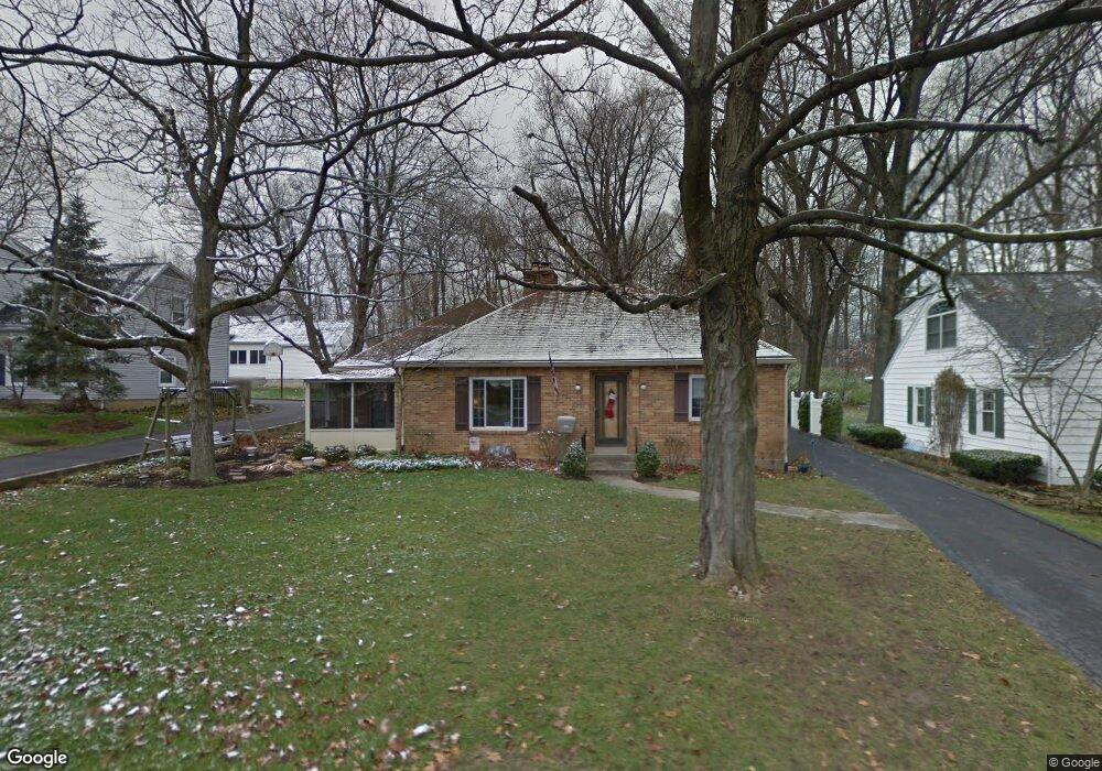
3949 Lenox Dr Dayton, OH 45429
Estimated Value: $322,000 - $406,000
4
Beds
3
Baths
2,780
Sq Ft
$132/Sq Ft
Est. Value
About This Home
This home is located at 3949 Lenox Dr, Dayton, OH 45429 and is currently estimated at $366,883, approximately $131 per square foot. 3949 Lenox Dr is a home located in Montgomery County with nearby schools including Southdale Elementary School, Van Buren Middle School, and Kettering Fairmont High School.
Ownership History
Date
Name
Owned For
Owner Type
Purchase Details
Closed on
Oct 27, 2021
Sold by
Hardesty Darren
Bought by
Hardesty Amie Lynn
Current Estimated Value
Purchase Details
Closed on
Nov 25, 2019
Sold by
Viall Micheal J and Viall Kathleen R
Bought by
Hardesty Amie Lynn
Home Financials for this Owner
Home Financials are based on the most recent Mortgage that was taken out on this home.
Original Mortgage
$203,700
Outstanding Balance
$178,587
Interest Rate
3.75%
Mortgage Type
New Conventional
Estimated Equity
$188,296
Create a Home Valuation Report for This Property
The Home Valuation Report is an in-depth analysis detailing your home's value as well as a comparison with similar homes in the area
Home Values in the Area
Average Home Value in this Area
Purchase History
| Date | Buyer | Sale Price | Title Company |
|---|---|---|---|
| Hardesty Amie Lynn | -- | None Available | |
| Hardesty Amie Lynn | $210,000 | Fidelity Lawyers Ttl Agcy Ll |
Source: Public Records
Mortgage History
| Date | Status | Borrower | Loan Amount |
|---|---|---|---|
| Open | Hardesty Amie Lynn | $203,700 |
Source: Public Records
Tax History
| Year | Tax Paid | Tax Assessment Tax Assessment Total Assessment is a certain percentage of the fair market value that is determined by local assessors to be the total taxable value of land and additions on the property. | Land | Improvement |
|---|---|---|---|---|
| 2025 | $6,676 | $102,660 | $22,960 | $79,700 |
| 2024 | $6,489 | $102,660 | $22,960 | $79,700 |
| 2023 | $6,489 | $102,660 | $22,960 | $79,700 |
| 2022 | $5,778 | $72,300 | $16,170 | $56,130 |
| 2021 | $5,352 | $72,300 | $16,170 | $56,130 |
| 2020 | $5,369 | $72,300 | $16,170 | $56,130 |
| 2019 | $5,263 | $72,830 | $16,170 | $56,660 |
| 2018 | $5,292 | $72,830 | $16,170 | $56,660 |
| 2017 | $4,873 | $72,830 | $16,170 | $56,660 |
| 2016 | $4,513 | $64,500 | $16,170 | $48,330 |
| 2015 | $4,310 | $64,500 | $16,170 | $48,330 |
| 2014 | $4,310 | $64,500 | $16,170 | $48,330 |
| 2012 | -- | $70,750 | $15,800 | $54,950 |
Source: Public Records
Map
Nearby Homes
- 117 Balmoral Dr
- 4024 Overland Trail
- 305 Glenridge Rd
- 110 Lincoln Park Blvd Unit 110
- 1905 Tait Rd
- 4422 Toulouse Cir
- 3487 Far Hills Ave
- 3448 Indian Hill Dr
- 3510 Ridgeway Rd
- 4440 Lotz Rd
- 3854 Shroyer Rd
- 500 Schuyler Dr
- 4390 Overland Trail
- 326 N Bromfield Rd
- 3993 Applewood Ln
- 639 Storms Rd
- 3102 Lenox Dr
- 3716 Wenzler Dr
- 3826 California Ave
- 835 Big Hill Rd
- 3945 Lenox Dr
- 253 W Stroop Rd
- 257 W Stroop Rd
- 3927 Lenox Dr
- 3954 Lenox Dr
- 3950 Lenox Dr
- 3946 Lenox Dr
- 3921 Lenox Dr
- 3850 Stoneyridge Dr
- 3926 Lenox Dr
- 3924 Lenox Dr
- 233 W Stroop Rd
- 3918 Lenox Dr
- 252 W Stroop Rd
- 256 W Stroop Rd
- 3909 Lenox Dr
- 269 W Stroop Rd
- 217 W Stroop Rd
- 232 W Stroop Rd
- 260 W Stroop Rd
Your Personal Tour Guide
Ask me questions while you tour the home.