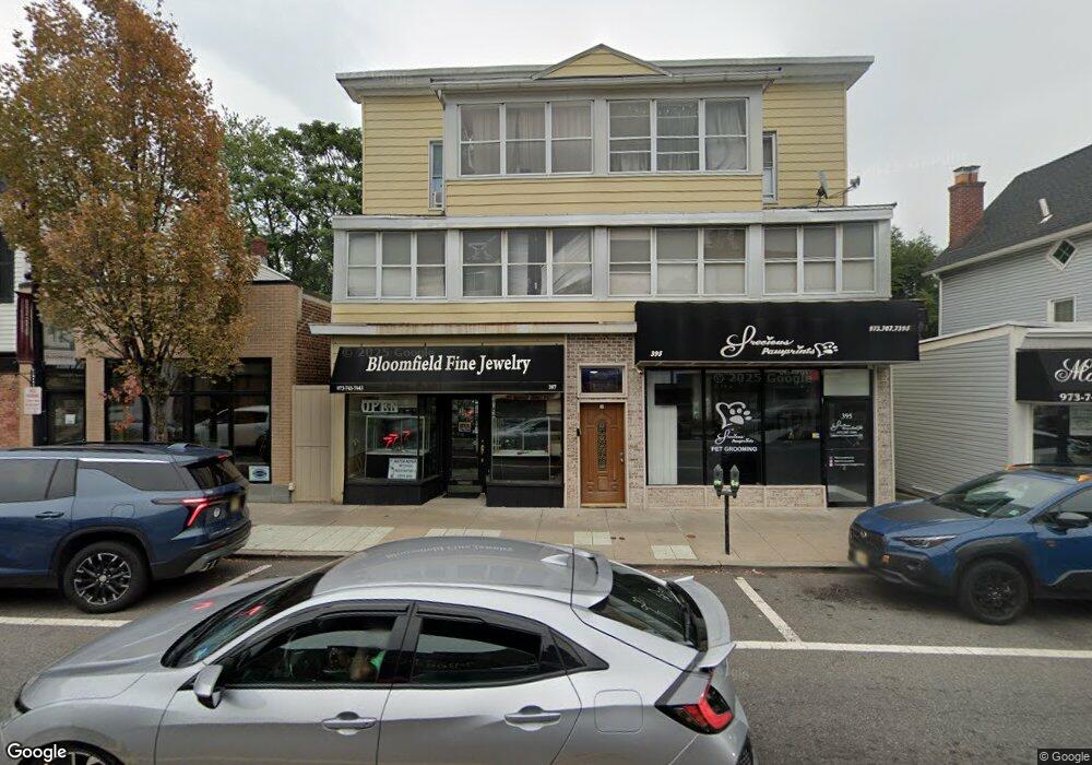
395 Broad St Bloomfield, NJ 07003
Estimated Value: $819,162
Studio
--
Bath
450
Sq Ft
$1,820/Sq Ft
Est. Value
About This Home
This home is located at 395 Broad St, Bloomfield, NJ 07003 and is currently estimated at $819,162, approximately $1,820 per square foot. 395 Broad St is a home located in Essex County with nearby schools including Franklin School, Bloomfield Middle School, and Bloomfield High School.
Ownership History
Date
Name
Owned For
Owner Type
Purchase Details
Closed on
Nov 11, 1998
Sold by
Broad St Corp
Bought by
St 395 97 Broad
Current Estimated Value
Home Financials for this Owner
Home Financials are based on the most recent Mortgage that was taken out on this home.
Original Mortgage
$125,000
Outstanding Balance
$27,045
Interest Rate
6.49%
Mortgage Type
Commercial
Estimated Equity
$787,885
Purchase Details
Closed on
Jul 24, 1992
Sold by
Zauistowsi Sigmund and Zauistowsi Lydia H
Bought by
Broad St Corp
Purchase Details
Closed on
Nov 27, 1990
Sold by
Sterbenz Susan
Bought by
Zawistowski Zawistowski S and Zawistowski L
Create a Home Valuation Report for This Property
The Home Valuation Report is an in-depth analysis detailing your home's value as well as a comparison with similar homes in the area
Home Values in the Area
Average Home Value in this Area
Purchase History
| Date | Buyer | Sale Price | Title Company |
|---|---|---|---|
| St 395 97 Broad | $200,000 | -- | |
| Broad St Corp | $270,000 | -- | |
| Zawistowski Zawistowski S | -- | -- |
Source: Public Records
Mortgage History
| Date | Status | Borrower | Loan Amount |
|---|---|---|---|
| Open | St 395 97 Broad | $125,000 |
Source: Public Records
Tax History
| Year | Tax Paid | Tax Assessment Tax Assessment Total Assessment is a certain percentage of the fair market value that is determined by local assessors to be the total taxable value of land and additions on the property. | Land | Improvement |
|---|---|---|---|---|
| 2025 | $17,752 | $543,200 | $183,800 | $359,400 |
| 2024 | $17,752 | $543,200 | $183,800 | $359,400 |
| 2022 | $17,393 | $543,200 | $183,800 | $359,400 |
| 2021 | $17,073 | $543,200 | $183,800 | $359,400 |
| 2020 | $16,812 | $543,200 | $183,800 | $359,400 |
| 2019 | $16,374 | $411,300 | $205,100 | $206,200 |
| 2018 | $16,304 | $411,300 | $205,100 | $206,200 |
| 2017 | $16,057 | $411,300 | $205,100 | $206,200 |
| 2016 | $15,876 | $411,300 | $205,100 | $206,200 |
| 2015 | $15,732 | $411,300 | $205,100 | $206,200 |
| 2014 | $15,444 | $411,300 | $205,100 | $206,200 |
Source: Public Records
Map
Nearby Homes
- 10 E Passaic Ave
- 378 Hoover Ave Unit 149
- 366 Hoover Ave Unit 119
- 348 Hoover Ave Unit 92
- 58 Osborne St
- 10 Almira St Unit 14
- 10 14almira St
- 7 Maple St
- 124 Essex Ave
- 46 Maple St
- 64 Forest Ave
- 46 Summit Ave
- 185 State St
- 290 Hoover Ave
- 290 Hoover Ave Unit 9
- 87 High St
- 48 Broughton Ave
- 54 Broughton Ave
- 210 Baldwin St
- 70 Valentine Rd
- 391-393 Broad St
- 391 Broad St
- 401 Broad St
- 389 Broad St
- 385 Broad St Unit 387
- 385 Broad St Unit 387
- 385 Broad St Unit 6
- 385 Broad St Unit 5
- 385 Broad St Unit 4
- 385 Broad St
- 405 Broad St Unit 405
- 405 Broad St
- 405 Broad St Unit 1
- 383 Broad St
- 383 Broad St Unit 2
- 383 Broad St Unit 1
- 380 Broad St
- 377 Broad St Unit 2
- 377 Broad St
- 407 Broad St Unit 3
Your Personal Tour Guide
Ask me questions while you tour the home.