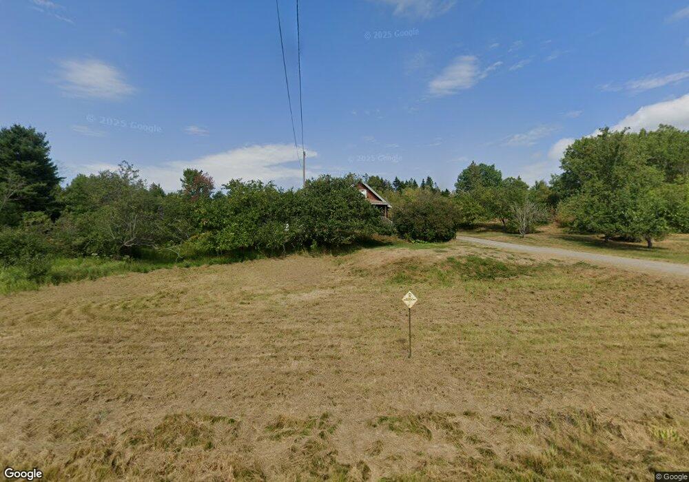
395 E River Rd Pembroke, ME 04666
Estimated Value: $172,000 - $257,000
3
Beds
1
Bath
864
Sq Ft
$250/Sq Ft
Est. Value
About This Home
This home is located at 395 E River Rd, Pembroke, ME 04666 and is currently estimated at $216,131, approximately $250 per square foot. 395 E River Rd is a home with nearby schools including Pembroke Elementary School.
Ownership History
Date
Name
Owned For
Owner Type
Purchase Details
Closed on
Jan 17, 2025
Sold by
Barr Jr Robert W Est and Philippon
Bought by
Young Joshua M and Young Kathryn A
Current Estimated Value
Home Financials for this Owner
Home Financials are based on the most recent Mortgage that was taken out on this home.
Original Mortgage
$256,500
Outstanding Balance
$253,620
Interest Rate
6.91%
Mortgage Type
Purchase Money Mortgage
Estimated Equity
-$37,489
Create a Home Valuation Report for This Property
The Home Valuation Report is an in-depth analysis detailing your home's value as well as a comparison with similar homes in the area
Purchase History
| Date | Buyer | Sale Price | Title Company |
|---|---|---|---|
| Young Joshua M | -- | None Available | |
| Young Joshua M | -- | None Available |
Source: Public Records
Mortgage History
| Date | Status | Borrower | Loan Amount |
|---|---|---|---|
| Open | Young Joshua M | $256,500 | |
| Closed | Young Joshua M | $256,500 |
Source: Public Records
Tax History
| Year | Tax Paid | Tax Assessment Tax Assessment Total Assessment is a certain percentage of the fair market value that is determined by local assessors to be the total taxable value of land and additions on the property. | Land | Improvement |
|---|---|---|---|---|
| 2024 | $2,718 | $114,200 | $41,300 | $72,900 |
| 2023 | $2,398 | $114,200 | $41,300 | $72,900 |
| 2022 | $2,444 | $114,200 | $41,300 | $72,900 |
| 2021 | $2,444 | $114,200 | $41,300 | $72,900 |
| 2020 | $365 | $114,200 | $41,300 | $72,900 |
| 2019 | $17 | $114,200 | $41,300 | $72,900 |
| 2018 | $17 | $114,200 | $41,300 | $72,900 |
| 2017 | $2,764 | $114,200 | $41,300 | $72,900 |
| 2016 | $408 | $114,200 | $41,300 | $72,900 |
| 2015 | $2,410 | $114,200 | $41,300 | $72,900 |
| 2014 | $2,284 | $114,200 | $41,300 | $72,900 |
| 2013 | $2,056 | $114,200 | $41,300 | $72,900 |
Source: Public Records
Map
Nearby Homes
- 202 Ayers Junction Rd
- 597 Ayers Junction Rd
- XX S Meadow Rd
- M10L1 U S Route 1
- Lot 22 Off South Meadow & Roys Way Rd
- 346 Us Route 1
- 12 Morgan Rd
- 265 U S 1
- 24 Roy's Way
- X Bechard Ln
- M3L19 Cross Rd
- 219 Smith Ridge Rd
- 387 Smith Ridge Rd
- 252 Ox Cove Rd
- 176 Charlotte Rd
- 434 Garnet Head Rd
- 448 Garnet Head Rd
- 130 Shipyard Rd
- Lot 13 Red Rock Estates
- 1 Daggett Rd
- 348 E River Rd
- 380 E River Rd
- 363 E River Rd
- 374 E River Rd
- TBD E River Rd
- 349 E River Rd
- 366 E River Rd
- 410 Little Falls Rd
- 402 Little Falls Rd
- 369 Little Falls Rd
- 353 Little Falls Rd
- 315 E River Rd
- 489 E River Rd
- 284 E River Rd
- 508 E River Rd
- 299 Little Falls Rd
- 513 E River Rd
- 275 E River Rd
- 0 E East River Rd Unit 1363333
- 287 Little Falls Rd
Your Personal Tour Guide
Ask me questions while you tour the home.
