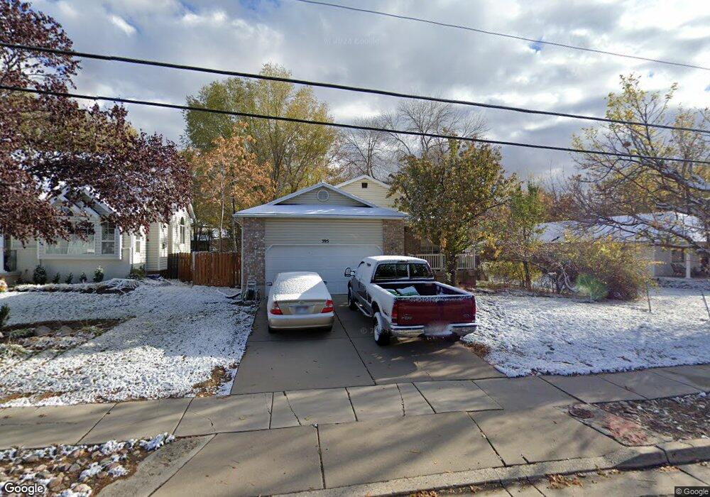
395 Flint St Layton, UT 84041
Estimated Value: $475,000 - $545,563
6
Beds
3
Baths
2,720
Sq Ft
$189/Sq Ft
Est. Value
About This Home
This home is located at 395 Flint St, Layton, UT 84041 and is currently estimated at $514,141, approximately $189 per square foot. 395 Flint St is a home located in Davis County with nearby schools including Layton Elementary School, Fairfield Junior High School, and Layton High School.
Ownership History
Date
Name
Owned For
Owner Type
Purchase Details
Closed on
Jan 9, 2019
Sold by
Freitas John
Bought by
Freitas John and Freitas Beth A
Current Estimated Value
Purchase Details
Closed on
Jun 26, 2003
Sold by
Bagnell Cindy
Bought by
Freitas John
Home Financials for this Owner
Home Financials are based on the most recent Mortgage that was taken out on this home.
Original Mortgage
$166,388
Outstanding Balance
$70,130
Interest Rate
5.26%
Mortgage Type
FHA
Estimated Equity
$444,011
Purchase Details
Closed on
Jun 24, 1998
Sold by
Bagnell Kent W and Bagnell Cindy
Bought by
Bagnell Cindy
Home Financials for this Owner
Home Financials are based on the most recent Mortgage that was taken out on this home.
Original Mortgage
$118,800
Interest Rate
7.06%
Create a Home Valuation Report for This Property
The Home Valuation Report is an in-depth analysis detailing your home's value as well as a comparison with similar homes in the area
Home Values in the Area
Average Home Value in this Area
Purchase History
| Date | Buyer | Sale Price | Title Company |
|---|---|---|---|
| Freitas John | -- | None Available | |
| Freitas John | -- | Equity Title Agency | |
| Bagnell Cindy | -- | Equity Title Agency |
Source: Public Records
Mortgage History
| Date | Status | Borrower | Loan Amount |
|---|---|---|---|
| Open | Freitas John | $166,388 | |
| Previous Owner | Bagnell Cindy | $118,800 |
Source: Public Records
Tax History
| Year | Tax Paid | Tax Assessment Tax Assessment Total Assessment is a certain percentage of the fair market value that is determined by local assessors to be the total taxable value of land and additions on the property. | Land | Improvement |
|---|---|---|---|---|
| 2025 | $1,030 | $264,551 | $129,124 | $135,427 |
| 2024 | $990 | $256,300 | $138,817 | $117,483 |
| 2023 | $888 | $427,000 | $145,520 | $281,480 |
| 2022 | $1,647 | $251,900 | $85,513 | $166,387 |
| 2021 | $1,356 | $355,000 | $128,257 | $226,743 |
| 2020 | $1,110 | $309,000 | $109,354 | $199,646 |
| 2019 | $1,061 | $296,000 | $108,676 | $187,324 |
| 2018 | $892 | $269,000 | $95,704 | $173,296 |
| 2016 | $611 | $120,835 | $39,410 | $81,425 |
| 2015 | $1,772 | $123,585 | $39,410 | $84,175 |
| 2014 | $619 | $118,631 | $39,410 | $79,221 |
| 2013 | -- | $108,055 | $27,341 | $80,714 |
Source: Public Records
Map
Nearby Homes
Your Personal Tour Guide
Ask me questions while you tour the home.