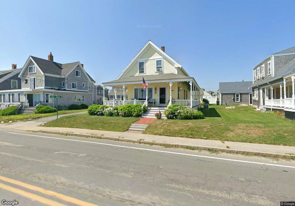
395 Ocean St Marshfield, MA 02050
Ocean Bluff-Brant Rock NeighborhoodEstimated Value: $788,000 - $1,036,000
3
Beds
1
Bath
1,321
Sq Ft
$686/Sq Ft
Est. Value
About This Home
This home is located at 395 Ocean St, Marshfield, MA 02050 and is currently estimated at $906,521, approximately $686 per square foot. 395 Ocean St is a home with nearby schools including Governor Edward Winslow School, Furnace Brook Middle School, and Marshfield High School.
Ownership History
Date
Name
Owned For
Owner Type
Purchase Details
Closed on
Aug 29, 2008
Sold by
Cornell Richard
Bought by
Germano Edward R and Germano Jeannie
Current Estimated Value
Home Financials for this Owner
Home Financials are based on the most recent Mortgage that was taken out on this home.
Original Mortgage
$436,000
Outstanding Balance
$286,789
Interest Rate
6.29%
Mortgage Type
Purchase Money Mortgage
Estimated Equity
$619,732
Purchase Details
Closed on
Jan 27, 2005
Sold by
Sullivan Barry P and Campisi Lorraine M
Bought by
Cornell Richard
Purchase Details
Closed on
Jun 4, 1990
Sold by
Sullivan Barry P
Bought by
Sullivan Barry P
Create a Home Valuation Report for This Property
The Home Valuation Report is an in-depth analysis detailing your home's value as well as a comparison with similar homes in the area
Home Values in the Area
Average Home Value in this Area
Purchase History
| Date | Buyer | Sale Price | Title Company |
|---|---|---|---|
| Germano Edward R | $545,000 | -- | |
| Germano Edward R | $545,000 | -- | |
| Cornell Richard | $630,000 | -- | |
| Cornell Richard | $630,000 | -- | |
| Sullivan Barry P | $10,000 | -- |
Source: Public Records
Mortgage History
| Date | Status | Borrower | Loan Amount |
|---|---|---|---|
| Open | Sullivan Barry P | $436,000 | |
| Closed | Sullivan Barry P | $436,000 |
Source: Public Records
Tax History
| Year | Tax Paid | Tax Assessment Tax Assessment Total Assessment is a certain percentage of the fair market value that is determined by local assessors to be the total taxable value of land and additions on the property. | Land | Improvement |
|---|---|---|---|---|
| 2025 | $8,826 | $891,500 | $625,300 | $266,200 |
| 2024 | $8,181 | $787,400 | $550,900 | $236,500 |
| 2023 | $6,641 | $675,300 | $476,400 | $198,900 |
| 2022 | $6,641 | $512,800 | $349,900 | $162,900 |
| 2021 | $6,675 | $506,100 | $349,900 | $156,200 |
| 2020 | $6,177 | $463,400 | $327,600 | $135,800 |
| 2019 | $6,119 | $457,300 | $327,600 | $129,700 |
| 2018 | $6,114 | $457,300 | $327,600 | $129,700 |
| 2017 | $6,110 | $445,300 | $327,600 | $117,700 |
| 2016 | $6,113 | $440,400 | $327,600 | $112,800 |
| 2015 | $6,921 | $520,800 | $387,100 | $133,700 |
| 2014 | $6,812 | $512,600 | $387,100 | $125,500 |
Source: Public Records
Map
Nearby Homes
- 399 Ocean St
- 389 Ocean St
- 389 Ocean St Unit 2
- 11 John Alden St
- 90 Ashburton Ave
- 385 Ocean St
- 405 Ocean St
- 14 Puritan St
- 379 Ocean St
- 379 Ocean St Unit 1
- 379 Ocean St Unit 379
- 411 Ocean St
- 83 Ashburton Ave
- 89 Ashburton Ave
- 375 Ocean St
- 95 Ashburton Ave
- 99 Ashburton Ave
- 14 Webster Ave
- 79 Ashburton Ave
- 106 Ashburton Ave
Your Personal Tour Guide
Ask me questions while you tour the home.