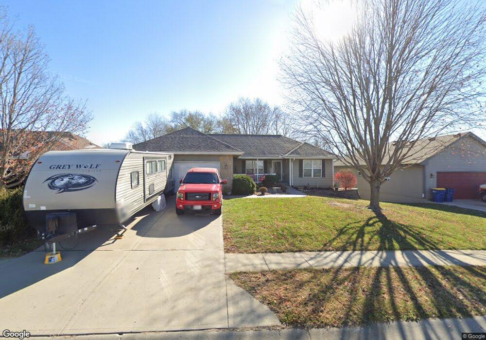
395 Redmond St Excelsior Springs, MO 64024
Estimated Value: $195,000
3
Beds
2
Baths
1,336
Sq Ft
$146/Sq Ft
Est. Value
About This Home
This home is located at 395 Redmond St, Excelsior Springs, MO 64024 and is currently priced at $195,000, approximately $145 per square foot. 395 Redmond St is a home located in Clay County with nearby schools including Excelsior Springs High School.
Ownership History
Date
Name
Owned For
Owner Type
Purchase Details
Closed on
Jun 22, 2016
Sold by
Lawerence Robert E and Lawerence Kari L
Bought by
Tucker Brianna R
Current Estimated Value
Purchase Details
Closed on
Jun 20, 2011
Sold by
Shea Robert and Shea Carol J
Bought by
First United Methodist Church
Purchase Details
Closed on
Feb 24, 2006
Sold by
Aartech Investments Inc
Bought by
Shea Robert E and Shea Carol J
Home Financials for this Owner
Home Financials are based on the most recent Mortgage that was taken out on this home.
Original Mortgage
$144,600
Interest Rate
6.1%
Mortgage Type
Fannie Mae Freddie Mac
Create a Home Valuation Report for This Property
The Home Valuation Report is an in-depth analysis detailing your home's value as well as a comparison with similar homes in the area
Home Values in the Area
Average Home Value in this Area
Purchase History
| Date | Buyer | Sale Price | Title Company |
|---|---|---|---|
| Tucker Brianna R | -- | None Available | |
| First United Methodist Church | -- | Stewart Title | |
| Shea Robert E | -- | Mokan Title Services Llc |
Source: Public Records
Mortgage History
| Date | Status | Borrower | Loan Amount |
|---|---|---|---|
| Previous Owner | Shea Robert E | $144,600 |
Source: Public Records
Tax History Compared to Growth
Tax History
| Year | Tax Paid | Tax Assessment Tax Assessment Total Assessment is a certain percentage of the fair market value that is determined by local assessors to be the total taxable value of land and additions on the property. | Land | Improvement |
|---|---|---|---|---|
| 2025 | -- | -- | -- | -- |
| 2024 | -- | -- | -- | -- |
| 2023 | $0 | $0 | $0 | $0 |
| 2022 | $0 | $0 | $0 | $0 |
| 2021 | $0 | $0 | $0 | $0 |
| 2020 | $0 | $0 | $0 | $0 |
| 2019 | $2,141 | $0 | $0 | $0 |
| 2018 | $2,141 | $29,200 | $0 | $0 |
| 2017 | $2,089 | $29,200 | $4,370 | $24,830 |
| 2016 | $2,089 | $29,200 | $4,370 | $24,830 |
| 2015 | -- | $29,200 | $4,370 | $24,830 |
| 2014 | -- | $28,030 | $4,370 | $23,660 |
Source: Public Records
Map
Nearby Homes
- 2116 Bradford Place
- 2081 Rock Bridge Pkwy
- 240 Rock Bridge Pkwy
- 220 Rock Bridge Pkwy
- 2021 Riverstone Dr
- 2017 Karlton Way
- 2210 Piedmont Place
- 25421 Marel Rd
- 2305 Arbor Ln
- 609 Kimberly Dr
- 206 Crest Dr
- 617 Lodwick Ln
- 2407 Merlot Place
- 106 Sunset Ln
- Lot 2 Wornall Rd
- 2017 Wornall Rd
- 125 Crown Hill Rd
- 606 Patrick Dr
- 24218 NE 136th St
- 1801 Rainbow Dr
- 393 Redmond St
- 391 Redmond St
- 2205 Madison Ave
- 2208 Chanticleer St
- 2203 Madison Ave
- 2207 Madison Ave
- 2207 Chanticleer St
- 2202 Ashford St
- 2210 Chanticleer St
- 389 Redmond St
- 2201 Madison Ave
- 2209 Chanticleer St
- 2209 Madison Ave
- 2210 Ashford St
- 2212 Chanticleer St
- 2202 Madison Ave
- 2200 Ashford St
- 2204 Madison Ave
- 2211 Chanticleer St
- 2212 Ashford St