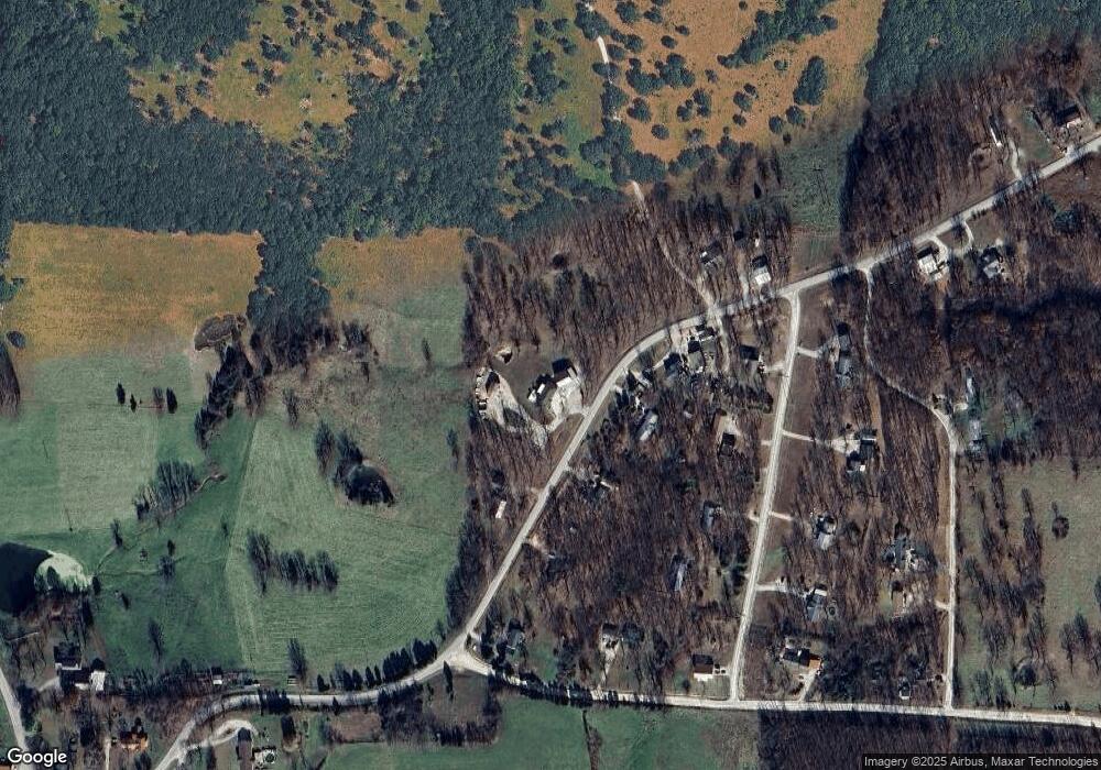
395 State Road P Camdenton, MO 65020
Estimated Value: $231,000 - $331,339
--
Bed
--
Bath
1,260
Sq Ft
$229/Sq Ft
Est. Value
About This Home
This home is located at 395 State Road P, Camdenton, MO 65020 and is currently estimated at $288,085, approximately $228 per square foot. 395 State Road P is a home located in Camden County with nearby schools including Climax Springs Elementary School and Climax Springs High School.
Ownership History
Date
Name
Owned For
Owner Type
Purchase Details
Closed on
Oct 1, 2021
Sold by
Willig Nathan D and Willig Keli
Bought by
Wallander Jack E and Wallander Judy
Current Estimated Value
Purchase Details
Closed on
Mar 13, 2020
Sold by
Lemery and Rachel
Bought by
Davis Tony L and Willig Nathan D
Home Financials for this Owner
Home Financials are based on the most recent Mortgage that was taken out on this home.
Original Mortgage
$130,492
Interest Rate
3.5%
Mortgage Type
Construction
Purchase Details
Closed on
Jun 1, 1997
Bought by
Howes Ronald
Create a Home Valuation Report for This Property
The Home Valuation Report is an in-depth analysis detailing your home's value as well as a comparison with similar homes in the area
Home Values in the Area
Average Home Value in this Area
Purchase History
| Date | Buyer | Sale Price | Title Company |
|---|---|---|---|
| Wallander Jack E | -- | Great American Title | |
| Davis Tony L | $131,796 | Integrity Title Solutions Llc | |
| Howes Ronald | -- | -- |
Source: Public Records
Mortgage History
| Date | Status | Borrower | Loan Amount |
|---|---|---|---|
| Previous Owner | Davis Tony L | $130,492 |
Source: Public Records
Tax History Compared to Growth
Tax History
| Year | Tax Paid | Tax Assessment Tax Assessment Total Assessment is a certain percentage of the fair market value that is determined by local assessors to be the total taxable value of land and additions on the property. | Land | Improvement |
|---|---|---|---|---|
| 2025 | $1,359 | $30,090 | $0 | $0 |
| 2024 | $1,314 | $30,090 | $0 | $0 |
| 2023 | $1,314 | $30,090 | $0 | $0 |
| 2022 | $1,287 | $30,090 | $0 | $0 |
| 2021 | $977 | $22,840 | $0 | $0 |
| 2020 | $755 | $17,560 | $0 | $0 |
| 2019 | $755 | $17,560 | $0 | $0 |
| 2018 | $752 | $17,480 | $0 | $0 |
| 2017 | $714 | $17,480 | $0 | $0 |
| 2016 | $697 | $17,480 | $0 | $0 |
| 2015 | $740 | $17,480 | $0 | $0 |
| 2014 | $740 | $0 | $0 | $0 |
| 2013 | -- | $17,480 | $0 | $0 |
Source: Public Records
Map
Nearby Homes
- 0 Winding Tree Dr
- 270 Foggy Bottom Rd
- 1070 Old Nonsuch Rd
- 570 Winding Tree Dr
- 0000 Old Nonsuch Rd
- 000 Old Nonsuch Rd
- TBD Coelleda School Rd
- LOT #3 Poco Risco Ln
- LOT #4 Poco Risco Ln
- 000 State Highway 7 N
- 1490 Cedar Ridge Cir
- 679 Wolf Pen Hollow
- 911 Georgene Rd
- 1150 Georgene Rd
- 1130 Laura Hufferd Rd
- 494 Georgene Rd
- 746 Velvet Antler Rd
- 34, 35, 39 Petticoat Jct
- 13 Island View Ln
- 0 Lot 14 & Part of Lot 15 Island View Ln Unit 3577999
- 878 State Road P
- 319 State Road P
- 412 State Road P
- 1836 State Road P
- 314 State Road P
- 1351 State Road P
- 444 State Road P
- 270 State Road P
- 360 State Road P
- 817 State Road P
- 693 State Road P
- 1203 State Road P
- 1165 State Road P
- 314 State Road P
- 1351 State Road P
- TBD State Rt J
- State Rt J
- 3005 State Road J
- 3007 State Road J
- TR 17 Full Gallop Ln
