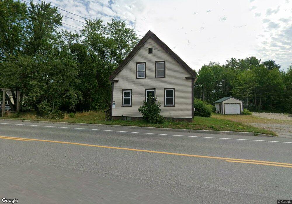
395 State St Ellsworth, ME 04605
Estimated Value: $188,282 - $330,000
--
Bed
--
Bath
1,930
Sq Ft
$134/Sq Ft
Est. Value
About This Home
This home is located at 395 State St, Ellsworth, ME 04605 and is currently estimated at $259,321, approximately $134 per square foot. 395 State St is a home located in Hancock County with nearby schools including Sumner Memorial High School, Kidspeace National Centers of New England, and Graham Lake School.
Ownership History
Date
Name
Owned For
Owner Type
Purchase Details
Closed on
Feb 6, 2024
Sold by
Hancock Cnty Planning Com
Bought by
Far End Enterprises Llc
Current Estimated Value
Home Financials for this Owner
Home Financials are based on the most recent Mortgage that was taken out on this home.
Original Mortgage
$112,500
Outstanding Balance
$110,290
Interest Rate
6.61%
Mortgage Type
Stand Alone Refi Refinance Of Original Loan
Estimated Equity
$149,031
Create a Home Valuation Report for This Property
The Home Valuation Report is an in-depth analysis detailing your home's value as well as a comparison with similar homes in the area
Home Values in the Area
Average Home Value in this Area
Purchase History
| Date | Buyer | Sale Price | Title Company |
|---|---|---|---|
| Far End Enterprises Llc | -- | None Available | |
| Far End Enterprises Llc | -- | None Available | |
| Far End Enterprises Llc | -- | None Available | |
| Far End Enterprises Llc | -- | None Available |
Source: Public Records
Mortgage History
| Date | Status | Borrower | Loan Amount |
|---|---|---|---|
| Open | Far End Enterprises Llc | $112,500 | |
| Closed | Far End Enterprises Llc | $112,500 |
Source: Public Records
Tax History Compared to Growth
Tax History
| Year | Tax Paid | Tax Assessment Tax Assessment Total Assessment is a certain percentage of the fair market value that is determined by local assessors to be the total taxable value of land and additions on the property. | Land | Improvement |
|---|---|---|---|---|
| 2024 | $2,591 | $148,500 | $30,400 | $118,100 |
| 2023 | $0 | $0 | $0 | $0 |
| 2022 | $0 | $0 | $0 | $0 |
| 2021 | $0 | $0 | $0 | $0 |
| 2020 | $0 | $0 | $0 | $0 |
| 2019 | $0 | $0 | $0 | $0 |
| 2018 | $0 | $0 | $0 | $0 |
| 2017 | $0 | $0 | $0 | $0 |
| 2016 | $0 | $0 | $0 | $0 |
| 2015 | -- | $0 | $0 | $0 |
| 2014 | -- | $0 | $0 | $0 |
| 2012 | -- | $0 | $0 | $0 |
Source: Public Records
Map
Nearby Homes