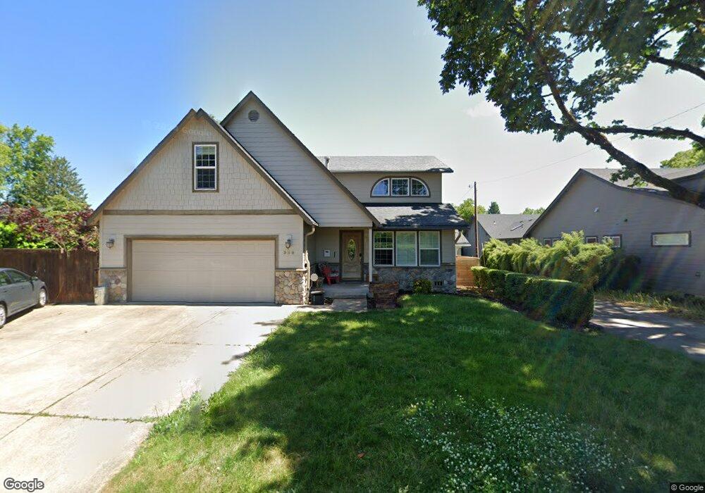
395 Walnut Ln Eugene, OR 97401
Harlow NeighborhoodEstimated Value: $718,401 - $743,000
3
Beds
3
Baths
2,800
Sq Ft
$260/Sq Ft
Est. Value
About This Home
This home is located at 395 Walnut Ln, Eugene, OR 97401 and is currently estimated at $726,850, approximately $259 per square foot. 395 Walnut Ln is a home located in Lane County with nearby schools including Holt Elementary School, Monroe Middle School, and Sheldon High School.
Ownership History
Date
Name
Owned For
Owner Type
Purchase Details
Closed on
Oct 21, 2022
Sold by
Kern Brian R and Kern Barbara C
Bought by
Kern Revocable Living Trust and Kern
Current Estimated Value
Purchase Details
Closed on
Sep 5, 2008
Sold by
Moody William E and Moody Darline N
Bought by
Kern Brian R and Kern Barbara C
Home Financials for this Owner
Home Financials are based on the most recent Mortgage that was taken out on this home.
Original Mortgage
$245,000
Interest Rate
6.5%
Mortgage Type
Purchase Money Mortgage
Purchase Details
Closed on
Apr 19, 2004
Sold by
Brown Tracy B
Bought by
Moody William E and Moody Darline N
Home Financials for this Owner
Home Financials are based on the most recent Mortgage that was taken out on this home.
Original Mortgage
$232,900
Interest Rate
5.57%
Mortgage Type
Credit Line Revolving
Create a Home Valuation Report for This Property
The Home Valuation Report is an in-depth analysis detailing your home's value as well as a comparison with similar homes in the area
Home Values in the Area
Average Home Value in this Area
Purchase History
| Date | Buyer | Sale Price | Title Company |
|---|---|---|---|
| Kern Revocable Living Trust | -- | None Listed On Document | |
| Kern Brian R | $350,000 | Western Title | |
| Moody William E | $205,000 | Fidelity Natl Title Co Of Or |
Source: Public Records
Mortgage History
| Date | Status | Borrower | Loan Amount |
|---|---|---|---|
| Previous Owner | Kern Brian R | $245,000 | |
| Previous Owner | Moody William E | $232,900 |
Source: Public Records
Tax History
| Year | Tax Paid | Tax Assessment Tax Assessment Total Assessment is a certain percentage of the fair market value that is determined by local assessors to be the total taxable value of land and additions on the property. | Land | Improvement |
|---|---|---|---|---|
| 2025 | $7,694 | $394,876 | -- | -- |
| 2024 | $7,598 | $383,375 | -- | -- |
| 2023 | $7,598 | $372,209 | $0 | $0 |
| 2022 | $7,118 | $361,368 | $0 | $0 |
| 2021 | $6,686 | $350,843 | $0 | $0 |
| 2020 | $6,709 | $340,625 | $0 | $0 |
| 2019 | $6,480 | $330,704 | $0 | $0 |
| 2018 | $6,099 | $311,720 | $0 | $0 |
| 2017 | $5,810 | $311,720 | $0 | $0 |
| 2016 | $5,578 | $302,641 | $0 | $0 |
| 2015 | $5,384 | $293,826 | $0 | $0 |
| 2014 | $5,162 | $285,268 | $0 | $0 |
Source: Public Records
Map
Nearby Homes
- 280 Regal Ct
- 2994 Dapple Way
- 2746 Harlow Rd
- 600 Cherry Dr Unit 8
- 2872 Suffolk Ct
- 347 Rustic Place Unit 14
- 2355 Pioneer Pike
- 950 Coburg Rd
- 860 N van Duyn St
- 820 Lariat Dr
- 825 Waverly St
- 2250 Turnberry Ct
- 3579 Oxbow Way
- 1038 President St
- 3025 Bailey Ln
- 446 Kodiak St
- 2036 Eastwood Ln
- 2150 Greenview St
- 1270 Calvin St
- 3360 Chevy Chase St
Your Personal Tour Guide
Ask me questions while you tour the home.