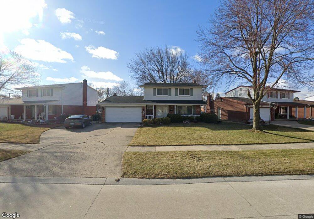
3950 Nowak Dr Unit Bldg-Unit Sterling Heights, MI 48310
Estimated Value: $291,000 - $355,000
4
Beds
2
Baths
1,722
Sq Ft
$189/Sq Ft
Est. Value
About This Home
This home is located at 3950 Nowak Dr Unit Bldg-Unit, Sterling Heights, MI 48310 and is currently estimated at $326,211, approximately $189 per square foot. 3950 Nowak Dr Unit Bldg-Unit is a home located in Macomb County with nearby schools including Angus Elementary School, Grissom Middle School, and Warren Mott High School.
Ownership History
Date
Name
Owned For
Owner Type
Purchase Details
Closed on
Jul 9, 2025
Sold by
Abbo Kamel and Abbo Bushra
Bought by
Kamel And Bushra Abbo Living Trust and Abbo
Current Estimated Value
Purchase Details
Closed on
Oct 30, 2017
Sold by
Adams Raquel Janene
Bought by
Abbo Kamel and Abbo Bushra
Purchase Details
Closed on
Apr 13, 2005
Sold by
Ciuba Karen
Bought by
Ciuba Karen and Karen Ciuba Trust
Home Financials for this Owner
Home Financials are based on the most recent Mortgage that was taken out on this home.
Original Mortgage
$60,000
Interest Rate
6.13%
Mortgage Type
Stand Alone Refi Refinance Of Original Loan
Create a Home Valuation Report for This Property
The Home Valuation Report is an in-depth analysis detailing your home's value as well as a comparison with similar homes in the area
Home Values in the Area
Average Home Value in this Area
Purchase History
| Date | Buyer | Sale Price | Title Company |
|---|---|---|---|
| Kamel And Bushra Abbo Living Trust | -- | None Listed On Document | |
| Kamel And Bushra Abbo Living Trust | -- | None Listed On Document | |
| Abbo Kamel | $140,000 | Title Connect Llc | |
| Ciuba Karen | -- | Metropolitan Title Company | |
| Ciuba Karen | -- | Metropolitan Title Company |
Source: Public Records
Mortgage History
| Date | Status | Borrower | Loan Amount |
|---|---|---|---|
| Previous Owner | Ciuba Karen | $60,000 |
Source: Public Records
Tax History Compared to Growth
Tax History
| Year | Tax Paid | Tax Assessment Tax Assessment Total Assessment is a certain percentage of the fair market value that is determined by local assessors to be the total taxable value of land and additions on the property. | Land | Improvement |
|---|---|---|---|---|
| 2025 | $6,391 | $156,500 | $0 | $0 |
| 2024 | $6,168 | $147,500 | $0 | $0 |
| 2023 | $5,853 | $133,200 | $0 | $0 |
| 2022 | $5,727 | $118,700 | $0 | $0 |
| 2021 | $5,609 | $110,500 | $0 | $0 |
| 2020 | $5,359 | $106,800 | $0 | $0 |
| 2019 | $5,237 | $102,400 | $0 | $0 |
| 2018 | $5,179 | $89,700 | $0 | $0 |
| 2017 | $3,002 | $82,400 | $16,900 | $65,500 |
| 2016 | $2,938 | $82,400 | $0 | $0 |
| 2015 | -- | $79,700 | $0 | $0 |
| 2014 | -- | $67,300 | $0 | $0 |
Source: Public Records
Map
Nearby Homes
- 34579 Hawke Dr
- 34551 Richard O Dr
- 4123 Bieber Dr
- 3538 Cero Dr
- 34544 Sandwood Dr
- 33879 Richard O Dr
- 33735 Kennedy Dr
- 4468 15 Mile Rd Unit F104
- 3040 Alden Dr
- 33569 Breckenridge Dr
- 35091 Cavant Dr
- 35078 Cavant Dr
- 2630 Pall Mall Dr
- 4874 Venetian Dr
- 2528 Koper Dr
- 4946 Vista Ct
- 34305 Tyler Dr
- 2269 Serra Dr
- 4996 Sanford Dr
- 5018 Northlawn Dr