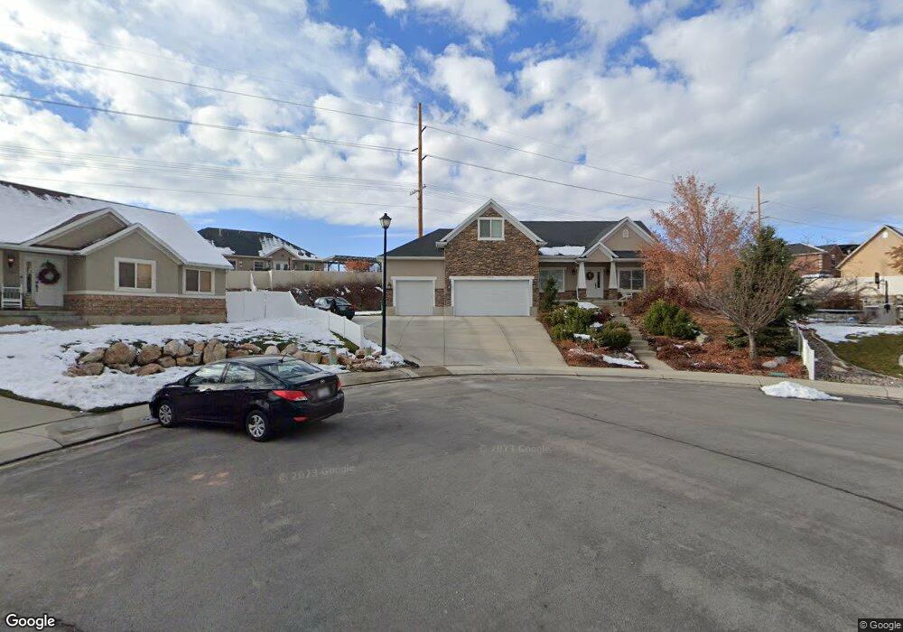
3950 W 10260 N Pleasant Grove, UT 84062
Estimated Value: $698,000 - $832,150
5
Beds
3
Baths
2,543
Sq Ft
$311/Sq Ft
Est. Value
About This Home
This home is located at 3950 W 10260 N, Pleasant Grove, UT 84062 and is currently estimated at $792,038, approximately $311 per square foot. 3950 W 10260 N is a home located in Utah County with nearby schools including Cedar Ridge Elementary School, Mountain Ridge Junior High School, and Lone Peak High School.
Ownership History
Date
Name
Owned For
Owner Type
Purchase Details
Closed on
Aug 11, 2025
Sold by
Given Michael T and Given Mary Rogers
Bought by
Michael T And Mary Rogers Given Trust and Given
Current Estimated Value
Purchase Details
Closed on
Jan 15, 2013
Sold by
Given Michael T and Given Mary Rogers
Bought by
Given Michael T and Given Mary Rogers
Home Financials for this Owner
Home Financials are based on the most recent Mortgage that was taken out on this home.
Original Mortgage
$230,000
Interest Rate
3.28%
Mortgage Type
New Conventional
Purchase Details
Closed on
Jun 1, 2005
Sold by
Hoover Bradley G and Hoover Jana Lea
Bought by
Given Michael T and Given Mary Rogers
Home Financials for this Owner
Home Financials are based on the most recent Mortgage that was taken out on this home.
Original Mortgage
$250,000
Interest Rate
5.74%
Mortgage Type
Fannie Mae Freddie Mac
Purchase Details
Closed on
Jul 29, 2004
Sold by
Yates Jim
Bought by
Hoover Bradley G and Hoover Jana Lea
Create a Home Valuation Report for This Property
The Home Valuation Report is an in-depth analysis detailing your home's value as well as a comparison with similar homes in the area
Home Values in the Area
Average Home Value in this Area
Purchase History
| Date | Buyer | Sale Price | Title Company |
|---|---|---|---|
| Michael T And Mary Rogers Given Trust | -- | None Listed On Document | |
| Given Michael T | -- | Pinnacle Title | |
| Given Michael T | -- | Empire Land Title Company | |
| Hoover Bradley G | -- | Empire Land Title Company |
Source: Public Records
Mortgage History
| Date | Status | Borrower | Loan Amount |
|---|---|---|---|
| Previous Owner | Given Michael T | $230,000 | |
| Previous Owner | Given Michael T | $250,000 |
Source: Public Records
Tax History Compared to Growth
Tax History
| Year | Tax Paid | Tax Assessment Tax Assessment Total Assessment is a certain percentage of the fair market value that is determined by local assessors to be the total taxable value of land and additions on the property. | Land | Improvement |
|---|---|---|---|---|
| 2025 | $3,322 | $431,310 | $332,800 | $451,400 |
| 2024 | $3,322 | $393,470 | $0 | $0 |
| 2023 | $3,068 | $390,335 | $0 | $0 |
| 2022 | $3,581 | $445,115 | $0 | $0 |
| 2021 | $3,225 | $597,100 | $216,400 | $380,700 |
| 2020 | $2,991 | $540,300 | $200,400 | $339,900 |
| 2019 | $2,593 | $486,500 | $188,400 | $298,100 |
| 2018 | $2,667 | $471,400 | $188,400 | $283,000 |
| 2017 | $2,626 | $248,215 | $0 | $0 |
| 2016 | $2,824 | $248,215 | $0 | $0 |
| 2015 | $2,737 | $227,700 | $0 | $0 |
| 2014 | $2,542 | $210,045 | $0 | $0 |
Source: Public Records
Map
Nearby Homes
- 10412 N Bayhill Dr
- 10358 N Tamarack Way
- 4198 W Sage Rd N
- 10514 N Doral Dr
- 10456 N Morgan Blvd
- 3870 Mountaintop Cir
- 4292 W Joshua Ln
- 10587 N Avalon St
- 10448 Sage Vista Ln
- 10468 N Sage Vista Ln
- 10207 N Cottonwood Dr
- 3851 W Mountaintop Cir Unit 5
- 4083 W Hayes Cir
- 9900 N Meadow Dr
- 4084 W Shinnecock
- 10795 N La Costa
- 4616 W Carriage Ln
- 4124 N 810 W
- 9752 N Dorchester Dr
- 10052 N Marigold Ln
- 3950 W 10260 N Unit 19
- 3930 W 10260 N
- 3930 W 10260 N Unit 18
- 10286 Bristlecone Way
- 10286 N Bristlecone Way Unit 36B
- 10286 N Bristlecone Way
- 10272 Bristlecone Way
- 10272 Bristlecone Way Unit 37B
- 3945 W 10260 N
- 3945 W 10260 N Unit 20
- 3937 W 10300 N
- 3937 W 10300 N Unit 15
- 10304 N Bristlecone Way
- 10304 N Bristlecone Way
- 3946 W 10300 N
- 3946 W 10300 N Unit 14
- 3925 W 10260 N
- 3925 W 10260 N Unit 21
- 10258 Bristlecone Way
- 10258 Bristlecone Way Unit 38