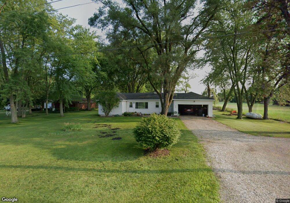
3953 Browntown Rd Sawyer, MI 49125
Estimated Value: $187,000 - $253,417
3
Beds
1
Bath
1,020
Sq Ft
$223/Sq Ft
Est. Value
About This Home
This home is located at 3953 Browntown Rd, Sawyer, MI 49125 and is currently estimated at $227,854, approximately $223 per square foot. 3953 Browntown Rd is a home located in Berrien County with nearby schools including Bridgman Elementary School, F.C. Reed Middle School, and Bridgman High School.
Ownership History
Date
Name
Owned For
Owner Type
Purchase Details
Closed on
Oct 29, 2004
Sold by
Johnson Richard Lee and Johnson Jennifer L
Bought by
Wise Thomas R
Current Estimated Value
Home Financials for this Owner
Home Financials are based on the most recent Mortgage that was taken out on this home.
Original Mortgage
$88,900
Outstanding Balance
$47,199
Interest Rate
6.75%
Mortgage Type
Purchase Money Mortgage
Estimated Equity
$180,655
Purchase Details
Closed on
Apr 20, 2000
Purchase Details
Closed on
Apr 15, 1998
Create a Home Valuation Report for This Property
The Home Valuation Report is an in-depth analysis detailing your home's value as well as a comparison with similar homes in the area
Home Values in the Area
Average Home Value in this Area
Purchase History
| Date | Buyer | Sale Price | Title Company |
|---|---|---|---|
| Wise Thomas R | $88,900 | -- | |
| -- | $78,000 | -- | |
| -- | $64,000 | -- |
Source: Public Records
Mortgage History
| Date | Status | Borrower | Loan Amount |
|---|---|---|---|
| Open | Wise Thomas R | $88,900 |
Source: Public Records
Tax History Compared to Growth
Tax History
| Year | Tax Paid | Tax Assessment Tax Assessment Total Assessment is a certain percentage of the fair market value that is determined by local assessors to be the total taxable value of land and additions on the property. | Land | Improvement |
|---|---|---|---|---|
| 2025 | $1,181 | $102,700 | $0 | $0 |
| 2024 | $795 | $98,000 | $0 | $0 |
| 2023 | $748 | $77,000 | $0 | $0 |
| 2022 | $712 | $62,100 | $0 | $0 |
| 2021 | $1,002 | $60,400 | $6,600 | $53,800 |
| 2020 | $982 | $59,400 | $0 | $0 |
| 2019 | $983 | $50,400 | $12,600 | $37,800 |
| 2018 | $967 | $50,400 | $0 | $0 |
| 2017 | $953 | $49,800 | $0 | $0 |
| 2016 | $893 | $49,800 | $0 | $0 |
| 2015 | $890 | $55,300 | $0 | $0 |
| 2014 | $601 | $57,800 | $0 | $0 |
Source: Public Records
Map
Nearby Homes
- 10671 California
- 2362 Browntown Rd
- 10617 Baldwin Rd
- 11159 Red Arrow Hwy Unit 278
- 4509 Hanover Rd
- 11760 Landon Rd
- 5650 Lily Ln
- 12856 Flynn Rd
- 3990 Sugarsand Ln
- 3995 Sugarsand Ln
- 4043 Sugarsand Ln
- 4019 Sugarsand Ln
- 12843 S Wolcott Ave
- 0 Gast Rd Unit 24006127
- 9992 Gast Rd
- 10067 Red Arrow Hwy
- 10051 Weko Dr
- 12370 Dunes Rd
- 00 Red Arrow Hwy
- Elements 2100 Plan at Lake Haven - Elements
- 3967 Browntown Rd
- 3903 Browntown Rd
- 3903 Browntown Rd
- 3917 Browntown Rd
- 3843 Browntown Rd
- 3883 Browntown Rd
- 3920 Browntown Rd
- 3884 Browntown Rd
- 3857 Browntown Rd
- 3944 Browntown Rd
- 3846 Browntown Rd
- 3826 Browntown Rd
- 3805 Browntown Rd
- 4022 Browntown Rd
- 3848 Browntown Rd
- 3783 Browntown Rd
- 3757 Browntown Rd
- 12145 California Rd
- 3783 Browntown Rd
- 12090 Gast Rd