Estimated Value: $268,000 - $327,830
4
Beds
3
Baths
1,744
Sq Ft
$179/Sq Ft
Est. Value
About This Home
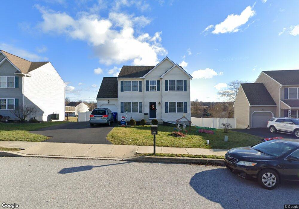
This home is located at 3953 Sheppard Dr, Dover, PA 17315 and is currently estimated at $311,458, approximately $178 per square foot. 3953 Sheppard Dr is a home located in York County with nearby schools including Dover Area High School and Lighthouse Christian School.
Ownership History
Date
Name
Owned For
Owner Type
Purchase Details
Closed on
Dec 21, 2006
Sold by
Afw Development Inc
Bought by
Morgan Orian and Morgan Melinda
Current Estimated Value
Home Financials for this Owner
Home Financials are based on the most recent Mortgage that was taken out on this home.
Original Mortgage
$178,100
Outstanding Balance
$106,364
Interest Rate
6.29%
Mortgage Type
Purchase Money Mortgage
Estimated Equity
$205,094
Create a Home Valuation Report for This Property
The Home Valuation Report is an in-depth analysis detailing your home's value as well as a comparison with similar homes in the area
Home Values in the Area
Average Home Value in this Area
Purchase History
| Date | Buyer | Sale Price | Title Company |
|---|---|---|---|
| Morgan Orian | $183,613 | None Available |
Source: Public Records
Mortgage History
| Date | Status | Borrower | Loan Amount |
|---|---|---|---|
| Open | Morgan Orian | $178,100 |
Source: Public Records
Tax History Compared to Growth
Tax History
| Year | Tax Paid | Tax Assessment Tax Assessment Total Assessment is a certain percentage of the fair market value that is determined by local assessors to be the total taxable value of land and additions on the property. | Land | Improvement |
|---|---|---|---|---|
| 2025 | $5,416 | $165,100 | $34,020 | $131,080 |
| 2024 | $5,367 | $165,100 | $34,020 | $131,080 |
| 2023 | $5,367 | $165,100 | $34,020 | $131,080 |
| 2022 | $5,269 | $165,100 | $34,020 | $131,080 |
| 2021 | $4,972 | $165,100 | $34,020 | $131,080 |
| 2020 | $4,927 | $165,100 | $34,020 | $131,080 |
| 2019 | $4,866 | $165,100 | $34,020 | $131,080 |
| 2018 | $4,744 | $165,100 | $34,020 | $131,080 |
| 2017 | $4,744 | $165,100 | $34,020 | $131,080 |
| 2016 | $0 | $165,100 | $34,020 | $131,080 |
| 2015 | -- | $165,100 | $34,020 | $131,080 |
| 2014 | -- | $165,100 | $34,020 | $131,080 |
Source: Public Records
Map
Nearby Homes
- 1919 Deerfield Dr
- 46 Chipawa Ave
- 1841 Wyatt Cir
- 86 Cherokee Ave
- 143 Pawnee Ave
- 140 Pawnee Ave
- 1951 Park St
- 3851 Country Dr
- 2031 Park St
- 3847 Country Dr
- 4008 Country Dr
- 4021 Country Dr
- 3836 Country Dr
- 2113 Huntington Rd
- 3510 Carlisle Rd
- 119 Cedar Dr
- 3756 Fox Chase Dr
- 2602 Brownstone Dr
- 3471 Holly Rd
- 2642 Victorian Dr
- 3957 Sheppard Dr Unit 131
- 3957 Sheppard Dr
- 3949 Sheppard Dr
- 3961 Sheppard Dr
- 0 Sheppard Dr Unit 21200312
- 0 Sheppard Dr Unit 21112382
- 3952 Sheppard Dr
- 3956 Sheppard Dr
- 3901 Lyn Cir
- 3917 Lyn Cir
- 3948 Sheppard Dr
- 3921 Lyn Cir
- 3965 Sheppard Dr
- 3913 Lyn Cir
- 3905 Lyn Cir
- 3909 Lyn Cir
- 3960 Sheppard Dr Unit 23
- 3925 Lyn Cir
- 3944 Sheppard Dr
- 3964 Sheppard Dr