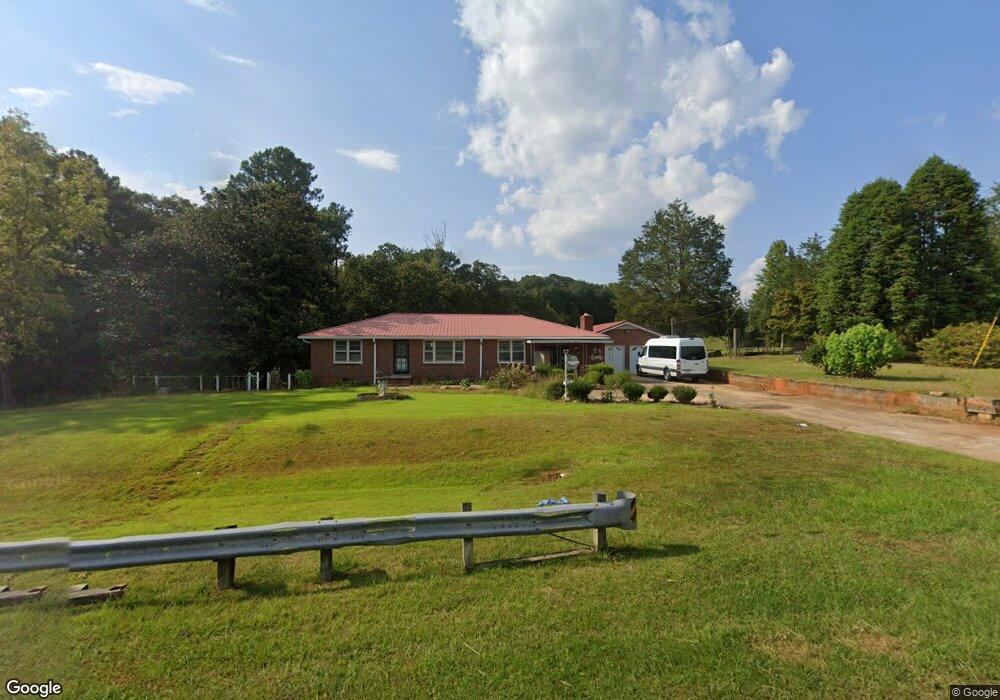
3955 S Highway 27 Carrollton, GA 30117
Estimated Value: $352,000 - $404,000
3
Beds
2
Baths
2,190
Sq Ft
$174/Sq Ft
Est. Value
About This Home
This home is located at 3955 S Highway 27, Carrollton, GA 30117 and is currently estimated at $381,868, approximately $174 per square foot. 3955 S Highway 27 is a home located in Carroll County with nearby schools including Roopville Elementary School, Central Middle School, and Central High School.
Ownership History
Date
Name
Owned For
Owner Type
Purchase Details
Closed on
Sep 17, 2021
Sold by
Bass Ron
Bought by
Villatoro Garcia Pedro and Villatoro Graciela
Current Estimated Value
Home Financials for this Owner
Home Financials are based on the most recent Mortgage that was taken out on this home.
Original Mortgage
$237,500
Outstanding Balance
$216,107
Interest Rate
2.8%
Mortgage Type
New Conventional
Estimated Equity
$165,761
Purchase Details
Closed on
Aug 5, 2020
Sold by
Brand Louise
Bought by
Bass Ron
Purchase Details
Closed on
Jun 11, 1998
Sold by
Brand Mrs Louise
Bought by
Brand Louise Mrs
Purchase Details
Closed on
Nov 17, 1978
Bought by
Brand Mrs Louise
Create a Home Valuation Report for This Property
The Home Valuation Report is an in-depth analysis detailing your home's value as well as a comparison with similar homes in the area
Home Values in the Area
Average Home Value in this Area
Purchase History
| Date | Buyer | Sale Price | Title Company |
|---|---|---|---|
| Villatoro Garcia Pedro | $250,000 | -- | |
| Bass Ron | $225,000 | -- | |
| Brand Louise Mrs | $15,000 | -- | |
| Brand Mrs Louise | -- | -- |
Source: Public Records
Mortgage History
| Date | Status | Borrower | Loan Amount |
|---|---|---|---|
| Open | Villatoro Garcia Pedro | $237,500 |
Source: Public Records
Tax History Compared to Growth
Tax History
| Year | Tax Paid | Tax Assessment Tax Assessment Total Assessment is a certain percentage of the fair market value that is determined by local assessors to be the total taxable value of land and additions on the property. | Land | Improvement |
|---|---|---|---|---|
| 2024 | $2,072 | $147,832 | $68,841 | $78,991 |
| 2023 | $2,072 | $127,090 | $55,073 | $72,017 |
| 2022 | $1,687 | $94,951 | $36,715 | $58,236 |
| 2021 | $1,493 | $79,489 | $29,372 | $50,117 |
| 2020 | $205 | $71,541 | $26,701 | $44,840 |
| 2019 | $210 | $67,544 | $26,701 | $40,843 |
| 2018 | $232 | $61,942 | $24,954 | $36,988 |
| 2017 | $233 | $61,942 | $24,954 | $36,988 |
| 2016 | $152 | $63,847 | $24,954 | $38,893 |
| 2015 | $200 | $51,853 | $24,844 | $27,009 |
| 2014 | $201 | $51,853 | $24,844 | $27,009 |
Source: Public Records
Map
Nearby Homes
- 0 Bonner Goldmine Rd Unit 145631
- 0 Bonner Goldmine Rd Unit 10433818
- 0 Ringer Rd Unit 10595950
- 00 Ringer Rd
- 141 Nugget Rd Unit 67
- 195 Gold Dust Trail
- 191 Tumlin Creek Rd
- 0 Lowell Rd Unit 10516194
- 2088 Star Point Rd
- 115 Nugget Rd
- 0 Louise Ln Unit 10563364
- 2492 Oak Grove Church Rd
- 221 Valley Ridge Dr
- 472 Carrie Kathleen Terrace
- 1170 Lowell Rd
- 915 Oak Grove Rd
- 301 E Highway 5
- 1915 Whooping Creek Church Rd
- 2214 Hays Mill Rd
- 0 W Highway 5 Unit 10519663
- 3955 Us Highway 27
- 3985 S Highway 27
- 0 Shirey Dairy Tract 5 (10 Acres) Unit 7117195
- 0 Shirey Dairy Tract 6 (10 Acres) Unit 7117163
- 0 Shirey Dairy Tract 6 (10 Acres) Unit 142775
- 0 Shirey Dairy Tract 5 (10 Acres) Unit 142776
- 0 Shirey Dairy Tract 2 (10 Acres) Unit 142777
- 0 Shirey Dairy Tract 2 (10 Acres) Unit 10044754
- 0 Shirey Dairy Tract 5 (10 Acres) Unit 10044742
- 0 Shirey Dairy Tract 6 (10 Acres) Unit 10044717
- 90 Shirey Dairy Rd
- 0 Shirey Dairy Tract 7 (10 Acres) Unit 7117153
- 0 Shirey Dairy Tract 7 (10 Acres) Unit 143028
- 0 Shirey Dairy Tract 7 (10 Acres) Unit 10061704
- 4027 S Highway 27
- 1355 N Highway 27 Bypass
- 85 Hester Rd
- 7 Bonner Goldmine Rd
- 0 Bonner Goldmine Rd
- 0 Bonner Goldmine Rd Unit 8360066