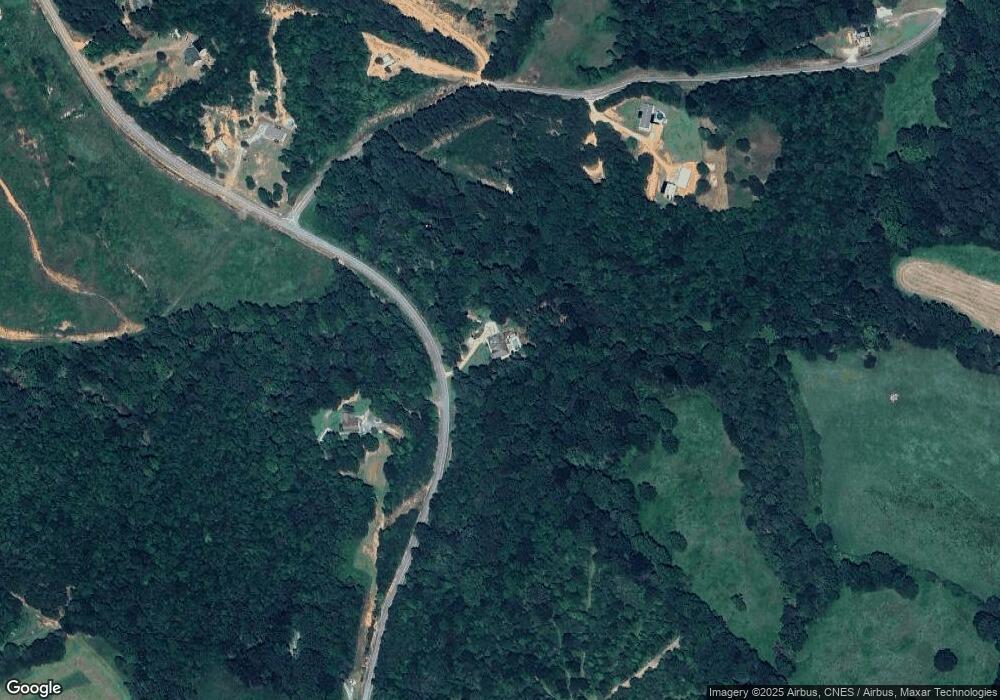
3959 Davis Rd Toccoa, GA 30577
Estimated Value: $276,000 - $593,000
4
Beds
3
Baths
2,154
Sq Ft
$213/Sq Ft
Est. Value
About This Home
This home is located at 3959 Davis Rd, Toccoa, GA 30577 and is currently estimated at $458,552, approximately $212 per square foot. 3959 Davis Rd is a home with nearby schools including Stephens County High School.
Ownership History
Date
Name
Owned For
Owner Type
Purchase Details
Closed on
Jul 22, 2020
Sold by
Garner Jayson
Bought by
Garner Jayson D and Garner Crystal
Current Estimated Value
Home Financials for this Owner
Home Financials are based on the most recent Mortgage that was taken out on this home.
Original Mortgage
$226,000
Outstanding Balance
$199,506
Interest Rate
3.1%
Mortgage Type
New Conventional
Estimated Equity
$259,046
Purchase Details
Closed on
Dec 28, 2007
Sold by
Not Provided
Bought by
Garner Jayson
Create a Home Valuation Report for This Property
The Home Valuation Report is an in-depth analysis detailing your home's value as well as a comparison with similar homes in the area
Purchase History
| Date | Buyer | Sale Price | Title Company |
|---|---|---|---|
| Garner Jayson D | -- | -- | |
| Garner Jayson | $36,000 | -- |
Source: Public Records
Mortgage History
| Date | Status | Borrower | Loan Amount |
|---|---|---|---|
| Open | Garner Jayson D | $226,000 |
Source: Public Records
Tax History
| Year | Tax Paid | Tax Assessment Tax Assessment Total Assessment is a certain percentage of the fair market value that is determined by local assessors to be the total taxable value of land and additions on the property. | Land | Improvement |
|---|---|---|---|---|
| 2025 | $4,132 | $178,768 | $9,811 | $168,957 |
| 2024 | $3,810 | $127,124 | $9,811 | $117,313 |
| 2023 | $3,520 | $120,230 | $9,811 | $110,419 |
| 2022 | $3,363 | $114,953 | $9,811 | $105,142 |
| 2021 | $3,332 | $108,541 | $9,811 | $98,730 |
| 2020 | $3,377 | $108,919 | $9,811 | $99,108 |
| 2019 | $3,376 | $108,452 | $9,344 | $99,108 |
| 2018 | $2,970 | $95,652 | $9,344 | $86,308 |
| 2017 | $3,017 | $95,680 | $9,344 | $86,336 |
| 2016 | $2,971 | $95,679 | $9,344 | $86,335 |
| 2015 | $3,175 | $95,594 | $9,344 | $86,250 |
| 2014 | $104 | $3,092 | $3,092 | $0 |
| 2013 | -- | $3,864 | $3,864 | $0 |
Source: Public Records
Map
Nearby Homes
- 2278 Tower Rd
- 2986 Defoor Rd
- 2230 Tower Rd
- 91 Almetie Dr
- 0 Celia Dr Unit 10661226
- 884 Swilling Rd
- 3.35 ACRES Keener Rd
- 134 Lakeside Hills Rd
- 410 Lakeside Hills Rd
- 0 Eagle Claw Ct Unit 7675414
- 0 Eagle Claw Ct Unit 420092
- 0 Eagle Claw Ct Unit 10637801
- 198 Grégory Dr
- 18 Webb Rd
- 201 Hickory Hill Ln
- 33 Webb Rd
- 538 Oil Mill Rd Unit 8
- 522 Oil Mill Rd Unit 10
- 474 Oil Mill Rd Unit 11
- 526 Oil Mill Rd Unit 9
- 3757 Davis Rd
- 3729 Davis Rd
- 3785 Davis Rd
- 3593 Davis Rd
- 0 Old Yow Mill Rd
- 3979 Davis Rd
- 274 Old Yow Mill Rd
- 4150 Davis Rd
- 1377 S Yow Mill Rd
- 1313 S Yow Mill Rd
- 1443 S Yow Mill Rd
- S S Yow Mill Rd
- 1279 S Yow Mill Rd
- 1279 S Yow Mill Rd
- 1279 S Yow Mill Rd
- 1410 S Yow Mill Rd
- 1112 N Yow Mill Rd
- 3435 Davis Rd
- 445 Old Yow Mill Rd
- 1225 S Yow Mill Rd
