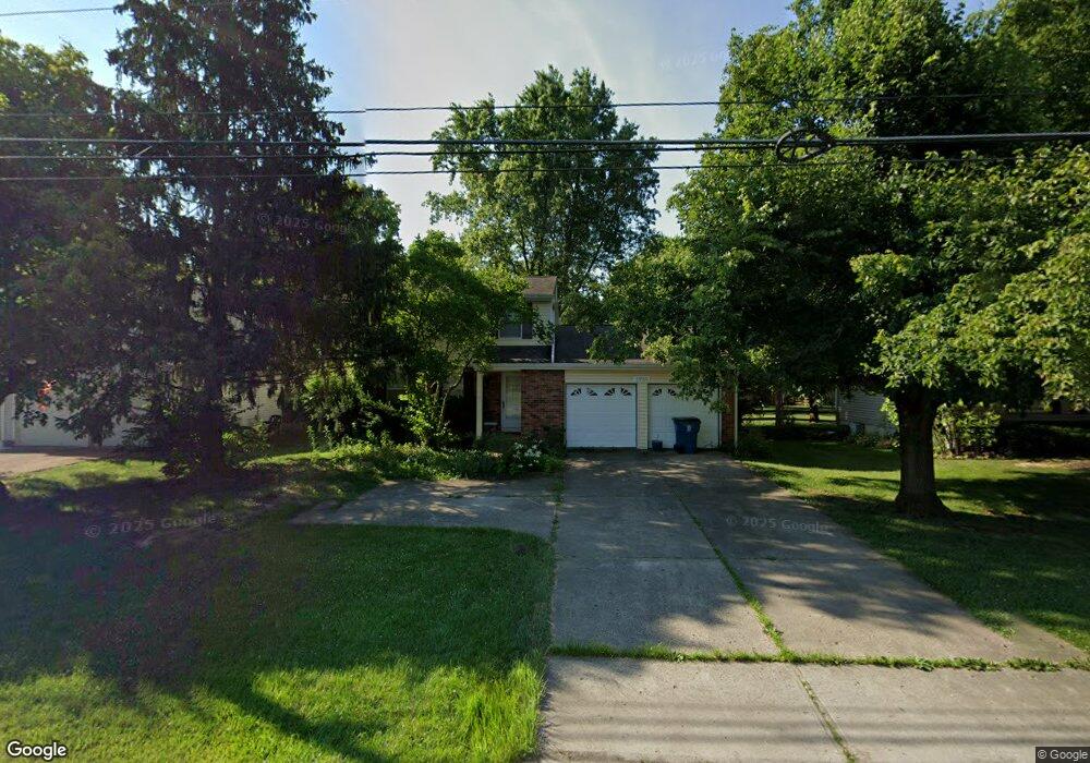
3959 Irwin Simpson Rd Mason, OH 45040
Landen NeighborhoodEstimated Value: $357,625 - $419,000
3
Beds
3
Baths
1,392
Sq Ft
$275/Sq Ft
Est. Value
About This Home
This home is located at 3959 Irwin Simpson Rd, Mason, OH 45040 and is currently estimated at $382,156, approximately $274 per square foot. 3959 Irwin Simpson Rd is a home located in Warren County with nearby schools including Kings Junior High School, Kings High School, and King Of Kings Lutheran Early Childhood Education.
Ownership History
Date
Name
Owned For
Owner Type
Purchase Details
Closed on
Jul 23, 1992
Sold by
Seemann Scott D and Seemann Donna
Bought by
Korostyshevski and Korostyshevski Peter
Current Estimated Value
Purchase Details
Closed on
Jun 29, 1987
Sold by
Apking Apking and Apking Donald J
Bought by
Scott Seemann and Scott D.
Purchase Details
Closed on
Mar 3, 1980
Sold by
Ryland Group & Inc
Purchase Details
Closed on
Dec 18, 1979
Sold by
Landen Farm Co
Purchase Details
Closed on
Jan 19, 1978
Sold by
Landen Farm Co
Create a Home Valuation Report for This Property
The Home Valuation Report is an in-depth analysis detailing your home's value as well as a comparison with similar homes in the area
Home Values in the Area
Average Home Value in this Area
Purchase History
| Date | Buyer | Sale Price | Title Company |
|---|---|---|---|
| Korostyshevski | $91,500 | -- | |
| Scott Seemann | $86,000 | -- | |
| -- | $70,000 | -- | |
| -- | $33,900 | -- | |
| -- | -- | -- |
Source: Public Records
Tax History
| Year | Tax Paid | Tax Assessment Tax Assessment Total Assessment is a certain percentage of the fair market value that is determined by local assessors to be the total taxable value of land and additions on the property. | Land | Improvement |
|---|---|---|---|---|
| 2025 | $4,950 | $94,840 | $24,500 | $70,340 |
| 2024 | $4,950 | $94,840 | $24,500 | $70,340 |
| 2023 | $4,284 | $75,117 | $12,915 | $62,202 |
| 2022 | $4,284 | $75,117 | $12,915 | $62,202 |
| 2021 | $3,590 | $75,117 | $12,915 | $62,202 |
| 2020 | $3,469 | $61,072 | $10,500 | $50,572 |
| 2019 | $3,511 | $61,072 | $10,500 | $50,572 |
| 2018 | $3,490 | $61,072 | $10,500 | $50,572 |
| 2017 | $3,657 | $56,613 | $10,371 | $46,242 |
| 2016 | $3,750 | $56,613 | $10,371 | $46,242 |
| 2015 | $3,186 | $56,613 | $10,371 | $46,242 |
| 2014 | $3,186 | $50,100 | $9,180 | $40,920 |
| 2013 | $3,191 | $57,320 | $10,500 | $46,820 |
Source: Public Records
Map
Nearby Homes
- 3833 Spring Mill Way
- 3761 Green Haven Way
- 8409 Winding Trail Place
- 8225 Winding Trail Ct
- 3464 Simpson Trace
- 8839 Pollard Place
- 9279 Hickory Hill Ct
- 9547 Carriage Run Cir
- 9204 Yarmouth Dr Unit 9204
- 4281 S Haven Dr
- 8819 Pembrooke St
- 9626 Greenery Ct
- 4390 S Mallard Cove
- 3444 Twenty Mile Way Unit 3444
- 2956 Kingsley Ct
- 2113 Clearwater Ct
- 8846 Morley Place
- 7838 Carraway Ct
- 8480 Island Pines Place
- 4796 White Blossom Blvd
- 3947 Irwin Simpson Rd
- 3971 Irwin Simpson Rd
- 3935 Irwin Simpson Rd
- 8749 Meadow Dr
- 8739 Meadow Dr
- 8759 Meadow Dr
- 3925 Irwin Simpson Rd
- 8729 Meadow Dr
- 3954 Irwin Simpson Rd
- 8773 Meadow Dr
- 4015 Irwin Simpson Rd
- 3911 Irwin Simpson Rd
- 8719 Meadow Dr
- 3942 Irwin Simpson Rd
- 3930 Irwin Simpson Rd
- 8785 Meadow Dr
- 3990 Irwin Simpson Rd
- 3918 Irwin Simpson Rd
- 8707 Meadow Dr
- 3901 Irwin Simpson Rd
Your Personal Tour Guide
Ask me questions while you tour the home.