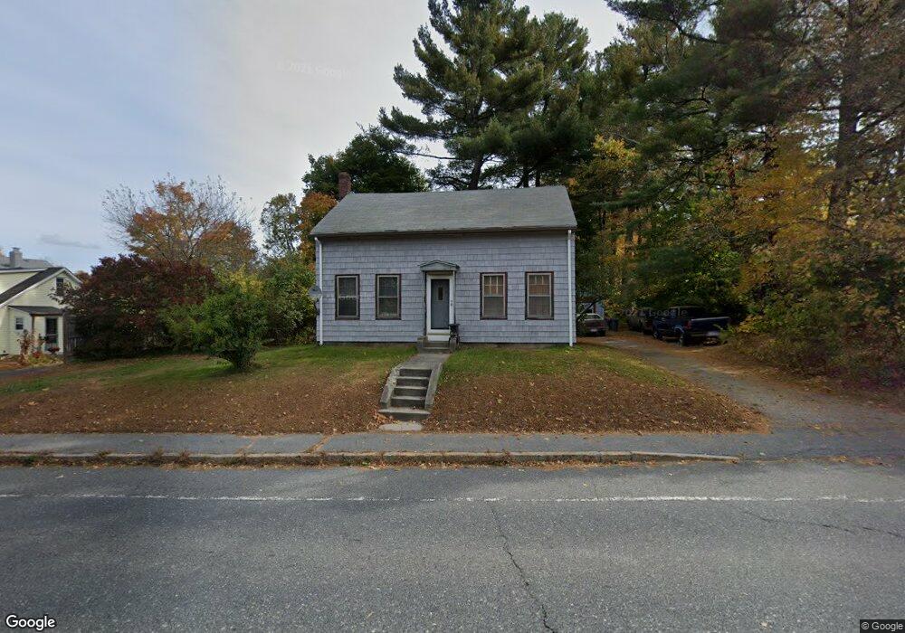
396 Main St Oxford, MA 01540
Estimated Value: $349,000 - $436,000
4
Beds
1
Bath
1,056
Sq Ft
$354/Sq Ft
Est. Value
About This Home
This home is located at 396 Main St, Oxford, MA 01540 and is currently estimated at $373,316, approximately $353 per square foot. 396 Main St is a home located in Worcester County with nearby schools including Oxford High School, Alfred M Chaffee, and Clara Barton Elementary School.
Ownership History
Date
Name
Owned For
Owner Type
Purchase Details
Closed on
Sep 30, 1991
Sold by
Dimond Frank
Bought by
Light Kenneth and Andrea Light
Current Estimated Value
Home Financials for this Owner
Home Financials are based on the most recent Mortgage that was taken out on this home.
Original Mortgage
$80,700
Interest Rate
9.1%
Mortgage Type
Purchase Money Mortgage
Create a Home Valuation Report for This Property
The Home Valuation Report is an in-depth analysis detailing your home's value as well as a comparison with similar homes in the area
Home Values in the Area
Average Home Value in this Area
Purchase History
| Date | Buyer | Sale Price | Title Company |
|---|---|---|---|
| Light Kenneth | $85,000 | -- |
Source: Public Records
Mortgage History
| Date | Status | Borrower | Loan Amount |
|---|---|---|---|
| Closed | Light Kenneth | $80,700 |
Source: Public Records
Tax History Compared to Growth
Tax History
| Year | Tax Paid | Tax Assessment Tax Assessment Total Assessment is a certain percentage of the fair market value that is determined by local assessors to be the total taxable value of land and additions on the property. | Land | Improvement |
|---|---|---|---|---|
| 2025 | $34 | $268,000 | $91,900 | $176,100 |
| 2024 | $3,265 | $242,200 | $87,500 | $154,700 |
| 2023 | $3,169 | $232,300 | $74,400 | $157,900 |
| 2022 | $3,232 | $200,000 | $69,100 | $130,900 |
| 2021 | $3,028 | $183,200 | $65,600 | $117,600 |
| 2020 | $2,839 | $170,400 | $65,600 | $104,800 |
| 2019 | $2,439 | $143,200 | $64,800 | $78,400 |
| 2018 | $2,473 | $143,200 | $64,800 | $78,400 |
| 2017 | $2,472 | $146,700 | $64,800 | $81,900 |
| 2016 | $2,484 | $146,700 | $64,800 | $81,900 |
| 2015 | $2,316 | $146,700 | $64,800 | $81,900 |
| 2014 | $2,270 | $151,300 | $64,800 | $86,500 |
Source: Public Records
Map
Nearby Homes