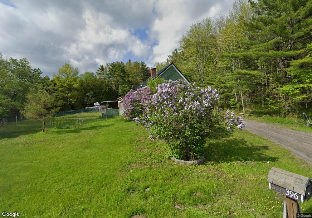
396 Swetts Pond Rd Orrington, ME 04474
Estimated Value: $346,000 - $430,000
3
Beds
2
Baths
1,609
Sq Ft
$235/Sq Ft
Est. Value
About This Home
This home is located at 396 Swetts Pond Rd, Orrington, ME 04474 and is currently estimated at $378,559, approximately $235 per square foot. 396 Swetts Pond Rd is a home located in Penobscot County with nearby schools including Center Drive School.
Ownership History
Date
Name
Owned For
Owner Type
Purchase Details
Closed on
Oct 2, 2013
Sold by
Mauss Robert L and Mauss Catherine R
Bought by
Robshaw Timothy W and Robshaw Shanna L
Current Estimated Value
Home Financials for this Owner
Home Financials are based on the most recent Mortgage that was taken out on this home.
Original Mortgage
$164,415
Outstanding Balance
$124,071
Interest Rate
4.61%
Mortgage Type
New Conventional
Estimated Equity
$254,488
Purchase Details
Closed on
Jul 10, 2006
Sold by
Yacono-Brandt Joann
Bought by
Mauss Robert L and Mauss Catherine R
Home Financials for this Owner
Home Financials are based on the most recent Mortgage that was taken out on this home.
Original Mortgage
$160,800
Interest Rate
6.6%
Mortgage Type
Purchase Money Mortgage
Create a Home Valuation Report for This Property
The Home Valuation Report is an in-depth analysis detailing your home's value as well as a comparison with similar homes in the area
Home Values in the Area
Average Home Value in this Area
Purchase History
| Date | Buyer | Sale Price | Title Company |
|---|---|---|---|
| Robshaw Timothy W | -- | -- | |
| Mauss Robert L | -- | -- |
Source: Public Records
Mortgage History
| Date | Status | Borrower | Loan Amount |
|---|---|---|---|
| Open | Robshaw Timothy W | $164,415 | |
| Previous Owner | Mauss Robert L | $160,800 |
Source: Public Records
Tax History Compared to Growth
Tax History
| Year | Tax Paid | Tax Assessment Tax Assessment Total Assessment is a certain percentage of the fair market value that is determined by local assessors to be the total taxable value of land and additions on the property. | Land | Improvement |
|---|---|---|---|---|
| 2024 | $2,992 | $274,500 | $44,700 | $229,800 |
| 2023 | $2,851 | $259,200 | $41,600 | $217,600 |
| 2022 | $2,953 | $231,600 | $41,600 | $190,000 |
| 2021 | $3,141 | $209,400 | $41,600 | $167,800 |
| 2020 | $2,633 | $165,600 | $41,600 | $124,000 |
| 2019 | $2,275 | $143,100 | $41,600 | $101,500 |
| 2018 | $1,989 | $143,100 | $41,600 | $101,500 |
| 2017 | $4,499 | $182,000 | $41,600 | $140,400 |
| 2016 | $1,548 | $190,600 | $45,100 | $145,500 |
| 2015 | $2,520 | $175,600 | $45,100 | $130,500 |
| 2014 | $2,419 | $168,600 | $45,100 | $123,500 |
| 2013 | $2,268 | $168,600 | $45,100 | $123,500 |
Source: Public Records
Map
Nearby Homes
- 21 Betts Rd
- 101 Oak Hill Rd
- 473 Center Dr
- Map4Lot3 E Bucksport Rd
- 309 Hoxie Hill Rd
- Lot.19 Betts Rd
- 290 Center Dr
- 245 Center Dr
- Map4Lot11 Center Dr
- 8 Bartlett Cove
- 1739 River Rd
- 1002 River Rd
- 173 Center Dr
- 38 Bartlett Cove Dr
- 119 Mill Creek Rd
- 12 Harvest Dr
- 38 Harvest Dr
- 518 Betts Rd
- 900 Brewer Lake Rd
- 03 Foss Farm Rd
- 396 Swett's Pond
- 406 Swetts Pond Rd
- 381 Swetts Pond Rd
- 650 Dow Rd
- 376 Swetts Pond Rd
- 379 Swetts Pond Rd
- 417 Swetts Pond Rd
- 640 Dow Rd
- 635 Dow Rd
- 17 Dornish Rd
- 432 Swetts Pond Rd
- 641 Dow Rd
- 13 Dornish Rd
- 624 Dow Rd
- 355 Swetts Pond Rd
- 00 Betts Rd
- 0 Betts Road Extension
- 350 Swetts Pond Rd
- 18 Betts Rd
- 617 Dow Rd