3960 Highway 231 W Ravenden Springs, AR 72460
Estimated Value: $90,008 - $124,000
--
Bed
1
Bath
1,208
Sq Ft
$91/Sq Ft
Est. Value
About This Home
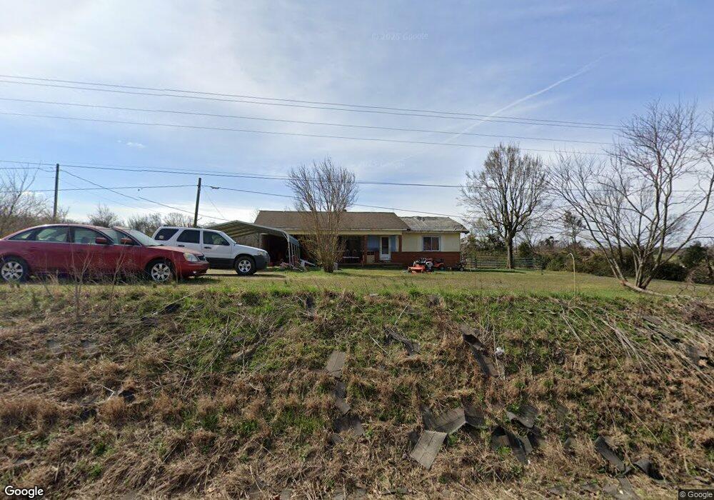
This home is located at 3960 Highway 231 W, Ravenden Springs, AR 72460 and is currently estimated at $109,336, approximately $90 per square foot. 3960 Highway 231 W is a home located in Randolph County with nearby schools including Maynard Elementary School and Maynard High School.
Ownership History
Date
Name
Owned For
Owner Type
Purchase Details
Closed on
Jul 28, 2011
Bought by
Probate Ii To Gary Busch
Current Estimated Value
Purchase Details
Closed on
Dec 1, 2005
Bought by
Bowers To Jones
Purchase Details
Closed on
Jul 17, 1995
Bought by
Bowers Ron D and Mckoon Cynthia D
Purchase Details
Closed on
Jan 1, 1988
Bought by
White To Rodgers
Create a Home Valuation Report for This Property
The Home Valuation Report is an in-depth analysis detailing your home's value as well as a comparison with similar homes in the area
Home Values in the Area
Average Home Value in this Area
Purchase History
| Date | Buyer | Sale Price | Title Company |
|---|---|---|---|
| Probate Ii To Gary Busch | -- | -- | |
| Bowers To Jones | $63,000 | -- | |
| Bowers Ron D | $35,000 | -- | |
| White To Rodgers | $29,000 | -- |
Source: Public Records
Tax History Compared to Growth
Tax History
| Year | Tax Paid | Tax Assessment Tax Assessment Total Assessment is a certain percentage of the fair market value that is determined by local assessors to be the total taxable value of land and additions on the property. | Land | Improvement |
|---|---|---|---|---|
| 2024 | $9 | $12,580 | $1,345 | $11,235 |
| 2023 | $45 | $12,580 | $1,345 | $11,235 |
| 2022 | $74 | $12,580 | $1,345 | $11,235 |
| 2021 | $54 | $12,580 | $1,345 | $11,235 |
| 2020 | $33 | $10,605 | $1,345 | $9,260 |
| 2019 | $32 | $10,605 | $1,345 | $9,260 |
| 2018 | $57 | $10,605 | $1,345 | $9,260 |
| 2017 | $118 | $11,510 | $1,325 | $10,185 |
| 2016 | $72 | $11,510 | $1,325 | $10,185 |
| 2015 | $72 | $11,510 | $1,325 | $10,185 |
| 2014 | $49 | $11,510 | $1,325 | $10,185 |
Source: Public Records
Map
Nearby Homes
- TBD Saienni Rd
- 0 Blackwell Den Rd
- 1929 Stubblefield Rd
- 339 Township Rd
- 5600 Baker Den Rd
- 0 Cokley Rd
- 351 Township Rd
- 0000 Cokley Rd
- 3601 Palestine Rd
- 85 Baker Den Rd
- Tbd Daily Trail Rd Unit LotWP001
- TBD Daily Trail Rd
- 0 County Road 529
- TBD Highway 90 W
- 681 Timber Trail
- 771 Red Rock Trail
- 1361 Baker Den Rd
- 5873 Highway 90 W
- 9369 Highway 93
- TBD Springview Rd
- 4166 Highway 231 W
- 77 Allen Trail
- 4230 Highway 231 W
- 250 Allen Trail
- 4340 Highway 231 W
- 4052 Highway 231 W
- 172 Henson Rd
- 4527 Highway 231 W
- 4107 Wallace Loop Rd
- 3298 Highway 231 W
- 57 Henson Rd
- 4663 Highway 231 W
- 449 Meador Rd
- 4771 Highway 231 W
- 3729 Wallace Loop Rd
- 3004 Highway 231 W
- 3003 Highway 231 W
- 3517 Wallace Loop Rd
- 4908 Highway 231 W