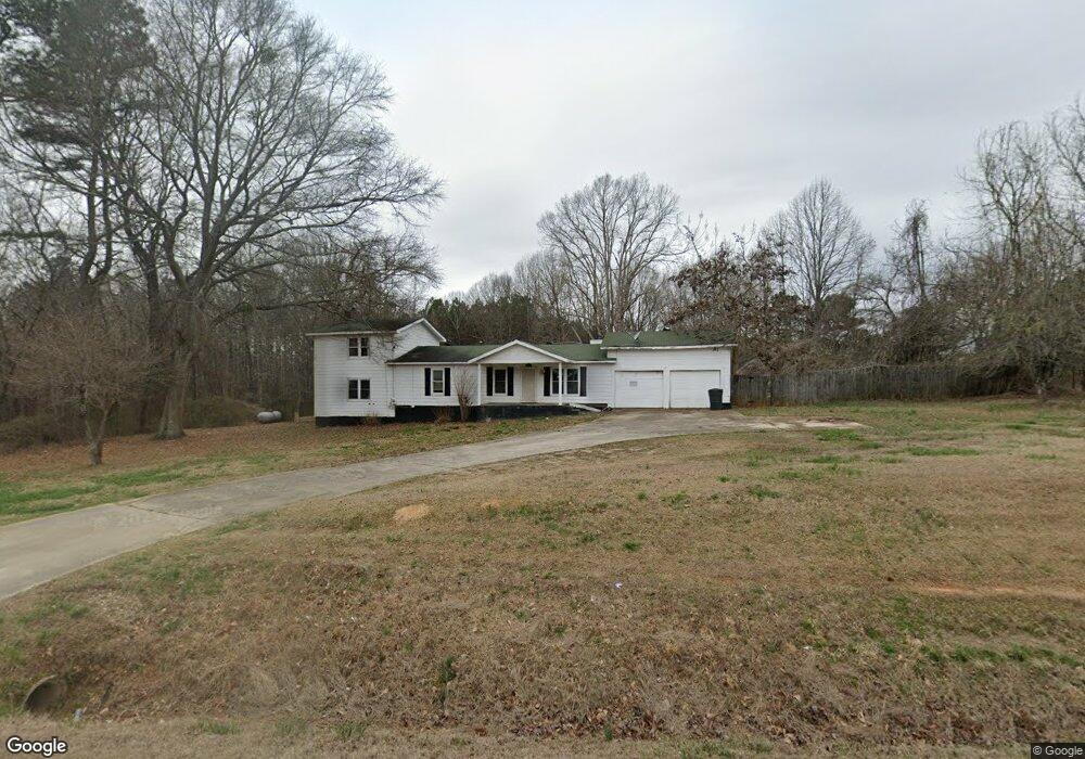
3961 Highway 101 N Rockmart, GA 30153
Estimated Value: $284,727 - $359,000
--
Bed
2
Baths
2,400
Sq Ft
$138/Sq Ft
Est. Value
About This Home
This home is located at 3961 Highway 101 N, Rockmart, GA 30153 and is currently estimated at $331,932, approximately $138 per square foot. 3961 Highway 101 N is a home located in Paulding County with nearby schools including Sara M. Ragsdale Elementary School, Carl Scoggins Sr. Middle School, and Paulding County High School.
Ownership History
Date
Name
Owned For
Owner Type
Purchase Details
Closed on
Nov 30, 2006
Sold by
Mcclure A Bertoe
Bought by
Mcclure Michael H
Current Estimated Value
Home Financials for this Owner
Home Financials are based on the most recent Mortgage that was taken out on this home.
Original Mortgage
$105,000
Outstanding Balance
$62,777
Interest Rate
6.31%
Mortgage Type
New Conventional
Estimated Equity
$269,155
Create a Home Valuation Report for This Property
The Home Valuation Report is an in-depth analysis detailing your home's value as well as a comparison with similar homes in the area
Home Values in the Area
Average Home Value in this Area
Purchase History
| Date | Buyer | Sale Price | Title Company |
|---|---|---|---|
| Mcclure Michael H | $140,000 | -- |
Source: Public Records
Mortgage History
| Date | Status | Borrower | Loan Amount |
|---|---|---|---|
| Open | Mcclure Michael H | $105,000 |
Source: Public Records
Tax History Compared to Growth
Tax History
| Year | Tax Paid | Tax Assessment Tax Assessment Total Assessment is a certain percentage of the fair market value that is determined by local assessors to be the total taxable value of land and additions on the property. | Land | Improvement |
|---|---|---|---|---|
| 2024 | $2,636 | $109,204 | $9,400 | $99,804 |
| 2023 | $2,857 | $112,100 | $8,360 | $103,740 |
| 2022 | $2,171 | $85,164 | $7,320 | $77,844 |
| 2021 | $1,988 | $70,284 | $5,920 | $64,364 |
| 2020 | $1,865 | $64,644 | $6,240 | $58,404 |
| 2019 | $1,836 | $62,804 | $5,360 | $57,444 |
| 2018 | $1,454 | $50,136 | $5,560 | $44,576 |
| 2017 | $1,345 | $45,896 | $5,560 | $40,336 |
| 2016 | $1,111 | $38,596 | $6,000 | $32,596 |
| 2015 | $1,068 | $36,557 | $6,000 | $30,557 |
| 2014 | $954 | $32,077 | $5,120 | $26,957 |
| 2013 | -- | $25,560 | $5,120 | $20,440 |
Source: Public Records
Map
Nearby Homes
- 326 White Creek Loop
- 316 White Creek Loop
- 39 Rosemary Path
- 404 Thorn Thicket Dr
- 46 Conifer Ln
- 716 Presley Farm Pkwy
- 540 Presley Farm Pkwy
- 662 Presley Farm Pkwy
- 790 Presley Farm Pkwy
- 219 Carthage Blvd
- 157 Thorn Thicket Way
- 117 Barnwood Dr
- 572 Southern Trace Dr
- 412 Southern Trace Dr
- 3002 Highway 101 N
- 35 Ravenwood Dr
- 96 Southern Trace Way
- 117 Wallace Way
- 516 Barnwood Dr
- 1174 Proctor Rd
- 3992 Highway 101 N
- 3936 Highway 101 N
- 4034 Highway 101 N
- 4055 Highway 101 N
- 3908 Highway 101 N
- 3857 Highway 101 N
- 10 Ayers Rd
- 0 Proctor Rd Unit 8449242
- 0 Proctor Rd
- 00 Proctor Rd
- 000000 Proctor Rd
- 0 Proctor Rd Unit 7197568
- 0 Proctor Rd Unit 20113678
- 0 Proctor Rd Unit 8042713
- 0 Proctor Rd Unit 3215500
- 0 Proctor Rd Unit 2996051
- 0 Proctor Rd Unit 3989910
- 0 Proctor Rd Unit 4166694
- 0 Proctor Rd Unit 6761543
- 0 Proctor Rd Unit 8833048