Estimated Value: $627,125 - $647,000
3
Beds
3
Baths
3,511
Sq Ft
$181/Sq Ft
Est. Value
About This Home
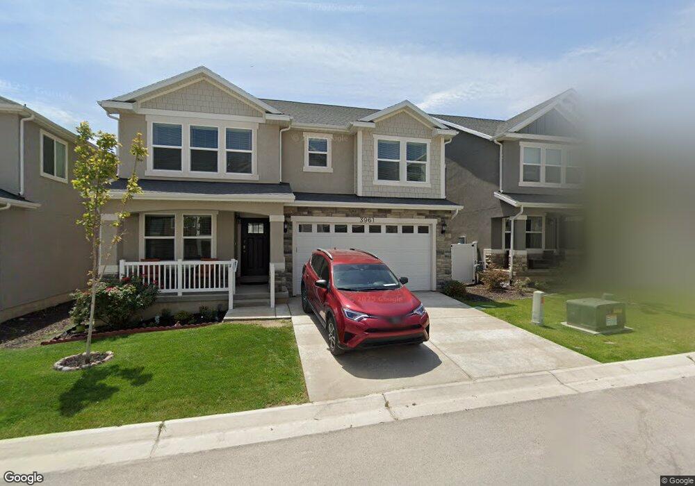
This home is located at 3961 W 1850 N Unit 210, Lehi, UT 84043 and is currently estimated at $637,031, approximately $181 per square foot. 3961 W 1850 N Unit 210 is a home located in Utah County with nearby schools including North Point Elementary School, Willowcreek Middle School, and Lehi High School.
Ownership History
Date
Name
Owned For
Owner Type
Purchase Details
Closed on
May 13, 2023
Sold by
Joel S And Barbara P Loosli Living Trust
Bought by
Bjl Heritage Llc
Current Estimated Value
Purchase Details
Closed on
Jul 29, 2020
Sold by
Hill Wade and Hill Anita P
Bought by
Loosli Joel S and Loosli Barbara P
Home Financials for this Owner
Home Financials are based on the most recent Mortgage that was taken out on this home.
Original Mortgage
$153,700
Interest Rate
3.1%
Mortgage Type
New Conventional
Purchase Details
Closed on
Nov 19, 2018
Sold by
Edge Homes Utah Llc
Bought by
Hill Wade and Hill Anita P
Home Financials for this Owner
Home Financials are based on the most recent Mortgage that was taken out on this home.
Original Mortgage
$290,000
Interest Rate
4.8%
Mortgage Type
New Conventional
Create a Home Valuation Report for This Property
The Home Valuation Report is an in-depth analysis detailing your home's value as well as a comparison with similar homes in the area
Home Values in the Area
Average Home Value in this Area
Purchase History
| Date | Buyer | Sale Price | Title Company |
|---|---|---|---|
| Bjl Heritage Llc | -- | None Listed On Document | |
| Loosli Joel S | -- | Us Title Ins Agency | |
| Loosli Joel S | -- | Us Title Insurance Agency | |
| Hill Wade | -- | Provo Land Title Co |
Source: Public Records
Mortgage History
| Date | Status | Borrower | Loan Amount |
|---|---|---|---|
| Previous Owner | Loosli Joel S | $153,700 | |
| Previous Owner | Hill Wade | $290,000 |
Source: Public Records
Tax History Compared to Growth
Tax History
| Year | Tax Paid | Tax Assessment Tax Assessment Total Assessment is a certain percentage of the fair market value that is determined by local assessors to be the total taxable value of land and additions on the property. | Land | Improvement |
|---|---|---|---|---|
| 2025 | $2,493 | $316,250 | $227,500 | $347,500 |
| 2024 | $2,493 | $292,160 | $0 | $0 |
| 2023 | $2,348 | $298,760 | $0 | $0 |
| 2022 | $2,428 | $299,530 | $0 | $0 |
| 2021 | $2,188 | $408,100 | $135,900 | $272,200 |
| 2020 | $2,077 | $383,000 | $121,300 | $261,700 |
| 2019 | $1,928 | $369,700 | $127,200 | $242,500 |
| 2018 | $1,276 | $127,200 | $127,200 | $0 |
Source: Public Records
Map
Nearby Homes
- 3984 W 1850 N Unit D102
- 4057 W 1760 N
- 4037 W 1730 N
- 3985 W 1960 N
- 2773 N Tower Way
- 236 W Glenbrittle Dr Unit 204
- 3852 W 1850 N Unit 204
- 1941 N 4100 W
- 4089 W 1700 N Unit 618
- 4173 W 1850 N
- 4155 W 1960 N
- Type C Outer Townhome Plan at Gardner Point - Townhomes
- Jordan Plan at Gardner Point
- Kate Plan at Gardner Point
- Condo B Front Third Level Plan at Gardner Point - Condos
- Type C Inner Townhome Plan at Gardner Point - Townhomes
- Kate B Plan at Gardner Point
- Natalie Plan at Gardner Point
- Condo A Third Level Plan at Gardner Point - Condos
- Condo B Front Second Level Plan at Gardner Point - Condos
- 3961 W 1850 N
- 3971 W 1850 N Unit 209
- 3953 W 1850 N Unit 211
- 3953 W 1850 N
- 3964 W 1800 N
- 3964 W 1800 N Unit 939
- 3981 W 1850 N Unit 208
- 3945 W 1850 N Unit 212
- 3972 W 1800 N Unit 940
- 3954 W 1800 N Unit 938
- 3982 W 1800 N Unit 941
- 3946 W 1800 N Unit 937
- 3956 W 1850 N
- 3956 W 1850 N Unit C201
- 3956 W 1850 N Unit C101
- 3956 W 1850 N Unit C303
- 3956 W 1850 N Unit C301
- 3956 W 1850 N Unit C202
- 3956 W 1850 N Unit C 102
- 3956 W 1850 N Unit 203