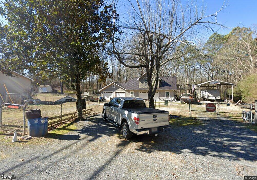
3962 Old Field Rd SW Dalton, GA 30721
Estimated Value: $86,000 - $262,000
3
Beds
2
Baths
1,287
Sq Ft
$144/Sq Ft
Est. Value
About This Home
This home is located at 3962 Old Field Rd SW, Dalton, GA 30721 and is currently estimated at $185,667, approximately $144 per square foot. 3962 Old Field Rd SW is a home located in Whitfield County with nearby schools including Valley Point Elementary School, Valley Point Middle School, and Southeast Whitfield County High School.
Ownership History
Date
Name
Owned For
Owner Type
Purchase Details
Closed on
Sep 17, 2012
Sold by
Johnson William D
Bought by
Johnson William Reed
Current Estimated Value
Purchase Details
Closed on
Mar 14, 2008
Sold by
Sec Of Veterans Affa
Bought by
Johnson William David and Johnson Sylvia L
Home Financials for this Owner
Home Financials are based on the most recent Mortgage that was taken out on this home.
Original Mortgage
$43,965
Interest Rate
5.68%
Mortgage Type
New Conventional
Purchase Details
Closed on
Oct 2, 2007
Sold by
Everhome Mtg Co
Bought by
Sec Of Veterans Affairs
Purchase Details
Closed on
May 1, 1991
Sold by
Patterson Robert W and Patterson Shirley A
Bought by
Suggs Jonathan B and Suggs Trinka
Create a Home Valuation Report for This Property
The Home Valuation Report is an in-depth analysis detailing your home's value as well as a comparison with similar homes in the area
Home Values in the Area
Average Home Value in this Area
Purchase History
| Date | Buyer | Sale Price | Title Company |
|---|---|---|---|
| Johnson William Reed | $12,000 | -- | |
| Johnson William David | $38,000 | -- | |
| Sec Of Veterans Affairs | $42,740 | -- | |
| Everhome Mtg Co | $42,740 | -- | |
| Suggs Jonathan B | -- | -- |
Source: Public Records
Mortgage History
| Date | Status | Borrower | Loan Amount |
|---|---|---|---|
| Previous Owner | Johnson William David | $43,965 |
Source: Public Records
Tax History Compared to Growth
Tax History
| Year | Tax Paid | Tax Assessment Tax Assessment Total Assessment is a certain percentage of the fair market value that is determined by local assessors to be the total taxable value of land and additions on the property. | Land | Improvement |
|---|---|---|---|---|
| 2024 | $447 | $15,836 | $4,101 | $11,735 |
| 2023 | $447 | $10,474 | $3,138 | $7,336 |
| 2022 | $355 | $12,026 | $2,755 | $9,271 |
| 2021 | $355 | $12,026 | $2,755 | $9,271 |
| 2020 | $367 | $12,026 | $2,755 | $9,271 |
| 2019 | $373 | $12,026 | $2,755 | $9,271 |
| 2018 | $366 | $11,617 | $2,346 | $9,271 |
| 2017 | $366 | $11,617 | $2,346 | $9,271 |
| 2016 | $352 | $11,617 | $2,346 | $9,271 |
| 2014 | $320 | $11,889 | $2,618 | $9,271 |
| 2013 | -- | $11,889 | $2,618 | $9,271 |
Source: Public Records
Map
Nearby Homes
- 586 Collington Cir
- 282 Collington Cir
- 473 Collington Cir
- 3737 S Dixie Hwy
- 3950 S Dixie Hwy
- 162 Valley Point Dr SE
- 112 Toria Trace
- 147 Toria Trace
- 139 Waterfront Way
- 169 Waterfront Way
- 0 S Dixie Hwy Unit 131308
- 00 S Dixie Hwy
- 000 S Dixie Hwy
- 171 Maurine Dr
- 243 Gaz Rd SE
- 112 Robin Hood Dr
- 116 Robin Hood Dr
- 122 Robin Hood Dr
- 2654 Foxmore Cir
- 2606 Foxmore Cir
- 00 Valley Point Dr SE
- 1180 Brookstone Cir
- 1190 Brookstone Cir
- 1170 Brookstone Cir Unit 13
- 1170 Brookstone Cir
- 1160 Brookstone Cir
- 1200 Brookstone Cir
- 1150 Brookstone Cir
- 1210 Brookstone Cir
- 1195 Brookstone Cir
- 1140 Brookstone Cir
- 1155 Brookstone Cir
- 1220 Brookstone Cir
- 1215 Brookstone Cir
- 1125 Brookstone Cir
- 1130 Brookstone Cir
- 1230 Brookstone Cir
- 1225 Brookstone Cir
- 1115 Brookstone Cir
- 1120 Brookstone Cir