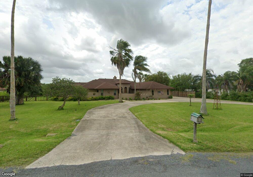
39626 Palm Dr Unit 7 Los Fresnos, TX 78566
Estimated Value: $431,000 - $463,136
3
Beds
3
Baths
2,748
Sq Ft
$162/Sq Ft
Est. Value
About This Home
This home is located at 39626 Palm Dr Unit 7, Los Fresnos, TX 78566 and is currently estimated at $444,784, approximately $161 per square foot. 39626 Palm Dr Unit 7 is a home located in Cameron County with nearby schools including Palmer-Laakso Elementary School, Los Cuates Middle School, and Los Fresnos High School.
Ownership History
Date
Name
Owned For
Owner Type
Purchase Details
Closed on
Jul 31, 2020
Sold by
Stanton William B and Rios Nancy
Bought by
Cavazos Matias and Cavazos Zaida Yareya
Current Estimated Value
Home Financials for this Owner
Home Financials are based on the most recent Mortgage that was taken out on this home.
Original Mortgage
$247,778
Outstanding Balance
$220,202
Interest Rate
3.1%
Mortgage Type
FHA
Estimated Equity
$224,582
Purchase Details
Closed on
Mar 31, 2009
Sold by
Fillingim Erskin P and Barnes Judith M
Bought by
Stanton William B and Rios Nancy
Home Financials for this Owner
Home Financials are based on the most recent Mortgage that was taken out on this home.
Original Mortgage
$156,600
Interest Rate
5.14%
Mortgage Type
Purchase Money Mortgage
Purchase Details
Closed on
Mar 5, 2007
Sold by
Baker Harlan H and Baker Ann
Bought by
Fillingim Erskin P and Barnes Judith M
Create a Home Valuation Report for This Property
The Home Valuation Report is an in-depth analysis detailing your home's value as well as a comparison with similar homes in the area
Home Values in the Area
Average Home Value in this Area
Purchase History
| Date | Buyer | Sale Price | Title Company |
|---|---|---|---|
| Cavazos Matias | -- | Edwards Abstract | |
| Stanton William B | -- | Cameron County Title Company | |
| Fillingim Erskin P | -- | None Available |
Source: Public Records
Mortgage History
| Date | Status | Borrower | Loan Amount |
|---|---|---|---|
| Open | Cavazos Matias | $247,778 | |
| Previous Owner | Stanton William B | $156,600 |
Source: Public Records
Tax History Compared to Growth
Tax History
| Year | Tax Paid | Tax Assessment Tax Assessment Total Assessment is a certain percentage of the fair market value that is determined by local assessors to be the total taxable value of land and additions on the property. | Land | Improvement |
|---|---|---|---|---|
| 2025 | $5,010 | $379,556 | $102,878 | $276,678 |
| 2024 | $5,010 | $382,783 | $102,878 | $279,905 |
| 2023 | $5,674 | $360,194 | $102,878 | $257,316 |
| 2022 | $5,784 | $316,475 | $102,878 | $213,597 |
| 2021 | $4,694 | $244,235 | $28,058 | $216,177 |
| 2020 | $4,760 | $246,816 | $28,058 | $218,758 |
| 2019 | $4,758 | $249,398 | $28,058 | $221,340 |
| 2018 | $4,803 | $251,982 | $28,058 | $223,924 |
| 2017 | $4,645 | $244,212 | $28,058 | $216,154 |
| 2016 | $4,692 | $246,723 | $28,058 | $218,665 |
| 2015 | $4,790 | $249,238 | $28,058 | $221,180 |
Source: Public Records
Map
Nearby Homes
- 39362 Loop Rd
- 39515 Palm Lane Rd
- 36661 Perez Rd
- 39785 Resaca Blvd
- 000 Sun Trail Dr
- 0 Centerline Rd Unit 200 103720
- 0 Centerline Rd Unit 29764976
- 168 N San Roman Rd
- 112 Madelyn Rose
- 38639 Centerline Rd
- 000 Hwy 100
- 00 Old Port Rd
- 140 Madelyn Rose
- 25488 Ted Hunt Rd
- 119 Chachalaca Dr
- 123 Chachalaca Dr
- 0 Chachalaca Dr Unit 29762699
- 00 Mockingbird Ln
- 120 Chachalaca Dr
- 108 Pomelo Bend Unit LOT 7
- 39626 Palm Dr
- 39626 Palm Lane Rd
- 39670 Palm Dr
- 39612 Palm Dr
- 39574 Palm Dr
- 39613 Palm Lane Rd Unit 19
- 39613 Palm Dr
- 39613 Palm Dr Unit 19
- 39687 Palm Dr
- 26 Palm Lane Rd Unit 26
- 2 Palm Lane Rd Unit 2
- 1 Palm Lane Rd Unit 1
- 00 Palm Lane Rd
- 000 Palm Lane Rd
- 0 Palm Lane Rd Unit Lot 3 50022
- 0 Palm Lane Rd Unit Lot 2
- 0 Palm Lane Rd Unit Lot 1
- 39629 Palm Dr
- 39563 Palm Dr
- 39709 Palm Dr