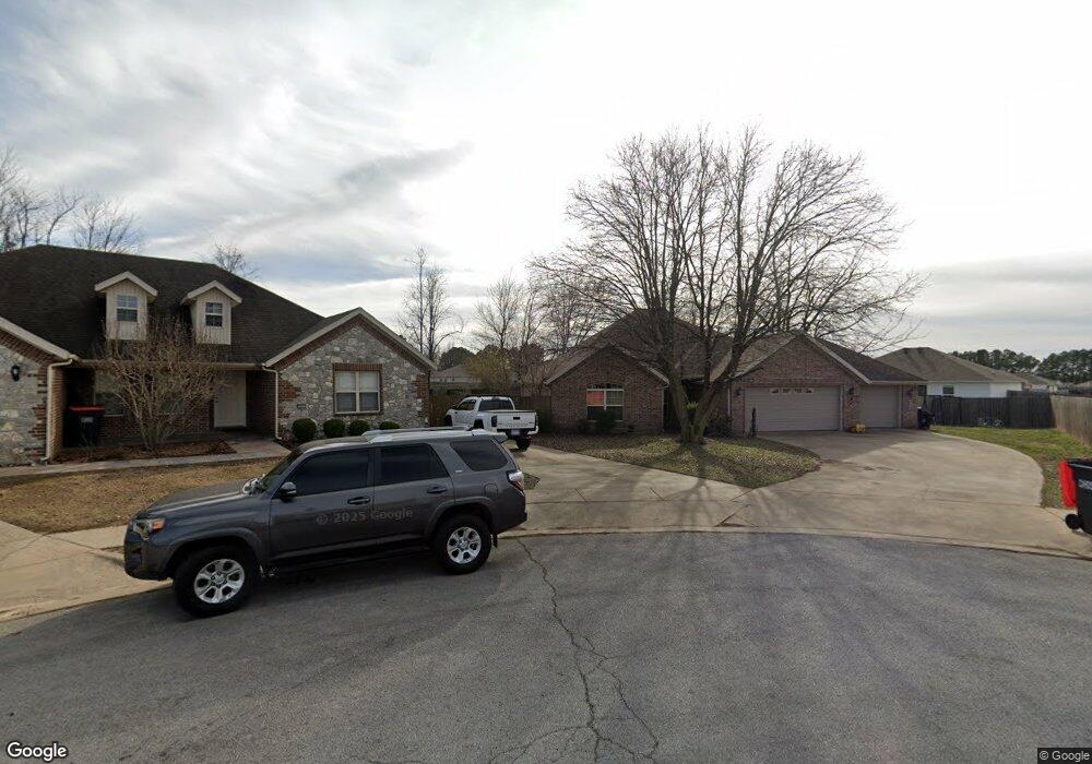
3963 Rosebud Ln Springdale, AR 72764
4
Beds
2
Baths
1,832
Sq Ft
0.27
Acres
About This Home
This home is located at 3963 Rosebud Ln, Springdale, AR 72764. 3963 Rosebud Ln is a home located in Benton County with nearby schools including Monitor Elementary School, Lakeside Junior High School, and Sonora Middle School.
Ownership History
Date
Name
Owned For
Owner Type
Purchase Details
Closed on
Apr 23, 2018
Sold by
Nwar 2015 Llc
Bought by
Mason Carol L
Purchase Details
Closed on
Apr 26, 2017
Sold by
Strasser Zachary Ryan and Strasser Bethany Ann
Bought by
Mason Carol L
Home Financials for this Owner
Home Financials are based on the most recent Mortgage that was taken out on this home.
Original Mortgage
$162,993
Interest Rate
4.25%
Mortgage Type
FHA
Purchase Details
Closed on
Aug 21, 2015
Sold by
Watson Heather
Bought by
Strasser Zachary Ryan and Strasser Bethany Ann
Home Financials for this Owner
Home Financials are based on the most recent Mortgage that was taken out on this home.
Original Mortgage
$161,499
Interest Rate
4.08%
Mortgage Type
New Conventional
Purchase Details
Closed on
Aug 4, 2009
Sold by
Bank Of Oklahoma Na
Bought by
Federal Home Loan Mortgage Corp
Create a Home Valuation Report for This Property
The Home Valuation Report is an in-depth analysis detailing your home's value as well as a comparison with similar homes in the area
Home Values in the Area
Average Home Value in this Area
Purchase History
| Date | Buyer | Sale Price | Title Company |
|---|---|---|---|
| Mason Carol L | -- | None Available | |
| Mason Carol L | $166,000 | Lenders Title Company | |
| Strasser Zachary Ryan | $170,000 | Mercury Title Llc | |
| Federal Home Loan Mortgage Corp | -- | None Available |
Source: Public Records
Mortgage History
| Date | Status | Borrower | Loan Amount |
|---|---|---|---|
| Previous Owner | Mason Carol L | $162,993 | |
| Previous Owner | Strasser Zachary Ryan | $161,499 |
Source: Public Records
Tax History Compared to Growth
Tax History
| Year | Tax Paid | Tax Assessment Tax Assessment Total Assessment is a certain percentage of the fair market value that is determined by local assessors to be the total taxable value of land and additions on the property. | Land | Improvement |
|---|---|---|---|---|
| 2025 | $2,476 | $69,285 | $15,200 | $54,085 |
| 2024 | $2,417 | $69,285 | $15,200 | $54,085 |
| 2023 | $2,302 | $45,730 | $7,200 | $38,530 |
| 2022 | $1,831 | $45,730 | $7,200 | $38,530 |
| 2021 | $1,722 | $45,730 | $7,200 | $38,530 |
Source: Public Records
Map
Nearby Homes
- 3435 Alliance Dr
- 3621 Alliance Dr
- 337 Joy Carol Loop
- 3751 Alliance Dr
- 2996 Twin County St
- 2977 Kings Dr
- 985 Remington Dr
- 413 W Highway 264
- 7.25 AC Thompson
- 3343 Grainger Cir
- 1337 Kendrick Ave
- 3450 Pasofino Loop
- 2169 Harry St
- 1308 W Stultz Rd
- 4809 Kimberly Place
- 1483 Leesburg Ave
- 5.06 AC Old Wire Rd
- 0 Old Wire Rd
- 1376 Lexington Cir
- 114 E Bailey Ave
- 3963 Rosebud Ave
- 3981 Rosebud Ave
- 3945 Rosebud Ln
- 3945 Rosebud Ave
- 3411 Alliance Dr
- 3999 Rosebud Ln
- 3816 Rosebud Ave
- 3999 Rosebud Ave
- 3387 Alliance Dr
- 3927 Rosebud Ln
- 3927 Rosebud Ave
- 3814 Rosebud Ave
- 3909 Rosebud Ln
- 3909 Rosebud Ave
- 3432 Alliance Dr
- 3408 Alliance Dr
- 3476 Alliance Dr
- 3812 Rosebud Ln
- 3891 Rosebud Ln
- 3817 Rosebud Ln