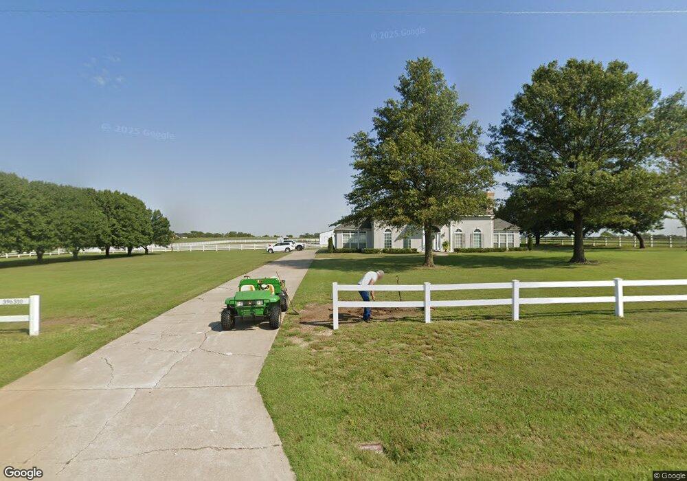
396310 W 2400 Rd Bartlesville, OK 74006
Estimated Value: $477,000 - $639,000
4
Beds
4
Baths
3,855
Sq Ft
$147/Sq Ft
Est. Value
About This Home
This home is located at 396310 W 2400 Rd, Bartlesville, OK 74006 and is currently estimated at $567,634, approximately $147 per square foot. 396310 W 2400 Rd is a home located in Washington County with nearby schools including Wayside Elementary School, Central Middle School, and Bartlesville High School.
Ownership History
Date
Name
Owned For
Owner Type
Purchase Details
Closed on
Aug 7, 2020
Sold by
Pruitt Joe Bob
Bought by
Union State Bank
Current Estimated Value
Purchase Details
Closed on
May 18, 2009
Sold by
Pruitt Nancy and Pruitt Nancy L
Bought by
Pruitt Joe Bob
Purchase Details
Closed on
Sep 22, 2006
Sold by
Missel Louis W and Missel Peggy S
Bought by
Pruitt Joe Bob and Pruitt Nancy L
Purchase Details
Closed on
Jun 13, 2001
Sold by
Missel Louis W and Missel Peggy S
Purchase Details
Closed on
Aug 9, 1999
Sold by
Ballard Edna K
Purchase Details
Closed on
Sep 2, 1998
Sold by
Ballard Donald R and Ballard Edna K
Create a Home Valuation Report for This Property
The Home Valuation Report is an in-depth analysis detailing your home's value as well as a comparison with similar homes in the area
Home Values in the Area
Average Home Value in this Area
Purchase History
| Date | Buyer | Sale Price | Title Company |
|---|---|---|---|
| Union State Bank | -- | None Available | |
| Pruitt Joe Bob | -- | -- | |
| Pruitt Joe Bob | $407,500 | None Available | |
| -- | $317,500 | -- | |
| -- | $308,500 | -- | |
| -- | -- | -- |
Source: Public Records
Tax History Compared to Growth
Tax History
| Year | Tax Paid | Tax Assessment Tax Assessment Total Assessment is a certain percentage of the fair market value that is determined by local assessors to be the total taxable value of land and additions on the property. | Land | Improvement |
|---|---|---|---|---|
| 2025 | $4,593 | $44,937 | $4,006 | $40,931 |
| 2024 | $4,482 | $43,629 | $3,890 | $39,739 |
| 2023 | $4,482 | $42,358 | $3,600 | $38,758 |
| 2022 | $4,341 | $42,358 | $3,600 | $38,758 |
| 2021 | $4,342 | $42,358 | $3,600 | $38,758 |
| 2020 | $4,958 | $47,215 | $3,600 | $43,615 |
| 2019 | $4,954 | $47,215 | $3,600 | $43,615 |
| 2018 | $5,012 | $47,744 | $3,600 | $44,144 |
| 2017 | $5,174 | $48,540 | $2,700 | $45,840 |
| 2016 | $4,869 | $48,540 | $2,700 | $45,840 |
| 2015 | $4,925 | $48,540 | $2,700 | $45,840 |
| 2014 | $4,917 | $48,540 | $2,700 | $45,840 |
Source: Public Records
Map
Nearby Homes
- 0 N 3967 Rd Unit 2544345
- 0 N 3967 Rd Unit 2544353
- 0 N 3967 Rd Unit 2544346
- 0 N 3967 Rd Unit 2544341
- 0 N 3967 Rd Unit 2544351
- 23861 US Highway 75
- 4015 Silver Lake Rd
- 397911 W 2400 Rd
- 2601 Rice Creek Rd
- 24099 N 3983 Dr
- 24200 N 3983 Dr
- 24168 N 3983 Dr
- 24197 N 3983 Dr
- 24138 N 3983 Dr
- 24159 N 3983 Dr
- 24106 N 3983 Dr
- 24066 N 3983 Dr
- 24131 N 3983 Dr
- 394440 Gap Rd
- 3201 Brighton Ln
- 0 3962 Dr
- 24162 N 3980 Rd
- 396520 W 2400 Rd
- 396515 W 2400 Rd
- 24098 N 3962 Rd
- 477 W 2400 Rd
- 24100 N 3965 Rd
- 0 N 3962 Rd
- 24034 N 3965 Rd
- 396569 W 2400 Rd
- 24105 N 3962 Rd
- 24158 N 3965 Rd
- 24135 N 3962 Rd
- 24177 N 3962 Rd
- 475 Moose Lodge Rd
- 4700 Silver Lake Rd
- 396146 W 2385 Dr
- 24206 N 3962 Rd
- 24125 N 3967 Rd
- 0 N 3965 Rd