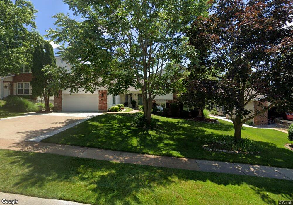
3964 Lockport Dr Bridgeton, MO 63044
Estimated Value: $347,000 - $506,000
4
Beds
4
Baths
3,626
Sq Ft
$119/Sq Ft
Est. Value
About This Home
This home is located at 3964 Lockport Dr, Bridgeton, MO 63044 and is currently estimated at $432,809, approximately $119 per square foot. 3964 Lockport Dr is a home located in St. Louis County with nearby schools including Robert Drummond Elementary School, Holman Middle School, and Pattonville High School.
Ownership History
Date
Name
Owned For
Owner Type
Purchase Details
Closed on
Oct 18, 1997
Sold by
Keel Thomas W and Keel Lisa D
Bought by
Kuehn Ralph P and Kuehn Tracy A
Current Estimated Value
Home Financials for this Owner
Home Financials are based on the most recent Mortgage that was taken out on this home.
Original Mortgage
$177,150
Outstanding Balance
$23,964
Interest Rate
6%
Estimated Equity
$408,845
Create a Home Valuation Report for This Property
The Home Valuation Report is an in-depth analysis detailing your home's value as well as a comparison with similar homes in the area
Home Values in the Area
Average Home Value in this Area
Purchase History
| Date | Buyer | Sale Price | Title Company |
|---|---|---|---|
| Kuehn Ralph P | -- | -- |
Source: Public Records
Mortgage History
| Date | Status | Borrower | Loan Amount |
|---|---|---|---|
| Open | Kuehn Ralph P | $177,150 |
Source: Public Records
Tax History
| Year | Tax Paid | Tax Assessment Tax Assessment Total Assessment is a certain percentage of the fair market value that is determined by local assessors to be the total taxable value of land and additions on the property. | Land | Improvement |
|---|---|---|---|---|
| 2025 | $6,386 | $90,820 | $12,500 | $78,320 |
| 2024 | $6,386 | $79,040 | $10,560 | $68,480 |
| 2023 | $6,386 | $79,040 | $10,560 | $68,480 |
| 2022 | $6,030 | $67,090 | $8,650 | $58,440 |
| 2021 | $5,950 | $67,090 | $8,650 | $58,440 |
| 2020 | $5,197 | $56,850 | $7,660 | $49,190 |
| 2019 | $4,767 | $51,990 | $7,660 | $44,330 |
| 2018 | $5,557 | $55,960 | $5,760 | $50,200 |
| 2017 | $5,472 | $55,960 | $5,760 | $50,200 |
| 2016 | $4,815 | $48,380 | $3,100 | $45,280 |
| 2015 | $4,770 | $48,380 | $3,100 | $45,280 |
| 2014 | $4,418 | $44,590 | $5,910 | $38,680 |
Source: Public Records
Map
Nearby Homes
- 11768 Parish Dr
- 11660 Mark Twain Ln
- 3705 Dax Ln
- 12130 Natural Bridge Rd Unit A
- 4110 Fee Rd
- 3534 Bostons Farm Dr
- 3623 Bridgeton Valley Cir
- 3706 Midview Ave
- 11351 Burgess Ave
- 11424 Burgess Ave
- 4229 Carrollton Dr Unit A
- 4105 Banks Rd
- 3303 Haas Ave
- 11658 Jaquetta Ct
- 3202 Denmark Dr Unit C
- 11239 Terry Ave
- 11318 Taylor Pines Dr
- 12195 McKelvey Place Dr
- 11920 Autumn Lakes Dr Unit 393
- 3122 Carnaby Ln Unit A
- 3970 Lockport Dr
- 3958 Lockport Dr
- 3976 Lockport Dr
- 3952 Lockport Dr
- 3949 Laux Dr
- 3937 Laux Dr
- 3961 Lockport Dr
- 3967 Lockport Dr
- 3955 Lockport Dr
- 3955 Laux Dr
- 3973 Lockport Dr
- 3925 Laux Dr
- 11752 Avery Ln
- 3961 Laux Dr
- 11748 Avery Ln
- 3949 Lockport Dr
- 11744 Avery Ln
- 3979 Lockport Dr
- 3943 Lockport Dr
- 11740 Avery Ln
Your Personal Tour Guide
Ask me questions while you tour the home.