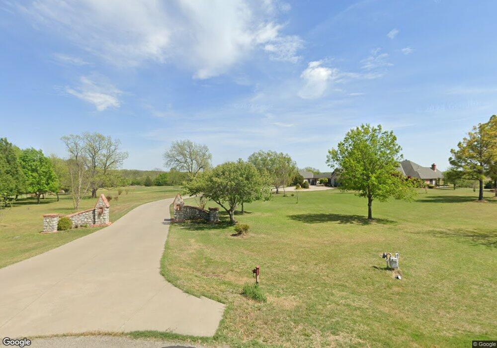
396543 W 2437 Rd Bartlesville, OK 74006
Estimated Value: $774,000 - $1,197,137
4
Beds
3
Baths
5,878
Sq Ft
$168/Sq Ft
Est. Value
About This Home
This home is located at 396543 W 2437 Rd, Bartlesville, OK 74006 and is currently estimated at $985,569, approximately $167 per square foot. 396543 W 2437 Rd is a home located in Washington County with nearby schools including Wayside Elementary School, Central Middle School, and Bartlesville High School.
Ownership History
Date
Name
Owned For
Owner Type
Purchase Details
Closed on
Sep 3, 2009
Sold by
Ambarian Edward and Ambarian Roberta C
Bought by
Carter Jerry B and Carter Cynthia L
Current Estimated Value
Purchase Details
Closed on
Mar 28, 2005
Sold by
Brent Taylor Homes Inc
Bought by
Ambarian Edward and Ambarian Roberta C
Home Financials for this Owner
Home Financials are based on the most recent Mortgage that was taken out on this home.
Original Mortgage
$58,000
Interest Rate
5.71%
Mortgage Type
Future Advance Clause Open End Mortgage
Create a Home Valuation Report for This Property
The Home Valuation Report is an in-depth analysis detailing your home's value as well as a comparison with similar homes in the area
Home Values in the Area
Average Home Value in this Area
Purchase History
| Date | Buyer | Sale Price | Title Company |
|---|---|---|---|
| Carter Jerry B | $93,000 | -- | |
| Ambarian Edward | $70,000 | None Available |
Source: Public Records
Mortgage History
| Date | Status | Borrower | Loan Amount |
|---|---|---|---|
| Previous Owner | Ambarian Edward | $58,000 |
Source: Public Records
Tax History Compared to Growth
Tax History
| Year | Tax Paid | Tax Assessment Tax Assessment Total Assessment is a certain percentage of the fair market value that is determined by local assessors to be the total taxable value of land and additions on the property. | Land | Improvement |
|---|---|---|---|---|
| 2025 | $7,674 | $76,200 | $10,539 | $65,661 |
| 2024 | $7,674 | $73,981 | $10,232 | $63,749 |
| 2023 | $7,674 | $71,826 | $10,178 | $61,648 |
| 2022 | $6,247 | $60,523 | $10,159 | $50,364 |
| 2021 | $6,102 | $60,523 | $10,159 | $50,364 |
| 2020 | $6,251 | $60,523 | $10,159 | $50,364 |
| 2019 | $6,245 | $60,523 | $10,159 | $50,364 |
| 2018 | $6,248 | $60,523 | $10,159 | $50,364 |
| 2017 | $6,345 | $60,523 | $10,159 | $50,364 |
| 2016 | $5,970 | $60,523 | $10,159 | $50,364 |
| 2015 | $6,030 | $60,523 | $10,159 | $50,364 |
| 2014 | $6,066 | $60,523 | $10,159 | $50,364 |
Source: Public Records
Map
Nearby Homes
- 0 N 3967 Rd Unit 2544345
- 0 N 3967 Rd Unit 2544353
- 0 N 3967 Rd Unit 2544346
- 0 N 3967 Rd Unit 2544341
- 0 N 3967 Rd Unit 2544351
- 23861 US Highway 75
- 397911 W 2400 Rd
- 4015 Silver Lake Rd
- 24200 N 3983 Dr
- 24168 N 3983 Dr
- 24197 N 3983 Dr
- 24138 N 3983 Dr
- 24159 N 3983 Dr
- 24106 N 3983 Dr
- 24066 N 3983 Dr
- 24131 N 3983 Dr
- 24099 N 3983 Dr
- 397843 W 2400 Rd
- 2601 Rice Creek Rd
- 394440 Gap Rd
- 396595 W 2437 Rd
- 24426 N 3965 Rd
- 396570 W 2437 Rd
- 396597 W 2437 Rd
- 24457 N 3967 Rd
- 24290 N 3965 Rd
- 24448 N 3967 Rd
- 24383 N 3967 Rd
- 24410 N 3967 Rd
- 24536 N 3965 Rd
- 0 N 3965 Rd
- 0 N 3967 Rd Unit 1121730
- 0 N 3967 Rd Unit 1019169
- 0 N 3967 Rd Unit 1019568
- 0 N 3967 Rd Unit 1019153
- 0 N 3967 Rd Unit 1019161
- 0 N 3967 Rd Unit 1019163
- 0 N 3967 Rd Unit 1019165
- 0 N 3967 Rd Unit 1019167
- 0 N 3967 Rd Unit 1019171