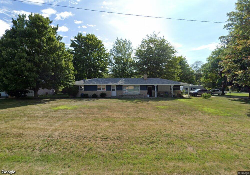
3966 Michael St Muskegon, MI 49444
Estimated Value: $256,000 - $274,000
3
Beds
2
Baths
1,302
Sq Ft
$204/Sq Ft
Est. Value
About This Home
This home is located at 3966 Michael St, Muskegon, MI 49444 and is currently estimated at $265,325, approximately $203 per square foot. 3966 Michael St is a home located in Muskegon County with nearby schools including Fruitport High School, Edgewood Elementary Academy, and Dr. Martin Luther King Academy.
Ownership History
Date
Name
Owned For
Owner Type
Purchase Details
Closed on
Jan 20, 2006
Sold by
H & F Properties Llc
Bought by
Anderson Randy
Current Estimated Value
Home Financials for this Owner
Home Financials are based on the most recent Mortgage that was taken out on this home.
Original Mortgage
$121,500
Outstanding Balance
$78,561
Interest Rate
8.95%
Mortgage Type
Fannie Mae Freddie Mac
Estimated Equity
$186,764
Create a Home Valuation Report for This Property
The Home Valuation Report is an in-depth analysis detailing your home's value as well as a comparison with similar homes in the area
Home Values in the Area
Average Home Value in this Area
Purchase History
| Date | Buyer | Sale Price | Title Company |
|---|---|---|---|
| Anderson Randy | $135,000 | None Available |
Source: Public Records
Mortgage History
| Date | Status | Borrower | Loan Amount |
|---|---|---|---|
| Open | Anderson Randy | $121,500 |
Source: Public Records
Tax History Compared to Growth
Tax History
| Year | Tax Paid | Tax Assessment Tax Assessment Total Assessment is a certain percentage of the fair market value that is determined by local assessors to be the total taxable value of land and additions on the property. | Land | Improvement |
|---|---|---|---|---|
| 2025 | $2,325 | $121,200 | $0 | $0 |
| 2024 | $1,613 | $107,600 | $0 | $0 |
| 2023 | $1,542 | $94,400 | $0 | $0 |
| 2022 | $2,038 | $84,700 | $0 | $0 |
| 2021 | $1,983 | $78,100 | $0 | $0 |
| 2020 | $1,964 | $70,400 | $0 | $0 |
| 2019 | $1,929 | $72,200 | $0 | $0 |
| 2018 | $1,839 | $70,900 | $0 | $0 |
| 2017 | $1,802 | $64,000 | $0 | $0 |
| 2016 | $1,095 | $57,600 | $0 | $0 |
| 2015 | -- | $55,800 | $0 | $0 |
| 2014 | -- | $58,500 | $0 | $0 |
| 2013 | -- | $53,700 | $0 | $0 |
Source: Public Records
Map
Nearby Homes
- 3835 Ellen St
- 1454 Airport Rd
- 4060 Buck St
- 1201 Shettler Rd
- 3598 Valley View Dr Unit 10
- V/L 4535 Thompson Rd
- 2322 Cline Rd
- 2355 Cress Creek Dr
- 1130 Englewood Ave
- V/L S Sheridan Dr
- 4563 Keener St
- 1068 Englewood Ave
- 4677 Harvey St
- 4535 Thompson Rd
- 4468 Spruce Ct
- 4476 Cedar Ln Unit 54
- 3176 Klug St
- 4769 Harvey St
- 4441 S Sheridan Dr
- 2171 Monte Ave
- 1718 Shettler Rd
- 3954 Michael St
- 1732 Shettler Rd
- 3940 Michael St
- 3967 Molly Blvd
- 3947 Michael St
- 3941 Ellen St
- 1687 Shettler Rd
- 3924 Michael St
- 1701 Shettler Rd
- 3929 Michael St
- 1717 Shettler Rd
- 3925 Ellen St
- 3961 Molly Blvd
- 3960 Ellen St
- 3934 Molly Blvd
- 3910 Michael St
- 3917 Michael St
- 3946 Ellen St
- 1764 Shettler Rd