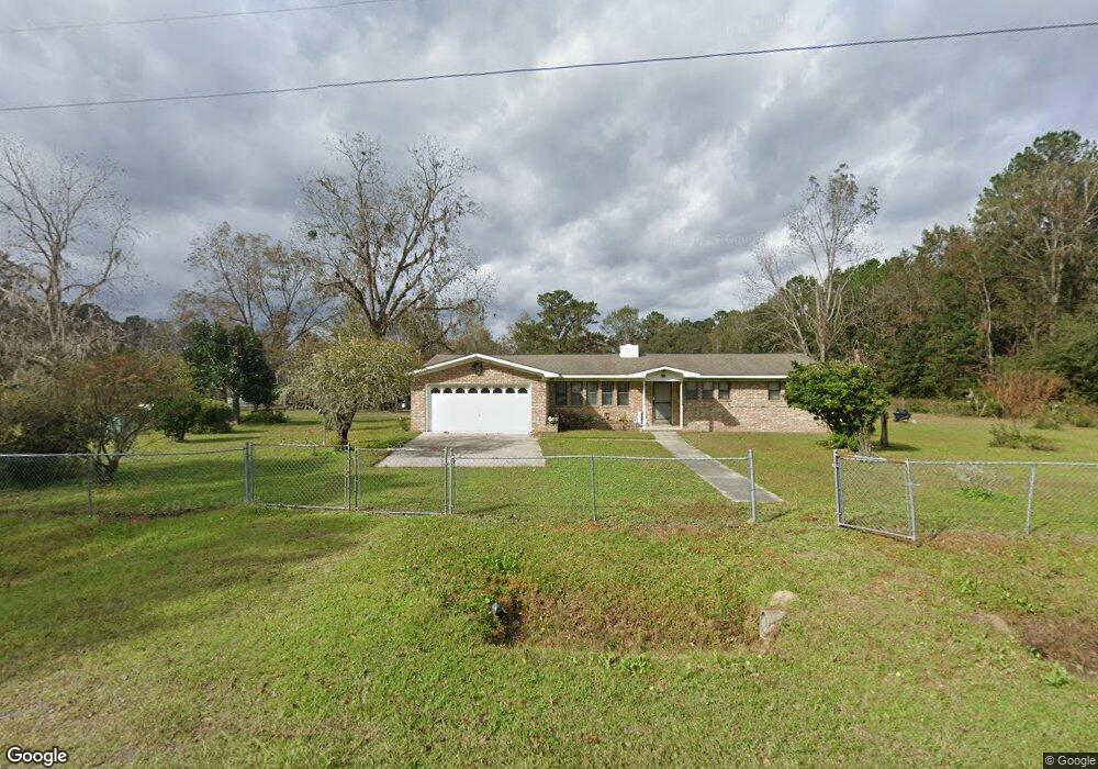
397 Dave Williams Rd Midway, GA 31320
Estimated Value: $99,000 - $397,000
3
Beds
2
Baths
1,612
Sq Ft
$151/Sq Ft
Est. Value
About This Home
This home is located at 397 Dave Williams Rd, Midway, GA 31320 and is currently estimated at $243,058, approximately $150 per square foot. 397 Dave Williams Rd is a home located in Liberty County with nearby schools including Liberty Elementary School, Midway Middle School, and Liberty County High School.
Ownership History
Date
Name
Owned For
Owner Type
Purchase Details
Closed on
Dec 20, 2017
Sold by
Roberts Kalvin
Bought by
Roberts Kalvin and Roberts Leslie S
Current Estimated Value
Purchase Details
Closed on
Dec 15, 2017
Sold by
Jm Allen Construction Inc
Bought by
Roberts Kalvin
Purchase Details
Closed on
Aug 7, 2017
Sold by
Powell Jake
Bought by
J M Allen Construction Inc
Purchase Details
Closed on
Apr 5, 2004
Sold by
Powell Jake
Bought by
Powell Nancy
Purchase Details
Closed on
Oct 4, 1994
Bought by
Powell Jake
Create a Home Valuation Report for This Property
The Home Valuation Report is an in-depth analysis detailing your home's value as well as a comparison with similar homes in the area
Home Values in the Area
Average Home Value in this Area
Purchase History
| Date | Buyer | Sale Price | Title Company |
|---|---|---|---|
| Roberts Kalvin | $201,500 | -- | |
| Roberts Kalvin | $201,500 | -- | |
| J M Allen Construction Inc | $12,000 | -- | |
| Powell Nancy | -- | -- | |
| Powell Jake | -- | -- |
Source: Public Records
Tax History Compared to Growth
Tax History
| Year | Tax Paid | Tax Assessment Tax Assessment Total Assessment is a certain percentage of the fair market value that is determined by local assessors to be the total taxable value of land and additions on the property. | Land | Improvement |
|---|---|---|---|---|
| 2024 | $1,668 | $61,110 | $2,130 | $58,980 |
| 2023 | $1,668 | $53,543 | $2,130 | $51,413 |
| 2022 | $1,265 | $44,147 | $2,130 | $42,017 |
| 2021 | $1,084 | $39,570 | $2,130 | $37,440 |
| 2020 | $1,096 | $40,052 | $2,130 | $37,922 |
| 2019 | $1,089 | $40,533 | $2,130 | $38,403 |
| 2018 | $1,095 | $41,015 | $2,130 | $38,885 |
| 2017 | $1,366 | $41,496 | $2,130 | $39,366 |
| 2016 | $1,063 | $41,987 | $2,130 | $39,856 |
| 2015 | $1,083 | $41,495 | $1,639 | $39,856 |
| 2014 | $1,083 | $43,613 | $1,639 | $41,974 |
| 2013 | -- | $41,145 | $1,956 | $39,189 |
Source: Public Records
Map
Nearby Homes
- 176 Dave Williams Rd
- 218 Shade Tree Dr
- 7337 E Oglethorpe Hwy
- 6223 E Oglethorpe Hwy
- 6228 E Oglethorpe Hwy
- 8578 E B Cooper Hwy
- 9 Ashlynn Ln
- 1 Acre Holmestown Rd
- 1.0 Acre Holmestown Rd
- 266 River Bend Dr
- 124 Denham Ln
- 124 Denham Ln
- 327 River Bend Dr
- 1979 S Coastal Hwy
- 0 E Oglethorpe Unit 10592168
- 0 E Oglethorpe Unit SA333651
- 0 E Oglethorpe Unit 153327
- 10 Katelynn Ln
- 90 Charleston Ct
- 334 Isaac Stevens Rd
- 397 Dave Williams Rd
- 363 Dave Williams Rd
- 333 Dave Williams Rd
- 386 Dave Williams Rd
- 486 Dave Williams Rd
- 245 Dave Williams Rd
- 270 Dave Williams Rd
- 550 Dave Williams Rd
- 184 Robert Hill Rd
- 3 Robert Hill Rd
- 175 Robert Hill Rd
- 610 Dave Williams Rd
- 282 Robert Hill Rd
- 206 Dave Williams Rd
- 253 Robert Hill Rd
- 0 Robert Hill Rd
- 111 Dave Williams Rd
- 154 Dave Williams Rd
- 255 Robert Hill Rd
- 689 Dave Williams Rd