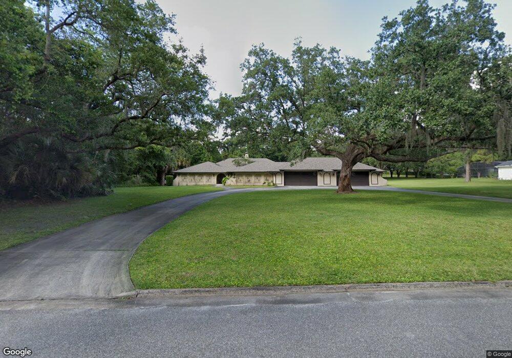
397 Forest Trail Oviedo, FL 32765
Estimated Value: $809,000 - $956,096
4
Beds
5
Baths
3,934
Sq Ft
$223/Sq Ft
Est. Value
About This Home
This home is located at 397 Forest Trail, Oviedo, FL 32765 and is currently estimated at $878,524, approximately $223 per square foot. 397 Forest Trail is a home located in Seminole County with nearby schools including Lawton Elementary School, Jackson Heights Middle School, and Oviedo High School.
Ownership History
Date
Name
Owned For
Owner Type
Purchase Details
Closed on
Jun 2, 2009
Sold by
Hussaini Haybat K and Hussaini Alison L
Bought by
Tenn Nicholas and Tenn Michelle
Current Estimated Value
Purchase Details
Closed on
Apr 1, 2007
Bought by
Tenn Nicholas and Tenn Michelle
Purchase Details
Closed on
Feb 16, 2007
Sold by
Hussaini Haybat K and Hussaini Alison L
Bought by
Hussaini Haybat K
Purchase Details
Closed on
Feb 1, 2007
Bought by
Tenn Nicholas and Tenn Michelle
Purchase Details
Closed on
Jan 26, 2000
Sold by
Armstrong John T and Elliott Mary
Bought by
Hussaini Haybat K and Hussaini Alison L
Home Financials for this Owner
Home Financials are based on the most recent Mortgage that was taken out on this home.
Original Mortgage
$172,368
Interest Rate
7.9%
Mortgage Type
Credit Line Revolving
Purchase Details
Closed on
Jan 1, 1976
Bought by
Tenn Nicholas and Tenn Michelle
Create a Home Valuation Report for This Property
The Home Valuation Report is an in-depth analysis detailing your home's value as well as a comparison with similar homes in the area
Home Values in the Area
Average Home Value in this Area
Purchase History
| Date | Buyer | Sale Price | Title Company |
|---|---|---|---|
| Tenn Nicholas | $207,000 | None Available | |
| Tenn Nicholas | $100 | -- | |
| Hussaini Haybat K | -- | Westcor Land Title Ins Co | |
| Tenn Nicholas | $100 | -- | |
| Hussaini Haybat K | $211,500 | -- | |
| Tenn Nicholas | $66,000 | -- |
Source: Public Records
Mortgage History
| Date | Status | Borrower | Loan Amount |
|---|---|---|---|
| Previous Owner | Hussaini Haybat K | $223,331 | |
| Previous Owner | Hussaini Haybat K | $48,360 | |
| Previous Owner | Hussaini Haybat K | $172,368 |
Source: Public Records
Tax History Compared to Growth
Tax History
| Year | Tax Paid | Tax Assessment Tax Assessment Total Assessment is a certain percentage of the fair market value that is determined by local assessors to be the total taxable value of land and additions on the property. | Land | Improvement |
|---|---|---|---|---|
| 2024 | $6,468 | $431,400 | -- | -- |
| 2023 | $6,080 | $418,835 | $0 | $0 |
| 2021 | $5,810 | $394,792 | $0 | $0 |
| 2020 | $5,764 | $389,341 | $0 | $0 |
| 2019 | $5,697 | $380,587 | $0 | $0 |
| 2018 | $5,647 | $373,491 | $0 | $0 |
| 2017 | $5,533 | $365,809 | $0 | $0 |
| 2016 | $5,739 | $360,793 | $0 | $0 |
| 2015 | $5,768 | $355,794 | $0 | $0 |
| 2014 | $5,768 | $352,970 | $0 | $0 |
Source: Public Records
Map
Nearby Homes
- 116 Winding Oaks Ln
- Marigold Plan at Oviedo Square
- Springdale II Plan at Oviedo Square
- 402 S Central Ave
- 659 Clark St
- 663 Clark St
- 675 Clark St
- 83 Clark St
- Richmond End Plan at Aulin Square
- Providence Plan at Aulin Square
- Richmond Interior Plan at Aulin Square
- 99 Orense Way
- 289 Smith St
- 840 Luarca Ln
- 80 Violet Vine Ln
- 159 Aulin Ave
- 110 Violet Vine Ln
- 294 Carib Ln
- 111 Violet Vine Ln
- 436 Magnolia Chase Ct
- 353 Forest Trail
- 407 Forest Trail
- 399 W High St
- 631 Forest Cove
- 325 W High St
- 410 W High St
- 427 Forest Trail
- 317 Forest Trail
- 426 Forest Trail
- 632 Forest Cove
- 320 W High St
- 661 Forest Cove
- 420 W High St
- 437 Forest Trail
- 123 Test Listing Ln
- 389 W High St
- 281 Forest Trail
- 446 Forest Trail
- 409 W High St
- 356 W High St