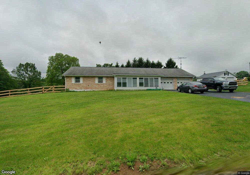
397 Long Lane Rd Walnutport, PA 18088
Estimated Value: $345,000 - $425,000
3
Beds
3
Baths
1,664
Sq Ft
$232/Sq Ft
Est. Value
About This Home
This home is located at 397 Long Lane Rd, Walnutport, PA 18088 and is currently estimated at $386,378, approximately $232 per square foot. 397 Long Lane Rd is a home with nearby schools including Lehigh Elementary School, Northampton Area Middle School, and Northampton Area High School.
Ownership History
Date
Name
Owned For
Owner Type
Purchase Details
Closed on
Jun 14, 2024
Sold by
Teel Elaine E
Bought by
Fink Elizabeth C and Fink Ryan M
Current Estimated Value
Home Financials for this Owner
Home Financials are based on the most recent Mortgage that was taken out on this home.
Original Mortgage
$240,000
Outstanding Balance
$237,053
Interest Rate
7.22%
Mortgage Type
New Conventional
Estimated Equity
$149,325
Create a Home Valuation Report for This Property
The Home Valuation Report is an in-depth analysis detailing your home's value as well as a comparison with similar homes in the area
Home Values in the Area
Average Home Value in this Area
Purchase History
| Date | Buyer | Sale Price | Title Company |
|---|---|---|---|
| Fink Elizabeth C | $300,000 | None Listed On Document |
Source: Public Records
Mortgage History
| Date | Status | Borrower | Loan Amount |
|---|---|---|---|
| Open | Fink Elizabeth C | $240,000 |
Source: Public Records
Tax History Compared to Growth
Tax History
| Year | Tax Paid | Tax Assessment Tax Assessment Total Assessment is a certain percentage of the fair market value that is determined by local assessors to be the total taxable value of land and additions on the property. | Land | Improvement |
|---|---|---|---|---|
| 2025 | $769 | $71,200 | $22,200 | $49,000 |
| 2024 | $5,234 | $71,200 | $22,200 | $49,000 |
| 2023 | $5,069 | $70,200 | $22,200 | $48,000 |
| 2022 | $5,069 | $70,200 | $22,200 | $48,000 |
| 2021 | $5,082 | $70,200 | $22,200 | $48,000 |
| 2020 | $5,082 | $70,200 | $22,200 | $48,000 |
| 2019 | $5,007 | $70,200 | $22,200 | $48,000 |
| 2018 | $4,933 | $70,200 | $22,200 | $48,000 |
| 2017 | $4,826 | $70,200 | $22,200 | $48,000 |
| 2016 | -- | $70,200 | $22,200 | $48,000 |
| 2015 | -- | $70,200 | $22,200 | $48,000 |
| 2014 | -- | $70,200 | $22,200 | $48,000 |
Source: Public Records
Map
Nearby Homes
- 390 Long Lane Rd
- 436 Willow Rd Unit Lot 15
- 315 Long Lane Rd
- 448 Long Lane Rd
- 464 Long Lane Rd
- 582 Ironwood Rd
- 4266 Chestnut Dr
- 4750 Three Mile Ln
- 1041 Dogwood St
- 1110 Greenbriar Ln
- 1074 Birch St
- 1321 Rising Sun Rd
- 1022 Dogwood St Unit 422
- 1070 Aspen St Unit 170
- 1021 Aspen St
- 4405 Lehigh Dr
- 4441 Lehigh Dr
- 12 Stacey Dr
- 43 David Dr
- 84 Linda Dr
- 401 Long Lane Rd
- 387 Long Lane Rd
- 394 Valley hi Ct
- 388 Long Lane Rd
- 388 Valley hi Ct
- 415 Long Lane Rd
- 386 Long Lane Rd
- 403 Pine Ct
- 417 Long Lane Rd
- 384 Long Lane Rd
- 382 Valley hi Ct
- 377 Long Lane Rd
- 395 Valley hi Ct
- 416 Willow Rd
- 390 Long Lane Rd
- 380 Long Lane Rd
- 419 Long Lane Rd
- 387 Valley hi Ct
- 374 Long Lane Rd
- 382 Long Lane Rd